
Birding Around Las Vegas, Favorite Places Far Away

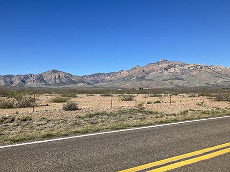 Chiricahua Mts and Cave Creek from Portal Road |
Overview The islands-in-the-sky mountains of southeastern Arizona are the only place in the U.S. to find a bit of high-elevation Mexican pine-oak woodland. As such, these mountains mark the northern breeding limits for several species of Mexican birds. From the tropical hummingbirds and Elf Owls in the town of Portal; to the Elegant Trogons, Sulphur-bellied flycatchers, and Coatimundi in South Fork; to the Mexican Chickadee, Yellow-eyed Juncos, and Red-faced Warblers in Rustlers Park, there is nowhere else in the United States like this. During May and June, 2011, the Horseshoe Two Fire burned almost 350 square-miles in the Chiricahua Mountains. Evidence is everywhere, especially at higher elevations, but the land and the wildlife are resilient. Link to Overview Map, Portal Area Map, Portal Town Map, South Fork Map, Rustler Park Map, or Chiricahua National Monument Map. Download GPS data: GPX or KML. The Friends of Cave Creek Canyon produced a nice map of their area; ask for a copy at the Ranger Station, or snatch a PDF here. |
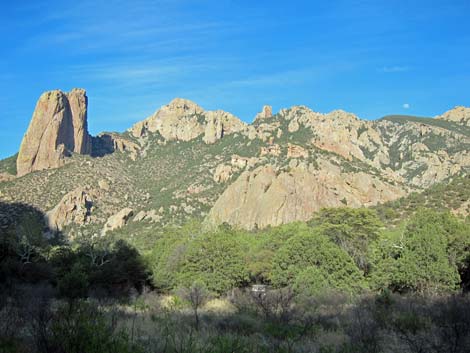 South Fork scenery |
Description The Chiricahua Mountains are a rugged mountain range with a wide range of elevations and habitat types. Desert grasslands and desert thorn-scrub are found at lower elevations (up to about 5,000 feet). Mexican pine-oak forests, with several species of evergreen oaks, several species of pine, and Arizona sycamore are found at middle elevations. Typical trees of the wooded canyons include Arizona Sycamore, Arizona Cypress, Apache Pine, Bigtooth Maple, Madrone, and Arizona Walnut. Alpine forests, with several species of pine (including tall ponderosa pine), alpine fir, and spruce are found at the highest elevations (to nearly 10,000 feet). When I think of birding the Chiricahuas, I think of four main areas: Portal Town, Paradise Town, Cave Creek and South Fork, and Rustler Park. On the other side of the mountain, Chiricahua National Monument also has good birding. |
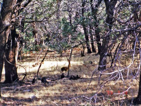 Mixed woods (oak and pine) with a grassy understory and a Coatimundi (center of photo with tail raised) |
Location The Chiricahua Mountains are located in southeastern Arizona, south of Interstate-10 near the New Mexico border. The town of Portal is the gateway to the east side of the Chiricahua Mountains. From Interstate-10, turn south onto Highway 80 near Steins, New Mexico (exit 5). On Highway 80, drive south about 30 miles to Highway 533 (about 3 miles north of Rodeo, New Mexico). Turn west (right) onto Highway 533, which becomes Portal Road at the Arizona state line, and head for the mountains. Portal is about 7 miles from Highway 80. Alternatively, from I-10 at San Simon, Arizona (Exit 382), turn south onto the frontage road. Drive east, parallel to the interstate, for 0.8 miles out, then turn south onto Portal Road. The road eventually becomes graded dirt as it traverses expansive grass and mesquite shrublands. At a fork about 17 miles out, stay left to Portal (8.3 miles to pavement, then right 0.7 miles) or right to Paradise (5.8 miles). Note that there is no gasoline in or near Portal, AZ. |
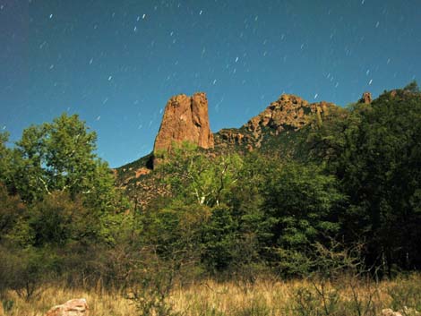 Starry night - listen for owls and nightjars |
Portal is located at the base of the mountains in the mouth of Cave Canyon. To get into the mountains, drive west through Portal on the main highway (Portal Road), which soon becomes the only road. For information on current birding opportunities, inquire at the Portal Store (Portal is a small town) or at the U.S. Forest Service Ranger Station just beyond Portal which is staffed by knowledgeable locals. Beyond Portal, continue up the road along Cave Creek, watching for Trogons and Coati. On Cave Creek Road, turn left into Cave Creek Ranch, right into the Ranger Station, and left into Idlewild Campground, Stewart Campground, and South Fork Road. Staying on the pavement, turn right into Sunny Flat Campground, left to the Southwestern Research Station, John Hands Campground and Herb Martyr Campground, or continue up the mountains to Onion Saddle (this road is closed during winter and is not suitable for large RVs or vehicles pulling trailers). At Onion Saddle, turn left to Rustler Park and Barfoot Park, or continue over the mountains on Pinery Canyon Road to Chiricahua National Monument. |
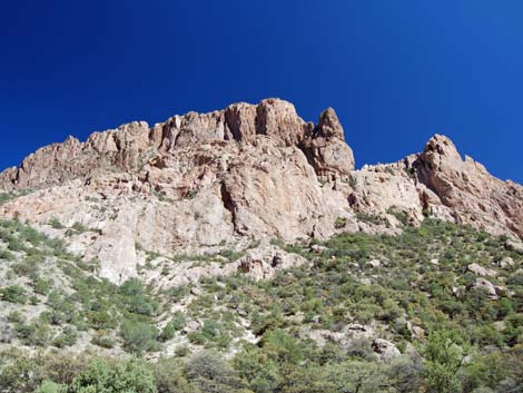 Rocky cliffs along the south fork of Cave Creek |
Hours The area is always open, but businesses and Open Yards have specific hours. Fees There are no entrance fees. The campgrounds cost $15-20 per night. Cave Creek Ranch costs $5 per person. Other areas are free, but there are lots of donation jars near bird feeders. Five dollars is the typical expectation, so bring a pocket full of $5s. |
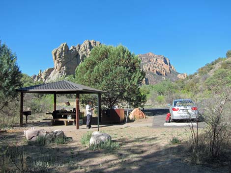 Sunny Flat Campground: a nice place to camp |
Food and Lodging The Chiricahua Mountains are too far from anywhere to ignore food and lodging. There are several options: stay along the Interstate highway, use lodging in Portal, Paradise, or Rodeo, camp in any of several small campgrounds above Portal, or Chiricahua National Monument. At large camping is legal at higher elevations in the mountains (above the Southwest Research Station). Along the interstate, the towns of Willcox, AZ, and Lordsburg, NM, have typical tourist facilities: nothing 5-star, but plenty of clean, comfortable places to stay and eat. Closer in, Portal and Paradise have rustic lodging and B&Bs, the Southwestern Research Station acts as a B&B, and the Portal Store serves hot, tasty food. There is also a place in Rodeo, Mountain Valley Lodge, that offers reasonable rates for rooms and campsites. |
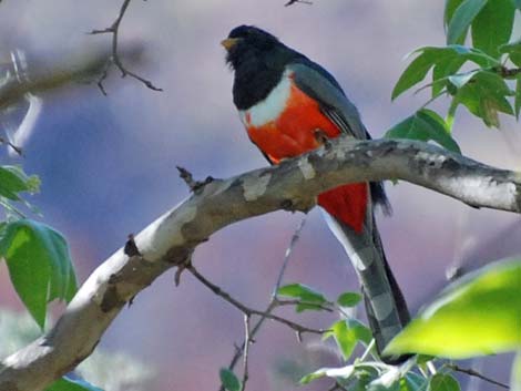 Elegant Trogon in South Fork |
Cave Creek camping is rustic. Sunny Flat Campground has a paved loop and some shade structures and drinking water, Stewart is dirt under the trees, and Idlewild has a rough road. All have tables, fire pits, and vault toilets. Chiricahua National Monument has shady Bonita Canyon Campground with tables, fire pits, and flush toilets, but no hookups. Specialties Think Mexican species -- tropical hummingbirds, Sulphur-bellied Flycatcher, Elegant Trogon, Mexican Chickadee, Yellow-eyed Junco, and Red-faced Warbler. Arizona Woodpeckers are common, and Elf Owls can be heard chattering in the night from Sunny Flat Campground down through Portal Town. |
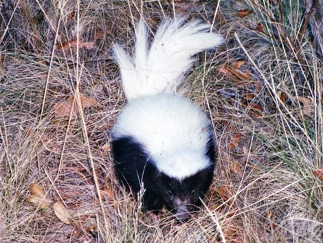 Hog-nosed Skunk near Sunny Flat Campground |
Elegant Trogon is one of the main birds to look for here; its most common call is said to be an unmusical clucking "kwa, kwa, kwa, kwa," like a hen turkey or a frog calling from the trees. Other interesting wildlife also occurs in the area. We got chased up onto our picnic table one night by a pack of wild javelina marauding through the campground, I got a picture of a Hog-nosed Skunk pounding its fists on the ground near the campground, we had a family of Coatimundis surround us in the woods, and there are Striped Skunks in the campgrounds. Apache Fox Squirrel, big gray squirrels with bushy tails and red bellies, are common, and the trees seemed to be full of big Yarrow Spiny Lizards. |
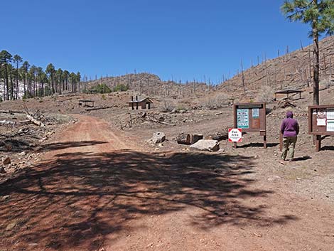 Rustler Park after the fire |
Special Information The South Fork Zoological and Botanical Area is a day-use area, and playing recorded calls to attract birds is not permitted. Read signs in the area for current information. For More Information Information on camping, trails, and road conditions can be obtained from the US Forest Service, Douglas Ranger District; Douglas, AZ; (520) 364-3468. Chiricahua National Monument, which is located on the west side of the Chiricahua Mountains in Willcox, AZ, also provides information on the area: (520) 824-3560. |
A few good Birding Locations Around the Chiricahua Mountains
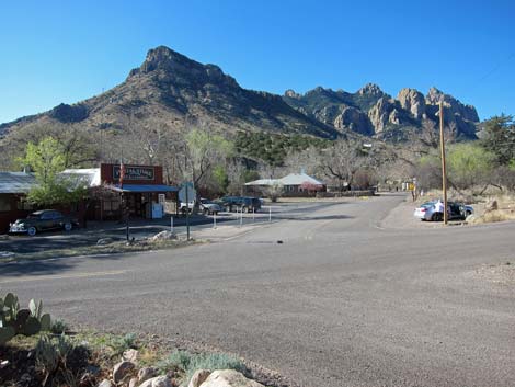 |
Portal Town. Portal is the town at the base of the mountains on the east side of the Chiricahua Mountains. The people who live there have a good thing going, and some of them even share it with the rest of us. Walk the main road through town birding the trees and yards. Some homeowners put out seed and nectar, making this a great place to see hummingbirds. Stop to eat at the Portal Store where they have good food and open wifi. The library provides free wifi during the day. At night, listen for Elf Owls and watch for them on powerlines. |
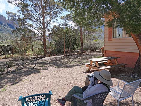 |
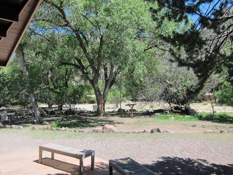
Portal Area: Jasper Feeders. The Jasper Feeders are a gift from the landowner to birders of the world. Chairs and a table are arranged under a shady tree with south-facing views of the seed and nectar feeders. |
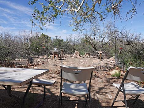 |
Portal Area: Rodrigues Feeders. The Rodrigues Feeders are a gift from the landowner to birders of the world. Chairs and a table are arranged under a shady tree with good views of the seed and nectar feeders. This site is good for desert species, and this is the epicenter of Crissal Thrasher sightings in the area. |
 |
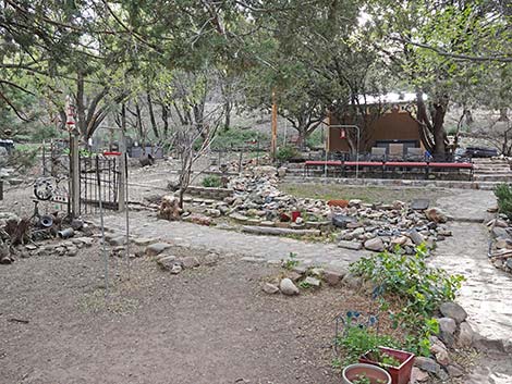
Portal Area: Cave Creek Ranch. Cave Creek Ranch is a lodge that caters to birders and puts out seed, nectar, peanut butter, and jelly feeders to attract birds and other wildlife to the office area. Visitors are welcome from 10am to 4pm at $5 each, to watch birds near the office. Visitors are not welcome around the cabins. The birding can be good, and for $5, it probably is worth relaxing in the shade on a hot afternoon and watching birds. |
 |
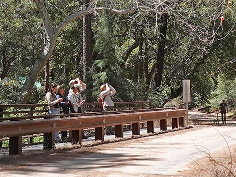
Paradise Town: George Walker House. The George Walker House is a B&B over the ridge from Portal in the town of Paradise. Jackie, the lady of the house, is friendly and an excellent birder who opens her yard to birders and provides running commentary on the birds in her yard. The dogs and Wes are quite friendly too. Often booked solid during birding seasons, the B&B rates are surprisingly low. Look for lower-elevation specialties and even Juniper Titmouse in the yard. |
 |
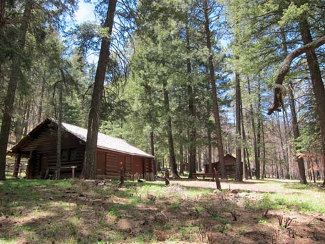
Cave Creek and South Fork. This is a driving and walking adventure, so from Portal, continue west on Portal Road following the pavement. The speed limit drops to 20 mph, so slow down, roll down the windows, hang your ears out the windows, and listen. When the birds sing, find a pullout and park off the road. At 3.25 miles above Portal Town, the road forks - turn left and follow the dirt South Fork Road. An easy trail runs up the canyon (south) from the end of the road. The trail crosses the mountains, but hiking the first mile or so puts you in some great birding habitat. If you don't want to hike the trail, walk the road. South Fork Bridge (near the end of the road), and the road for about 200 yards below the bridge, seem to be especially productive. |
 |
Rustler Park and Barfoot Park. Rustlers Park is a wildland fire station with a nice campground (closed during winter) in a ponderosa pine forest. The campground is located near the crest of the mountains, and foot trails lead north and south from the campground along the crest of the mountains. Birding around the fire station and houses can be quite productive. This is the place to look for high-elevation species such as Mexican Chickadee, Yellow-eyed Junco, Red-faced Warbler, Olive Warbler, Red Crossbill, and Band-tailed Pigeon. This is now a fire-altered landscape, but some original forest habitat remains, and the birds are coming back. |
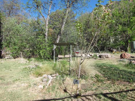 |
Southwestern Research Station. The Southwestern Research Station is an American Museum of Natural History research facility focusing on the ecology of the southwestern mountains and ecosystems. Being good neighbors, they put out seed and nectar to attract bird species and allow the public to walk into the area and watch the birds. The grounds are particularly good for hummingbirds, and Magnificent Hummingbird, Blue-throated Mountain-gem, and Black-chinned Hummingbirds can be abundant. |
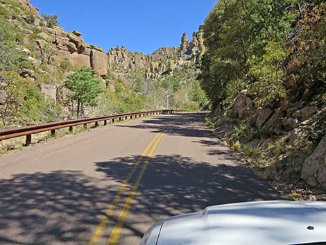 |
Chiricahua National Monument. Chiricahua National Monument is located on the northwest side of the Chiricahua Mountains. The birding here isn't as good as places farther south (e.g., Cave Creek Area), but it can be good. Near the park entrance, look for grassland sparrows, Loggerhead Shrike, and hawks, and in the canyons and higher elevations, look for Mexican Jays, Dark-eyed Juncos, warblers, and other birds typical of the area. The Horseshoe Two Fire was particularly hard on higher elevations in the park, but the shrubby vegetation is growing back and supports lots of bird species. |
Happy birding! All distances, elevations, and other facts are approximate.
![]() ; Last updated 241020
; Last updated 241020
| Favorite Places Far Away | Birding Around Las Vegas | Glossary | Copyright, Conditions, Disclaimer | Home |