
Southern Nevada Wilderness Areas

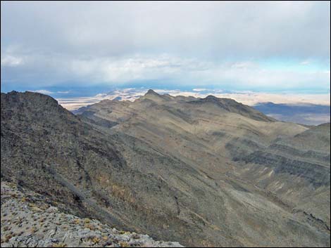 Arrow Canyon Range (view N from high point) |
Overview The Arrow Canyon Wilderness Area is a medium sized wilderness area with elevations that range from about 2,000 to 5,200 feet. The area includes the northern 12 miles of the Arrow Range and bajadas and canyons to the east of there. The western face of the Arrow Range, a grand fault scarf with dramatic bands of quartzite and, is one of the most scenic ranges in southern Nevada. The eastern edge of the wilderness area runs through Arrow Canyon, which for about 3 miles is confined between sheer cliffs that are so tall and close together that sunlight rarely reaches the bottom. The Arrow Range is thick with bighorn sheep (so thick you will get ticks while hiking), and there are some interesting and unusual petroglyphs along Pahranagat Wash and in Arrow Canyon. The wilderness area also includes Table Mountain, a small mesa top on the east side of Pahranagat Wash, which is adjacent to, but separate from, the rest of the wilderness area. |
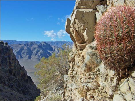 Rocky hillside with barrel cactus (view W) |
If you hike in wilderness areas, help protect them by learning about and reporting noxious and invasive weeds. Location The Arrow Canyon Wilderness Area is located on the northern end of the Arrow Range, about 45 air-miles northeast of Las Vegas. The wilderness area lies east of U.S. Highway 93, north of Interstate-15, and south of Highway 168 (the road from Moapa to Highway 93). Link to map of the Arrow Canyon Wilderness Area. |
 Arrow Canyon (view SE from cliffs above the terminus of the upper end of the canyon) |
Boundaries The western boundary generally runs along the top of the bajada at the base of the Arrow Range. The northeastern boundary is Pahranagat Wash (including Arrow Canyon). Below Arrow Canyon, the southeastern boundary follows Side Canyon Wash until reaching the base of the Arrow Range, then generally follows the base of the mountains southward, staying near the 3,000-ft contour line. The southern boundary is an unnamed wash that flows east, a saddle, and another wash that flow west to the western edge of the mountains. Access Access is on foot from Highway 93 and from roads off Highway 168 that run into Pahranagat Wash. Note that the road no longer runs up into the narrows. Link to map. |
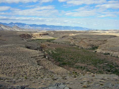 Pahranagat Wash (view NW from cliffs above the terminus of the upper end of Arrow Canyon) |
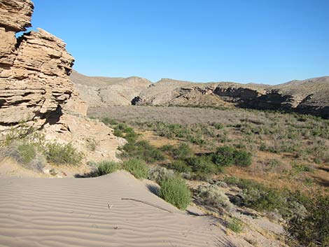
Terrain The Arrow Canyon Wilderness Area includes three distinct landforms: the craggy Arrow Range, wide valleys, and deep narrow canyons. The Arrow Range lies along the west edge of the wilderness area. This craggy block of tilted sedimentary carbonate rock exposes the underlying strata along the west side of the ridge. This spectacular fault scarf, several thousand feet high, is marked by distinctive black and white bands of carbonate rock (limestone or dolomite) and quartzite that run the length of the mountain range. The northeastern central portion of the wilderness area contains a wide valley cut by numerous washes, while the east side is characterized by a series of deep washes, including Arrow Canyon with the nearly vertical sides several hundred feet deep. Pahranagat Wash runs along the northeastern edge of the wilderness area and flows through Arrow Canyon. |
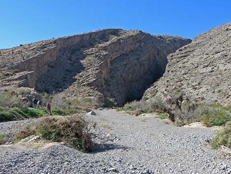 Lower entrance to Arrow Canyon (view NW) |
Habitat Type The habitat type over most of the wilderness area is typical of the Upper Sonoran (Mojave Desert Scrub) Life Zone, where species such as Creosote Bush, White Bursage, Mojave Yucca, and Barrel Cactus are common. At higher elevations, Blackbrush is also common. In washes such as in Pahranagat Wash, Honey Mesquite, Catclaw Acacia, Saltcedar are common. Some uncommon species, such as Butterfly Bush, are common here. |
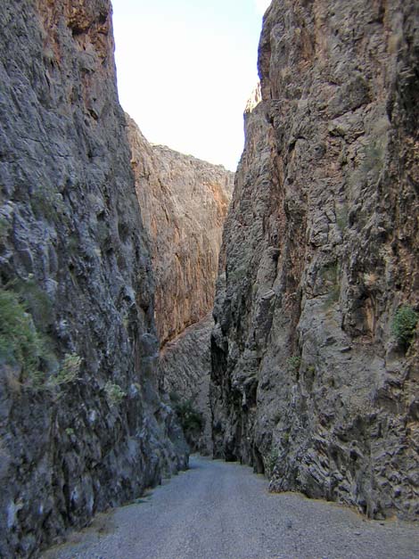 Arrow Canyon (view NW; upstream) |
Wildlife Bighorn sheep are common in the Mormon Mountains, and desert tortoise occur at lower elevations. Several species of carnivores (including coyote, kit fox, ringtail cats, and bobcat) occur in the canyons. Small mammals include valley pocket gopher, kangaroo rats, and deer mice. Lizards in the area include side-blotched Lizards, banded geckos, and leopard lizards; snakes include sidewinders, speckled rattlesnakes, common kingsnakes, and long-nosed snakes. Birds are common, especially during migration when a variety of species can be found in Pahranagat Wash. Golden Eagle, Great Horned Owl, Black-tailed Gnatcatchers, Say's Phoebe, White-crowned Sparrow, Gambel's Quail, Loggerhead Shrike, Rock Wren, Ruby-crowned Kinglet, Common Ravens, and even Mountain Chickadee use the wilderness area. |
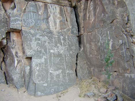 Petroglyph panel in Pahranagat Wash |
Archaeology There are extensive petroglyph panels on the rock walls of Pahranagat Wash, above, below, and in Arrow Canyon. Some of the petroglyphs are on rock walls that lack patina, which is unusual. Other evidence of prehistoric use includes agave roasting pits, shelter caves, rock alignments, lithic scatters, stone scrapers, and broken arrowheads. The Moapa Band of Paiutes still resides in the area just east of the Arrow Canyon Range. |
 |
Geology The west side of the Arrow Canyon Range rises sharply 2,800 feet above the valley floor, its banded, jagged cliffs show nearly 200 million years of geologic history. The striking black layer, visible across the entire length of the western face, is early Mississippian Dawn Limestone that is about 350 millions years old. The dark color is from carbon in the rock. Fossils are common in the area, and it is possible to find crinoids, brachiopods, corals, and other marine organisms, as well as the roots of Lepidodendron "trees." Many of the fossils date to the Cambrian period, 500 million years ago, when these rocks were mucky sediments accumulating at the bottom of the ocean, but the Lepidodendron "trees" stood on an ancient shoreline. |
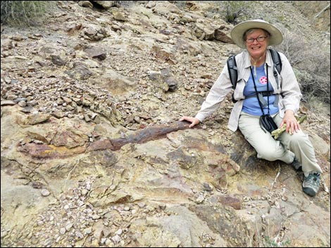 Happy lady with fossilized Lepidodendron root |
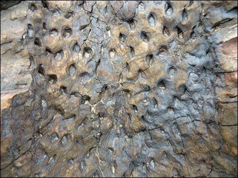 Surface texture of Lepidodendron fossil |
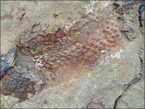 Fossilized Lepidodendron root |
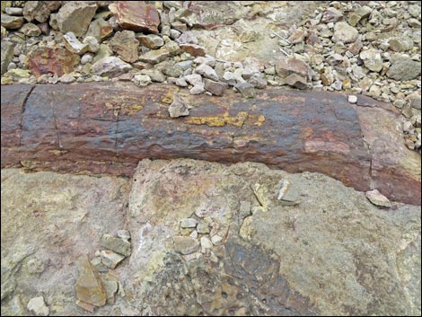 Fossilized Lepidodendron root |
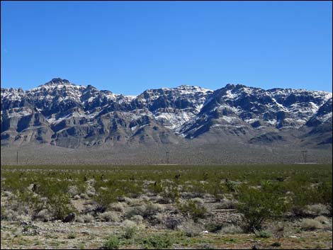 Arrow Canyon Wilderness Area during winter (view E) |
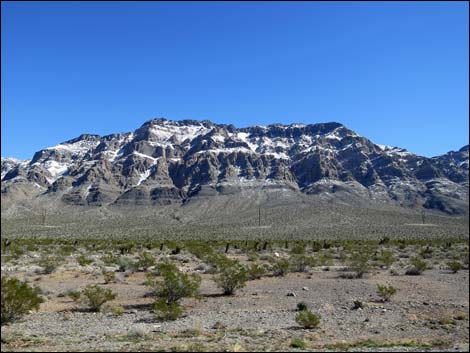 Arrow Canyon Wilderness Area during winter (view E) |
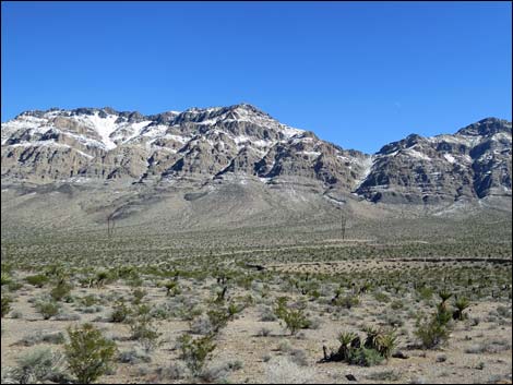 Arrow Canyon Wilderness Area during winter (view E) |
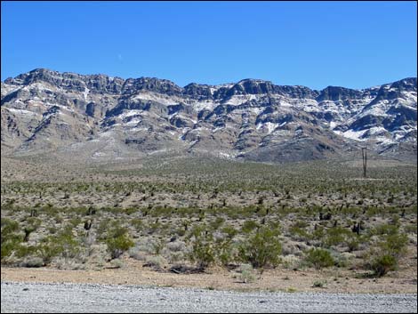 Arrow Canyon Wilderness Area during winter (view E) |
Note: All distances, elevations, and other facts are approximate.
![]() ; Last updated 240331
; Last updated 240331
| Wilderness Areas | Hiking | Guide Services | Glossary | Copyright, Conditions, Disclaimer | Home |