
Hiking Around Las Vegas, Muddy Mountains Wilderness Area

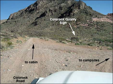 Last fork on Colorock Road (Site 1032) |
Overview Colorock Quarry is a historical sandstone quarry. Judging from the amount of rock removed, that seems that the quarry went bust shortly after it got started. In 1983, the area was explored for gas and oil, but none was found. Now only a stone cabin and a few cut stones sit quietly among towering sandstone and limestone cliffs on the edge of the Muddy Mountains Wilderness Area. This is an area of stark solitude with a bit of local history thrown in, but the cabin is deteriorating. This short (3/4-miles round trip) and easy hike follows old roads into the quarry area. The wilderness area boundary is the wash, so keep all vehicles in the wash or on the cabin side of the wash. Across the wash and up the wash past the cabin is designated wilderness too. Link to map. |
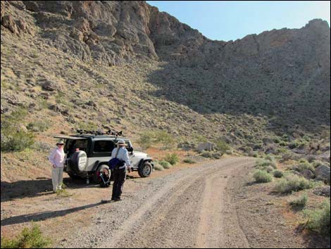 |
Watch Out Other than the standard warnings about hiking in the desert, ... this is a safe hike with no unusual hazards. There are many cactus and other things with sharp points (including rusty nails), so be careful when walking around. While driving, please respect the land and the other people out there, and try to Leave No Trace of your passage. This road goes to the edge of Wilderness, so pay particular attention to respecting the land. This area is little used so nobody will find you if you need help, so be sure to bring the 10 Essentials. Cell phones don't work in this area. |
 |
Getting to the Trailhead This hike is located on the west edge of the Muddy Mountains Wilderness Area, about 1.5 hours north of Las Vegas near Valley of Fire State Park. From Las Vegas, drive northbound Interstate 15 for 33 miles to Exit 75E. Turn right onto Highway 169 and drive east 3.5 miles to Bitter Spring Backcountry Byway Road. The pavement curves left, and the Byway continues straight. The Byway sometimes gets graded, but the other roads are not, thus this road requires, at the least, a 2WD-HC vehicle. Follow the Byway and then Colorock Road to the trailhead for the Wash Route into Hidden Valley, which also is the trailhead for Colorock Cabin. |
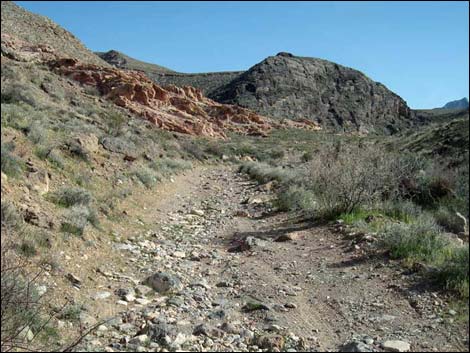 Just past Wash Route trailhead (Site 1035) |
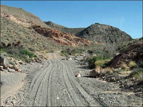
The Hike From the trailhead (Table 1, Waypoint 06), the hike follows the road up the canyon. The road quickly becomes quite rocky, and then is washed out where it crosses the wash. About 0.2 miles out, the road turns steeply up the high bank on the right (Wpt. 06a), but for hikers it is easier to stay in the wash along the base of the hill because the road just drops back into the wash up ahead. In the wash, the road forks (Wpt. 07) to form a loop, although here it looks more like the road leaving the wash on the left (east) side. The loop will return to the wash at this point. Staying in the wash, hikers come around a rocky promontory on the right and the cabin, in the distance ahead, comes into view. Shortly, the road leaves the wash (Wpt. 07a) and climbs towards the cabin. The road here is so rocky that few ATVs come this way. |
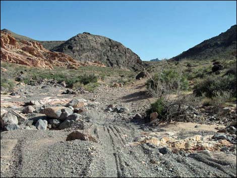 Washed out road |
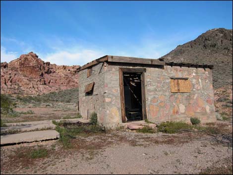
Following the rocky road, hikers arrive at Colorock Cabin (Wpt. 08), which is literally inches from the edge of designated wilderness area. The cabin walls were made using quarried sandstone chunks held together with concrete. I imagine that workers used broken blocks from the quarry to build the cabin. The roof and doors are wooden. The windows have long been broken out, and for a time were covered with hinged boards so they can be opened and closed, but now they gape open. There are a few odd-and-ends around the exterior, plus cement pads that might have been the floor of storage sheds or wall tents. Inside the cabin, the few amenities of modern life (including chairs, trash cans, lanterns, a carpet, and a ceramic pot-bellied stove) have all been removed. The door was not locked and was available to anyone, but it is hardly something to stay in these days. While visiting the cabin, please respect this site as part of our shared Nevada history. |
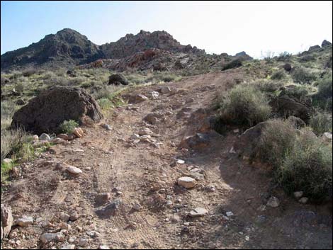 Hikers should stay in wash here |
An old road runs up the canyon above the cabin, probably to another quarry test site. From the cabin, an old (now closed) road runs southeast down into the wash and into the wilderness area. For hikers heading into Hidden Valley through Hidden Valley Canyon, drop into the wash and head upstream. For those visiting the quarry site, drop into the wash and quickly cross to the far side. Just up the wash (Wpt. 09), an old road climbs out of the wash to the left to a T-intersection. The road left runs back into the wash, but the right eventually bends to the north to run along sandstone cliffs. What seems to have been the main quarry site (Wpt. 10) in this area is the large sandstone crag northeast of the cabin. Cut marks can be seen on the crag, and a few cut stones lie at the base. A few concrete pads also remain and probably were foundations for winches or cranes. Passing the quarry site heading northwest, the old road runs back down into the wash (Wpt. 07). Following the wash or road downstream leads back to the trailhead (Wpt. 06). |
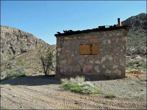 Arriving at the cabin (Dec 2014; view SW) |
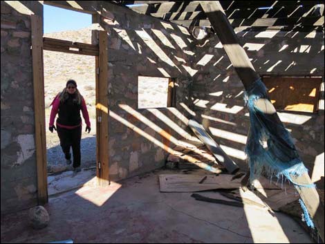 Cabin interior (Dec 2014; view NW) |
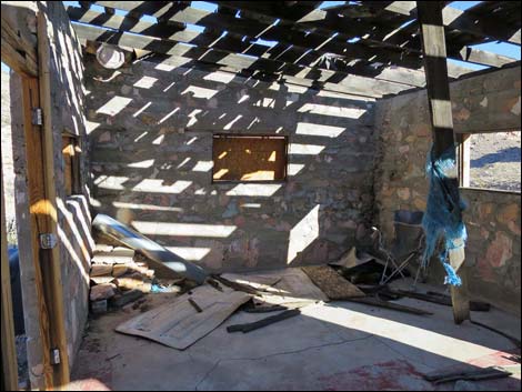 Cabin interior (Dec 2014; view NE) |
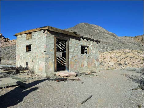 Cabin exterior (Dec 2014; view NW) |
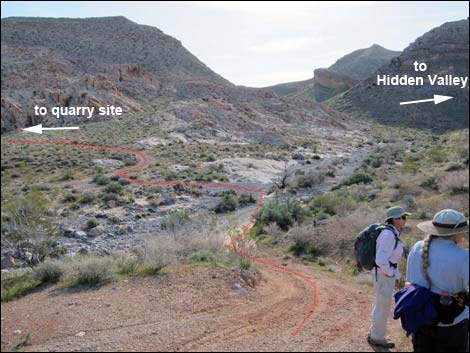 Hikers departing the cabin |
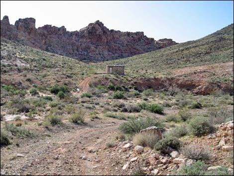 Looking back at the cabin from quarry road (view W) |
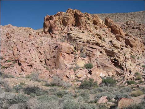 Sandstone Quarry site |
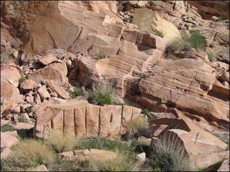 Cut stones at the quarry |
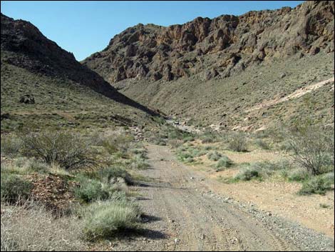 Departing the quarry site; returning towards trailhead (view NW) |
 More to come ... |
Historic Photos (March 2010)
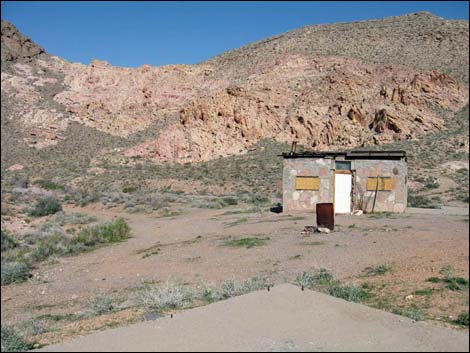 Colorock Cabin (view E) |
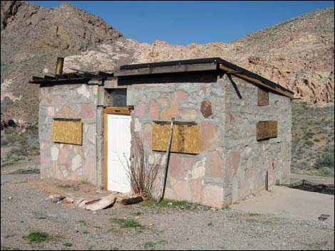 Colorock Cabin exterior (view NE) |
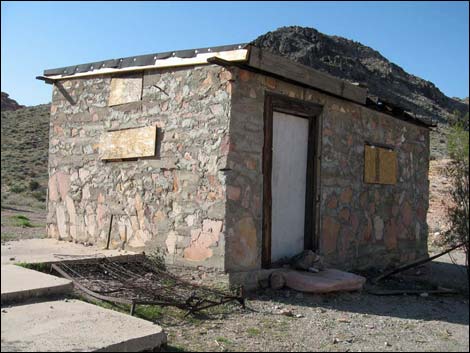 Colorock Cabin exterior (view NW) |
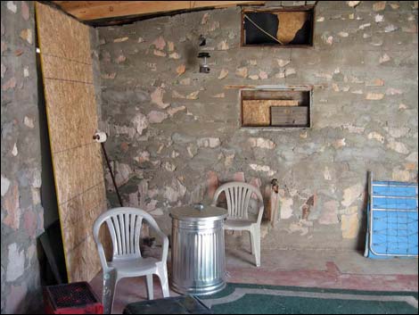 Colorock Cabin interior (view S) |
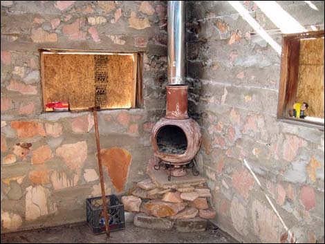 Colorock Cabin interior (view NW) |
 More to come ... |
Historic Photos (March 2011)
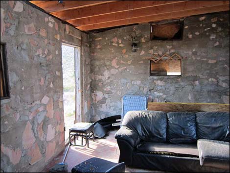 |
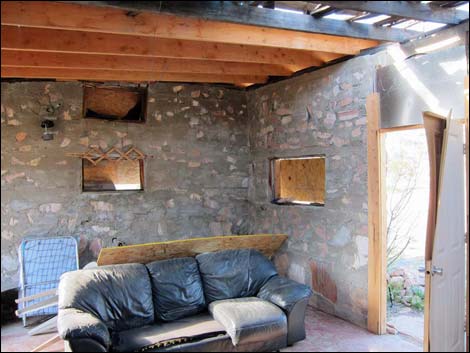 |
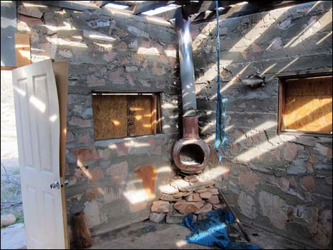 |
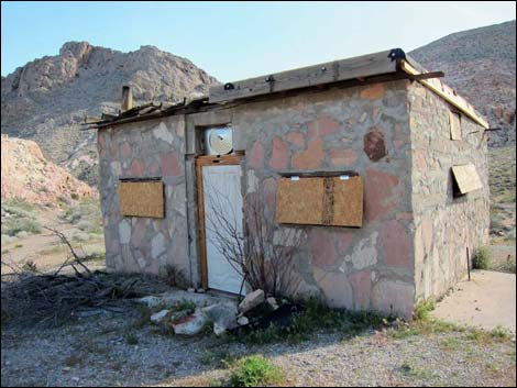 |
 |
 |
Table 1. Hiking Coordinates (NAD27; UTM Zone 11S). Download Hiking GPS Waypoints (*.gpx) file.
| Wpt. | Location | UTM Easting | UTM Northing | Elevation (ft) | Point-to-Point Distance (mi) | Cumulative Distance (mi) | Verified |
|---|---|---|---|---|---|---|---|
| 06 | Trailhead | 705873 | 4027013 | 2,802 | 0.00 | 0.00 | GPS |
| 06a | Fork Leaves Wash | 706072 | 4026834 | 2,822 | 0.20 | 0.20 | GPS |
| 07 | Fork in the Road | 706107 | 4026755 | 2,834 | 0.06 | 0.26 | GPS |
| 07a | Road Leaves Wash | 706075 | 4026695 | 2,831 | 0.05 | 0.31 | GPS |
| 08 | Colorock Cabin | 706005 | 4026614 | 2,845 | 0.08 | 0.39 | GPS |
| 09 | Fork in the Road | 706058 | 4026587 | 2,836 | 0.04 | 0.43 | GPS |
| 10 | Quarry Site | 706150 | 4026712 | 2,845 | 0.12 | 0.55 | GPS |
| 07 | Fork in the Road | 706107 | 4026755 | 2,834 | 0.04 | 0.59 | GPS |
| 06a | Fork Leaves Wash | 706072 | 4026834 | 2,822 | 0.06 | 0.65 | GPS |
| 06 | Trailhead | 705873 | 4027013 | 2,802 | 0.20 | 0.85 | GPS |
Happy Hiking! All distances, elevations, and other facts are approximate.
![]() ; Last updated 240330
; Last updated 240330
| Hiking Wilderness Areas | Hiking Around Las Vegas | Glossary | Copyright, Conditions, Disclaimer | Home |