
Hiking Around Las Vegas, Spring Mountains (Mt. Charleston), Kyle Canyon

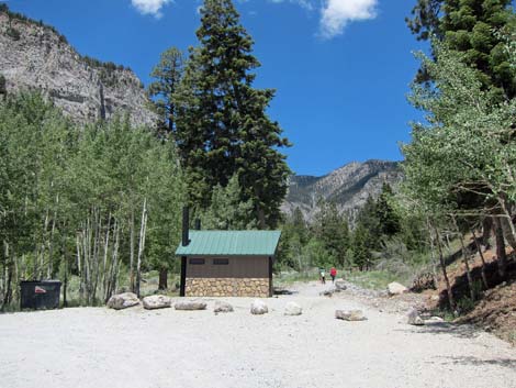 Mary Jane Falls and Big Falls trailhead (view W) |
Overview -- Trail is Closed due to damage from the 2023 hurricane. The Big Falls Canyon route is a fairly strenuous, 2.7-mile (round trip) hike that starts on the Mary Jane Falls Trail and runs up Kyle Canyon. When the Mary Jane Trail starts switchbacks to start up the hillside, this unmarked route stays left and drops into Echo Wash. In the bottom of the canyon, the route heads upstream a short distance, then curves left into Big Falls Canyon. Following the boulder- and log-strewn canyon upward, the hike ends at the base of Big Falls. The canyon is deep, forested, and surrounded by beautiful gray limestone cliffs. The falls are seasonal, flowing strongest in the spring when snow on the high mountain slopes is melting. The hike, however, is more difficult at that time because melting snow hides snow caves and loose logs. Link to map. |
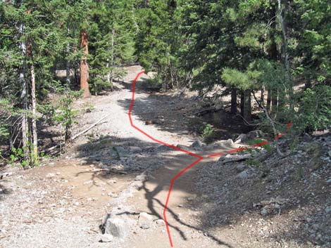 Mary Jane Falls Trail, approaching Big Falls trail junction (view NW) |
Watch Out Other than the standard warnings about hiking in the desert, ...this trail is strenuous, so take it easy at this elevation if you've just come up from the desert. There are places along the route where slips could result in serious injury. Watch for ice if you hike in the winter or early spring. Because of the boulder scrambling, this isn't one of the best hikes for young children or dogs. Limestone rocks are usually rough to the touch, but the boulders in the bottom of the canyon are unusually smooth and slippery. The hike is more difficult when the snow is melting because of hidden snow caves and loose logs. While hiking, please respect the land and the other people out there, and try to Leave No Trace of your passage. Also, even though this hike is short, be sure to bring what you need of the 10 Essentials. |
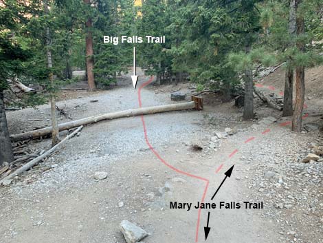 At trail junction, continue straight (left) to Big Falls (view NW) |
Getting to the Trailhead This hike is located in Kyle Canyon up in the Spring Mountains National Recreation Area, about 1 hour northwest of Las Vegas. From town, drive out to the Spring Mountains Visitor Center, then continue up the road to the Mary Jane Falls Trailhead. Park here; this is the trailhead. The Hike From the Mary Jane Falls trailhead (Table 1, Waypoint 01), the hike follows the Mary Jane Falls Trail up Kyle Canyon on a broad and clearly marked trail (an old road). Along this section, the trail passes through a forest of towering ponderosa pines, white fir, quaking aspens, and mountain mahogany. The understory is mostly open, but there are a few wax currents, other shrubs, grasses, thistles, and forbs under the trees. For details of this section, see Mary Jane Falls Trail. |
 Old road approaches canyon bottom (view SW) |
At an obscure and unmarked trail junction (Wpt. 02), the Big Falls Trail leaves the Mary Jane Falls Trail. To this point, the Mary Jane Falls Trail has been following an old road. When the Mary Jane Falls Trail jogs right off the old road and into the trees, the Big Falls Trail stays right (straight), remaining on the old road. Alternatively, hikers can continue up the Mary Jane Falls trail for another 25 yards to the base of the first switchback (Wpt. 11). At the base of the switchback, hikers can walk down the hillside and return to the old road. About 25 yards past the switchback (Wpt. 03), the old road forks. Both forks will get you there, but it might be a little easier to take the left (south) fork. The goal in this area is merely to get into the bottom of Echo Canyon without giving up too much elevation. |
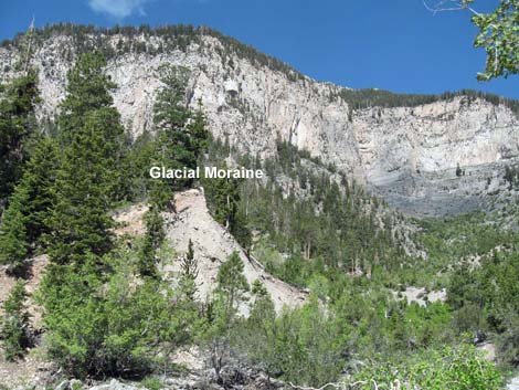 Route drops into canyon bottom (view W) |
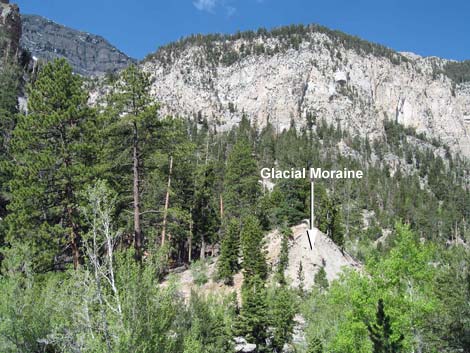
After a couple of minutes on the south road, the road ends, and the route drops into the bottom of Echo Canyon (Wpt. 04). At this point, an obvious trail leads straight across the wash and up the bank on the far side towards a snow-survey marker. Don't follow the trail to the marker; rather, turn uphill staying in the canyon bottom. Staying in the rocky wash, the route quickly passes a huge pile of dirt on the south (left) side of the wash (Wpt. 05). This pile is interpreted by some geologists as the remains of a glacial moraine (terminal moraine). If correct, this is evidence that a glacier once flowed down the east side of Mt. Charleston. Just past the glacial moraine, the route curves left and runs south into Big Falls Canyon (Wpt. 06). Because of the lay of the land and recent erosion, it seems like the route should stay in the main canyon (right), but this is not the case. Echo Canyon, the main canyon, continues to the west-northwest, while Big Falls Canyon runs to the south-southwest. |
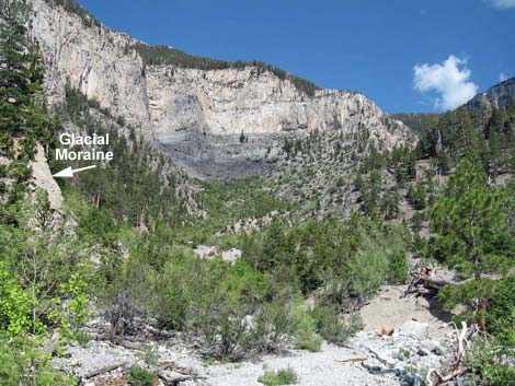 Route follows canyon bottom upstream (view S) |
The route runs up Big Falls Canyon, scrambling over and around boulders and logs most of the way. Staying in the wash, the route reaches a 20-foot-high pour-over, which is formed where the wash runs through a narrow slot in a band of cliffs and a big boulder is jammed in the top of the slot (aka: a chockstone). The obstacle can be passed by a log ladder up over the boulder or by backtracking a few yards (Wpt. 07) and climbing the east bank on a steep, narrow, rocky use-trail. The bypass runs up and around the pour-over, then drops back into the wash. There are a number of use-trails in this part of the canyon. From atop the pour-over, the route continues up the wash until use-trails climb onto the west (right) side of the canyon. Several of the use-trails in this area are useful, but the route stays as low and close to the wash as possible. |
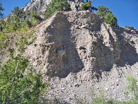 Kyle Canyon Moraine (view S) |
The route continues boulder- and log-hopping up the canyon to the base of the tall, gray limestone cliffs (Wpt. 08). If the water is flowing, it is obvious that this is Big Falls. I've not done the climb, but the falls can be passed by scrambling up the steep, tree covered cliffs just east (left) of the falls. Return to the trailhead by retracing your steps down the canyon. When hiking down, if you follow use-trails along the west side of the canyon and get to the Mt. Charleston Wilderness Area Boundary sign, cut steeply down the hillside to the bottom of the canyon. The broad and level use-trail that traverses the hillside to the north of the sign is not a better way to go. |
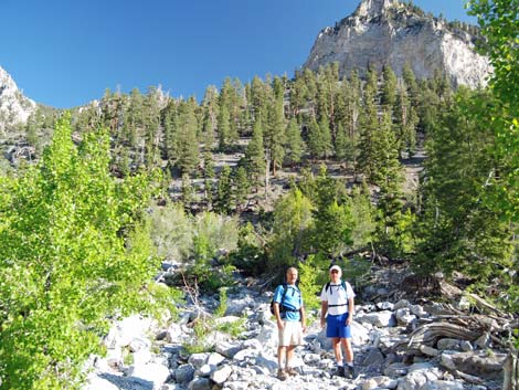 Hikers in wash past moraine (view NW) |
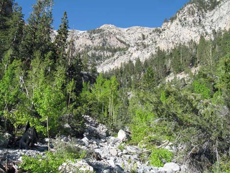 Curving left (southward) into Big Falls Canyon (view W) |
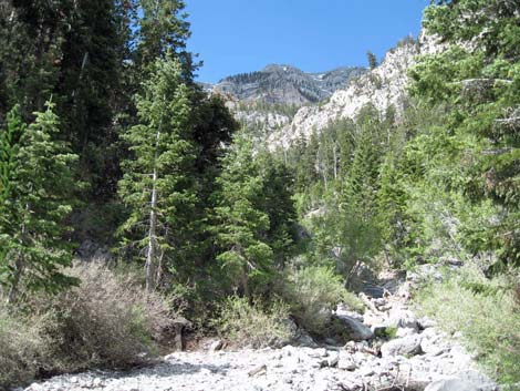 Base of Big Falls Canyon (view SW) |
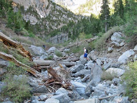 Climbing over boulders and logs in Big Falls Canyon (view S) |
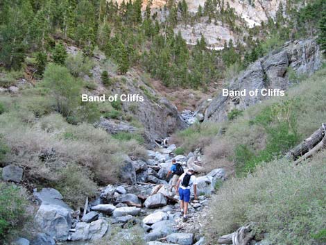 Approaching band of cliffs and pour-over with chockstone (view S) |
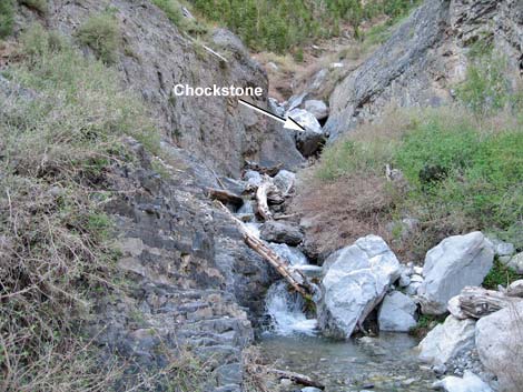 Bypass waterfall to the left (view S) |
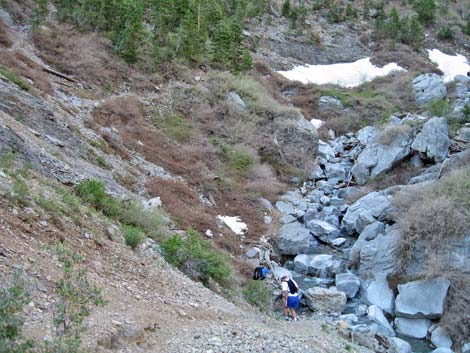 Returning to canyon bottom after bypassing pour-over (view S) |
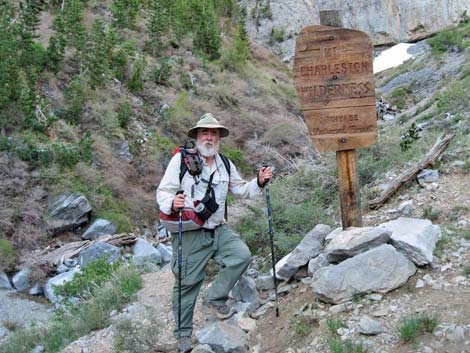 BirdAndHike Guy at the wilderness boundary |
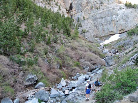 Staying low in the canyon is best (view SW) |
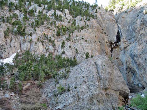 Cliffs east of Big Falls (route to get above the falls) |
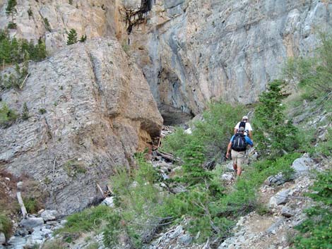 Hikers approaching Big Falls |
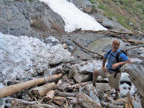 Hikers climbing over avalanche debris |
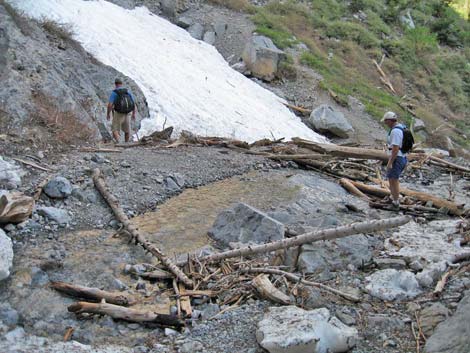 Hikers approaching Big Falls |
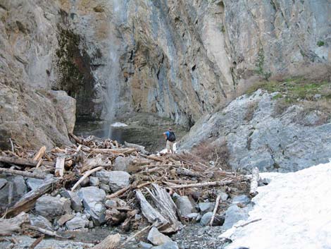 Hiker at plunge pool below Big Falls |
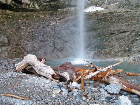 Plunge pool below Big Falls |
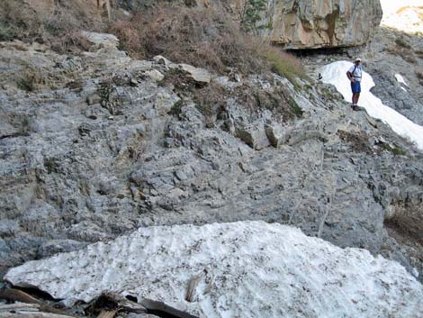 Rocks and snowbank below Big Falls |
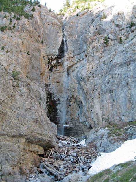 Big Falls (view S) |
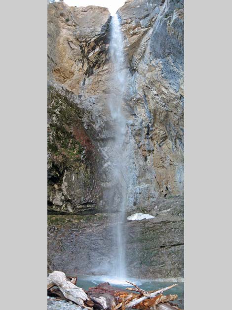 Big Falls (view S; vertical panorama) |
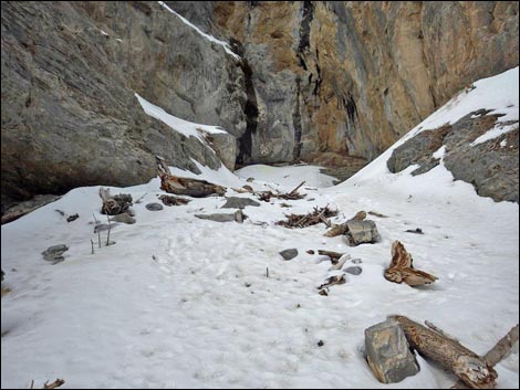 Approaching Big Falls in the snow (April 2014) |
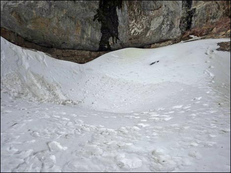 Big Falls plunge pool in April 2014 |
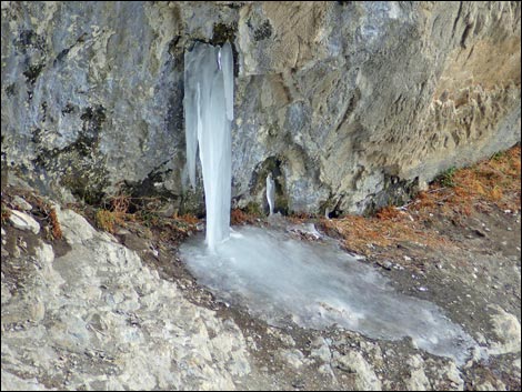 Big Falls icicle in April 2014 |
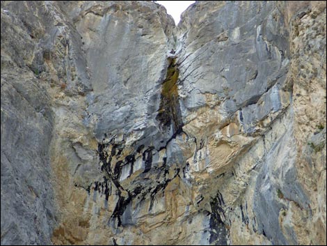 Looking up Big Falls with only a trickle of water in April 2014 |
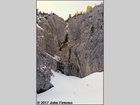 Big Falls with snow, March 2017 |
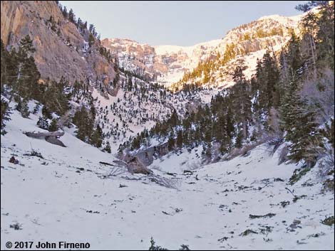 Big Falls Canyon with snow, March 2017 |
Table 1. Hiking Coordinates Based on GPS Data (NAD27; UTM Zone 11S). Download Hiking GPS Waypoints (*.gpx) file.
| Wpt. | Location | UTM Easting | UTM Northing | Elevation (ft) | Point-to-Point Distance (mi) | Cumulative Distance (mi) | Verified |
|---|---|---|---|---|---|---|---|
| 01 | Trailhead | 620227 | 4014220 | 7,817 | 0.00 | 0.00 | GPS |
| 02 | Leave MJF Trail | 619456 | 4014950 | 8,150 | 0.68 | 0.68 | GPS |
| 03 | Old road forks | 619417 | 4014975 | 8,168 | 0.03 | 0.71 | GPS |
| 04 | Wash | 619178 | 4014908 | 8,222 | 0.16 | 0.87 | GPS |
| 05 | Moraine | 619143 | 4014915 | 8,231 | 0.03 | 0.9 | GPS |
| 06 | Big Falls Canyon | 619050 | 4014926 | 8,275 | 0.07 | 0.97 | GPS |
| 07 | Bypass Chockstone Waterfall | 618904 | 4014610 | 8,487 | 0.24 | 1.21 | GPS |
| 08 | Big Falls | 618802 | 4014426 | 8,689 | 0.15 | 1.36 | GPS |
| 09 | Alternate Route (not good) | 618876 | 4014602 | 8,633 | . | . | GPS |
| 10 | Alternate Route (not good) | 618897 | 4014629 | 8,548 | . | . | GPS |
| 11 | MJF First Switchback | 619428 | 4014989 | 8,248 | . | . | GPS |
| 01 | Trailhead | 620227 | 4014220 | 7,817 | 1.36 | 2.72 | GPS |
Happy Hiking! All distances, elevations, and other facts are approximate.
![]() ; Last updated 240329
; Last updated 240329
| Hiking Around Mt Charleston | Hiking Around Las Vegas | Glossary | Copyright, Conditions, Disclaimer | Home |