Southern Nevada Wilderness Areas
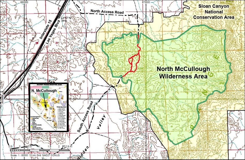
Note: Map based on USGS 7.5-minute topo map, which may have red grid lines and various numbers. North is at the top. Grid is UTM NAD27 CONUS. Roads are black (solid = paved; dashed = unpaved; width implies quality). Trails and routes are red (solid = main; dashed = adjacent or alternate). Washes, streams, and lakes are blue (solid = permanent; dashed = intermittent). Wilderness Areas (boundaries solid green, fill light green) based on BLM data. National Conservation Areas (boundaries dash-dot green, fill light green) based on BLM data. Urban areas (yellow) based on Google Earth images. BLM public lands (no color overlay) based on BLM data.
Note: All distances, elevations, and other facts are approximate.
![]() ; Last updated 250420
; Last updated 250420
| North McCullough Wilderness Area | Southern Nevada Wilderness | Hiking | Copyright, Conditions, Disclaimer | Home |