Southern Nevada Wilderness Areas
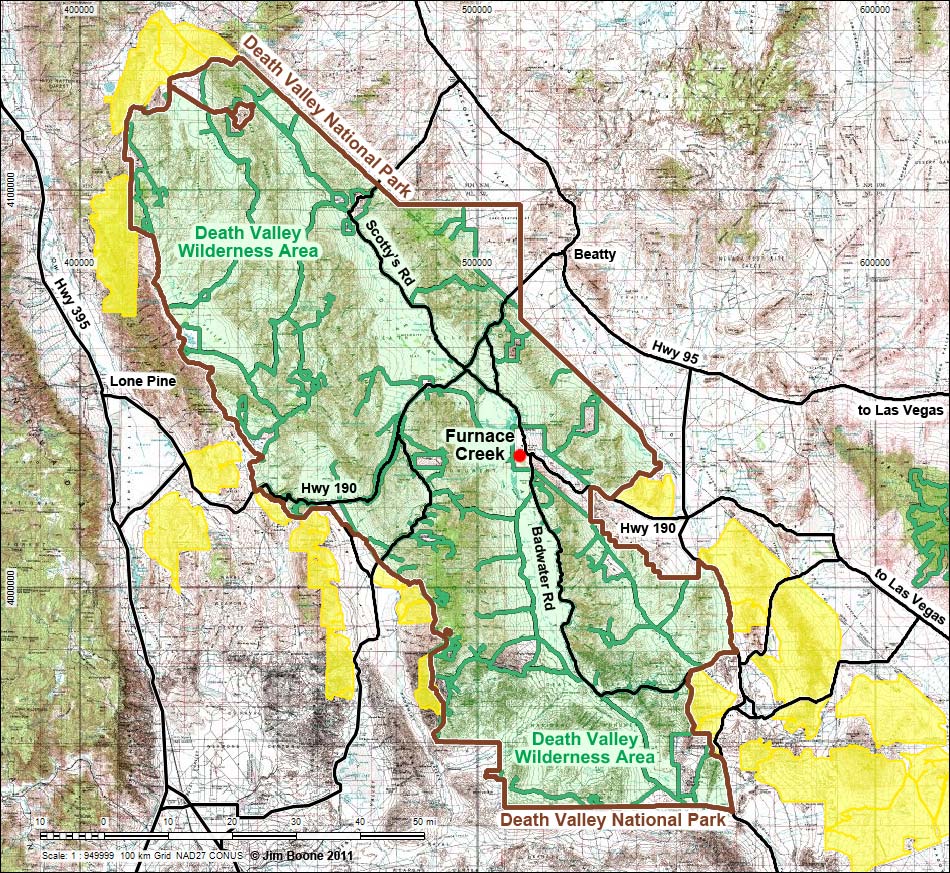
Note: Map based on USGS 7.5-minute topo map, which may have red grid lines and various numbers. North is at the top. Grid is UTM NAD27 CONUS. Roads are black (solid = paved; dashed = unpaved; width implies quality). Trails and routes are red (solid = main; dashed = adjacent or alternate). Washes, streams, and lakes are blue (solid = permanent; dashed = intermittent). Wilderness Areas (boundaries solid green, fill light green) based on BLM data. National Park areas (boundaries dashed green, fill light green) based on NPS data. Almost all of Death Valley National Park is designated wilderness, with many individual wilderness areas separated only by dirt roads. Several more wilderness areas surround the National Park.
Note: All distances, elevations, and other facts are approximate.
![]() ; Last updated 250420
; Last updated 250420
| Death Valley Wilderness Area | Wilderness Areas | Hiking Around Las Vegas | Copyright, Conditions, Disclaimer | Home |