Backroads Around Las Vegas, Red Rock Canyon National Conservation Area
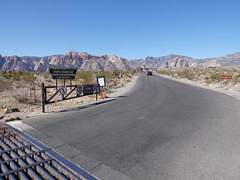
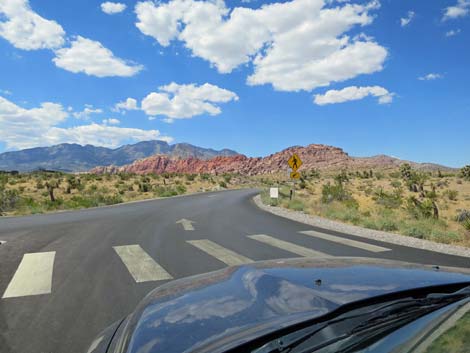
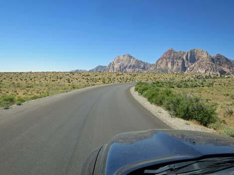
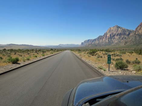
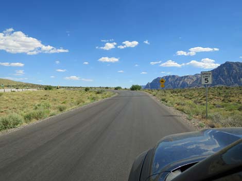
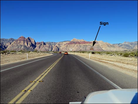 Approaching Scenic Loop Road entrance sign (view S) |
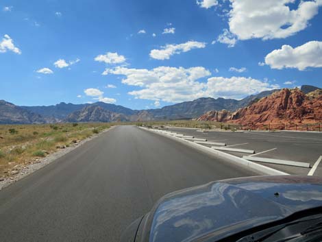
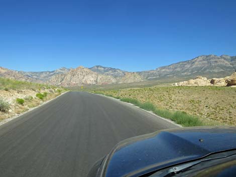
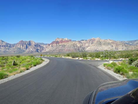
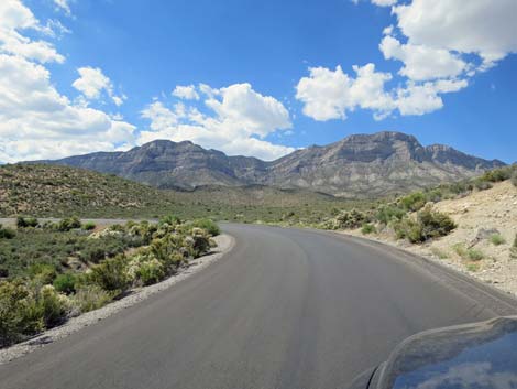
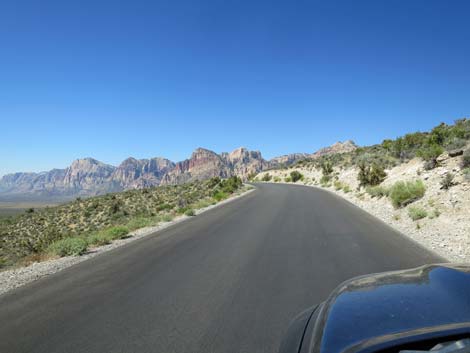
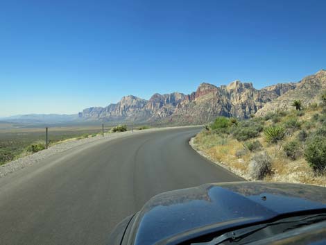
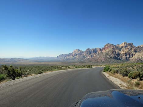
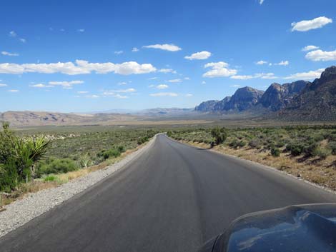
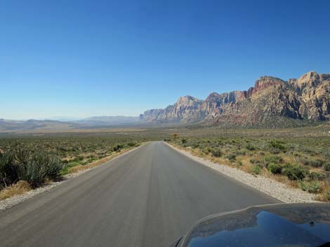
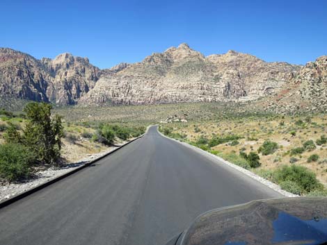
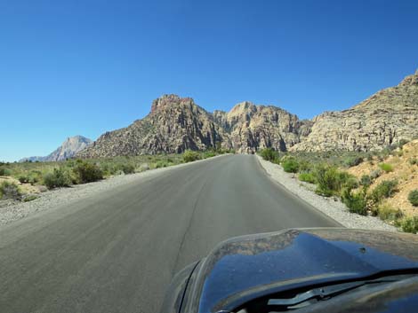
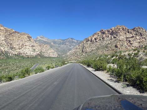
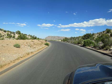
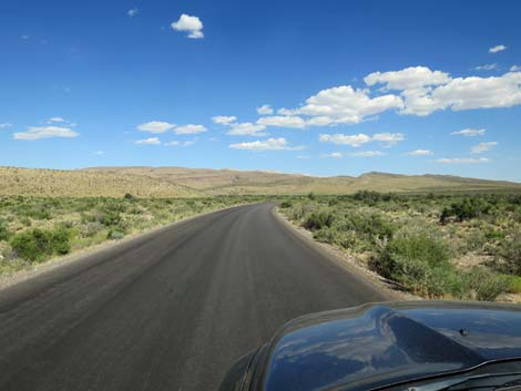
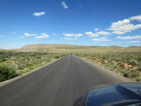
Overview The Red Rock Canyon Scenic Loop Road is the main paved road through Red Rock Canyon National Conservation Area and makes a horse-shoe shaped loop off the north side of West Charleston Blvd. Many people think the Scenic Loop Road is Red Rock Canyon NCA, but while this is the most scenic area, it is only a small part of the NCA. The road is one-way and 12.5 miles long, so if visitors miss something (perhaps a parking lot was full), just finish the loop, drive 2.2 miles back to the entrance, and drive the loop again -- the entrance fee is good all day. The road runs north and uphill along the bright red Calico Hills, loops to the west below the gray La Madre Mountain Range (La Madre Mountain Wilderness Area), and curves back down and south along the red-and-white Red Rock Cliffs (Rainbow Mountain Wilderness Area) to the highway. The road provides access to the Visitor Center, two Wilderness areas, numerous hikes, scenic pullouts, rock climbs, picnic areas, and lots of grand scenery with a variety of desert vegetation types. The road was repaved and parking lots were expanded in 2017 and 2018; link to photos. Link to Road Map. |
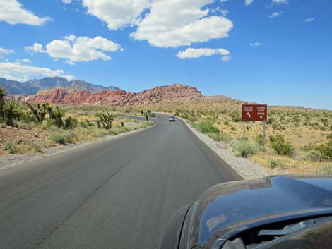
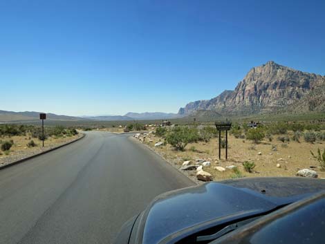
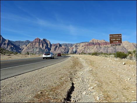 Sign announces entrance to Visitor Center and Scenic Loop (view W) |
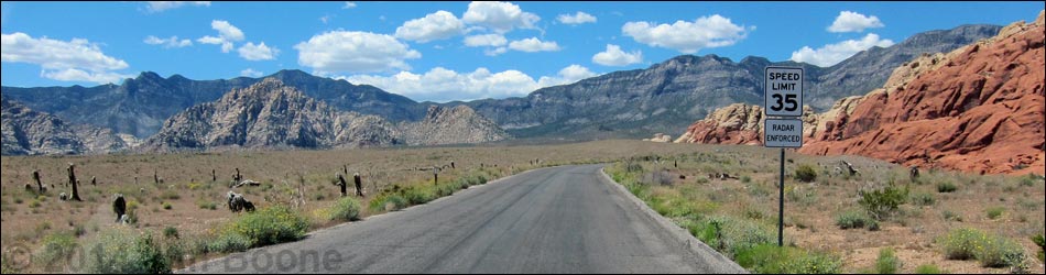
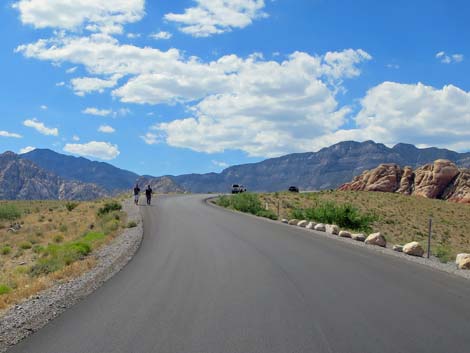
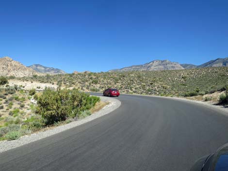
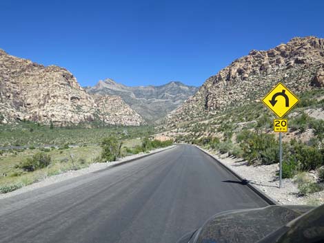
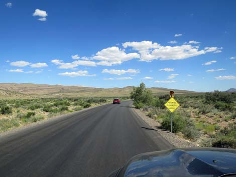
Watch Out Other than the standard warnings about driving in the desert, ...this is a fairly safe drive except that there are lots of sharp curves, pedestrians, bicycles, small animals, seemingly blind drivers, and people stopping in the middle of the road to take pictures. The road has no center line, but it is two lanes wide, so fast drivers will try to pass on curves and anywhere they want to give it a try. The maximum speed limit is 35 mph, but some sections are posted 15 mph. Drive slowly, enjoy the view, and pay attention to warning signs. Don't hug the right shoulder on sharp right-hand curves as you might clip a bicycle or pedestrian. While out, please respect the land and the other people out there, and try to Leave No Trace of your passage. Also, even though this road is short, be sure to bring what you need of the 10 Hiking Essentials. |
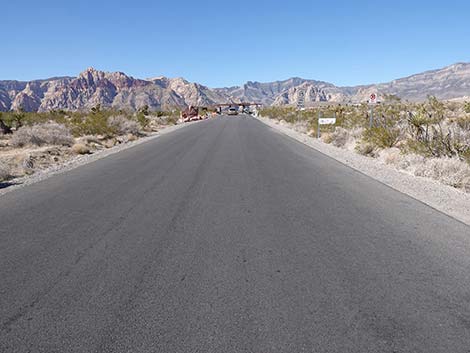
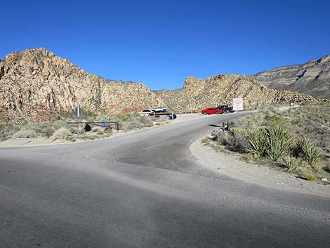
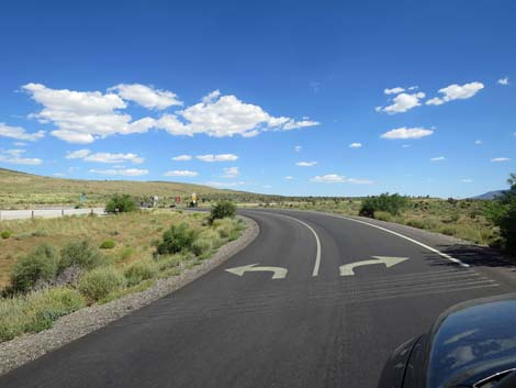
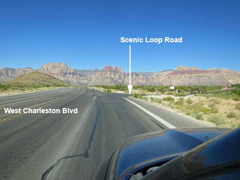 West Charleston Blvd at Scenic Loop Road (view SW) |
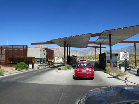
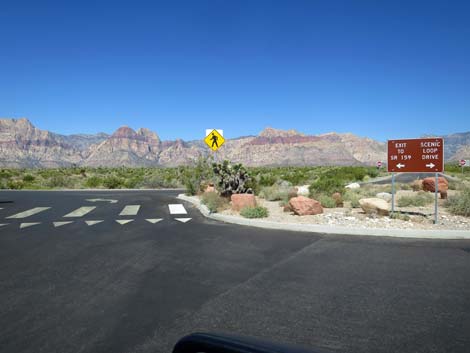
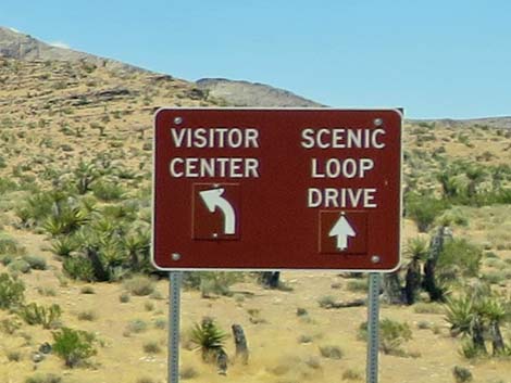
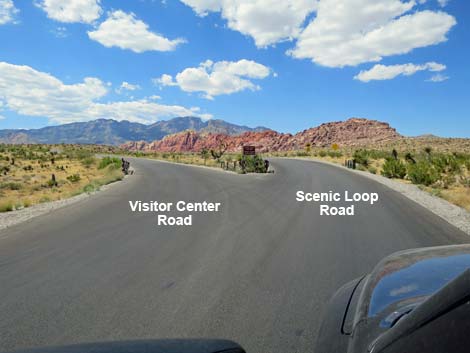
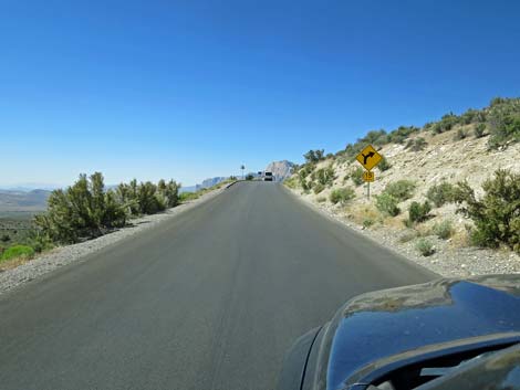
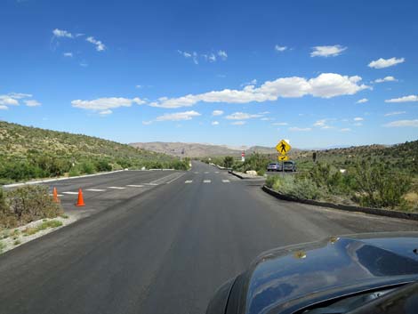
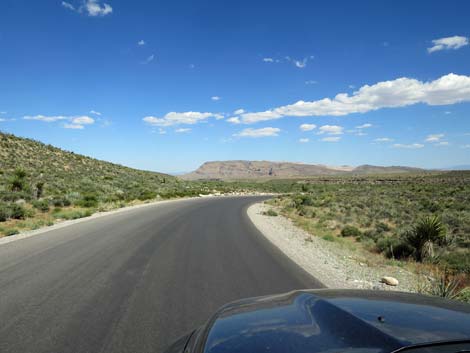
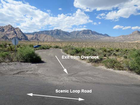
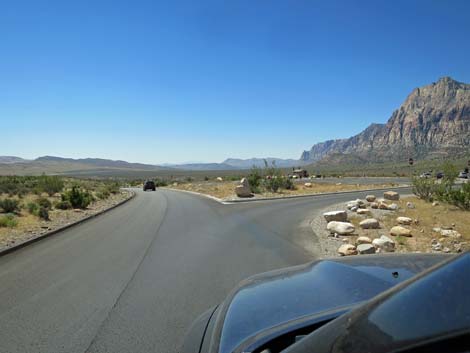
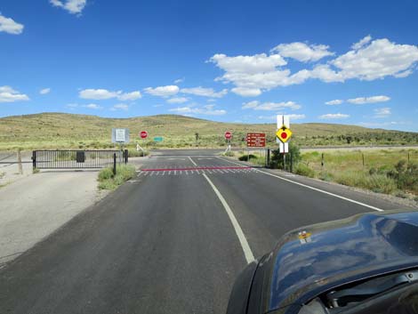
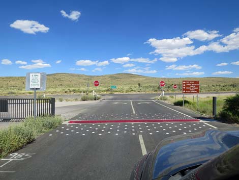
Getting to the Scenic Loop Road From Las Vegas, drive out West Charleston Blvd to Red Rock Canyon National Conservation Area. Pay the fee and start the Scenic Loop Road. The Road From West Charleston Blvd about 3.9 miles past the edge of town (Table 1, Site 0519), the paved Scenic Loop Road branches off to the right and runs northwest to the Fee Station. After paying the entrance fee, the Scenic Loop Road stays right, although drivers can turn left into a parking area or exit the area back to West Charleston Blvd. At about 0.28 miles out, the Scenic Loop Road forks. The main road stays right, while the road to the left runs up to the Visitor Center (Site 1526), which can be seen on the hill to the left. If stopping at the Visitor Center, drivers can loop back to the Scenic Loop Road. |
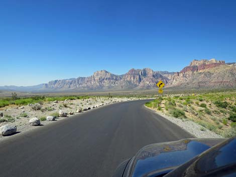
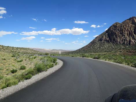
 Turning onto Scenic Loop Road (view NW) |
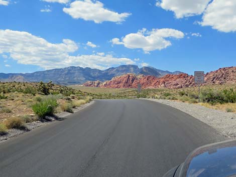
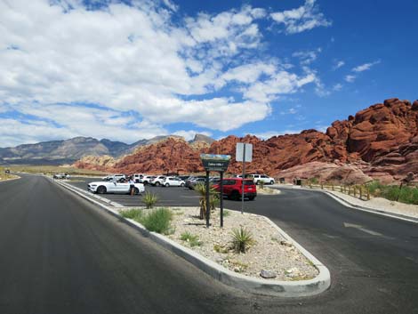
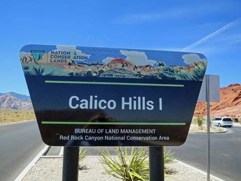
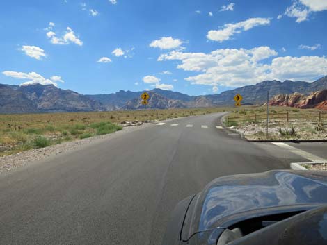
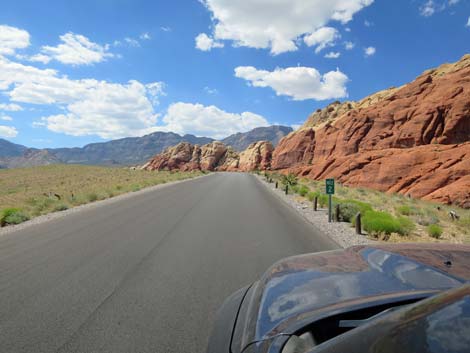
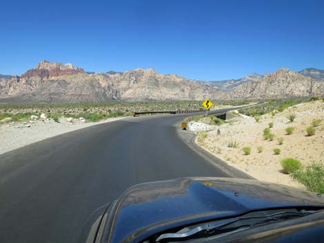
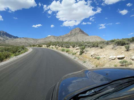
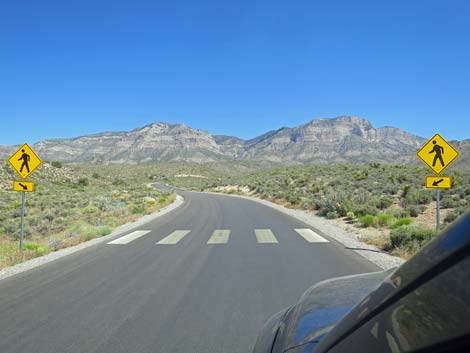
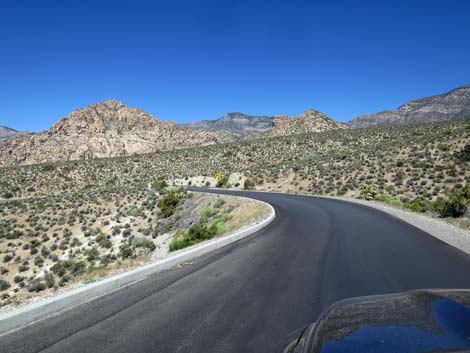
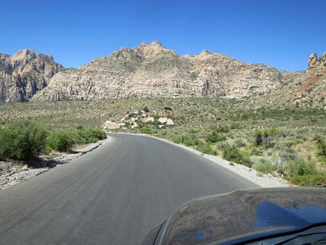
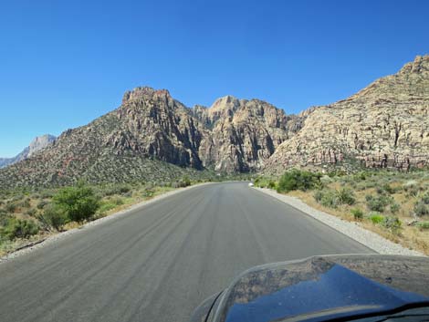
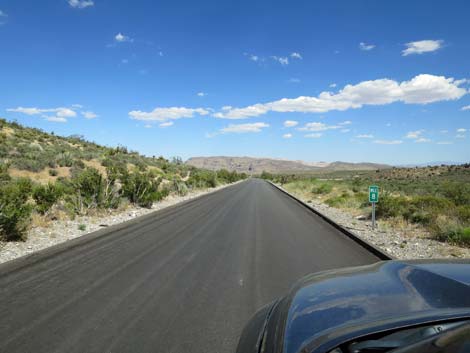
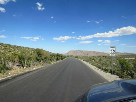
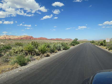
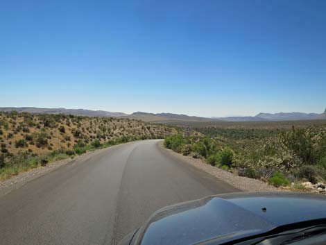
Continuing, the Scenic Loop Road runs up over a low hill and presents drivers with nice views of the Calico Hills ahead and on the right, plus views left towards the Red Rock Cliffs. After dropping through a wash, the road begins winding relentlessly uphill. Pay attention to caution signs -- most along here deal with pedestrians, crosswalks (Grand Circle Trail), and tortoises on the road. Notice in these hills that the vegetation on the left side of the road burned in the 850-acre Loop Fire in 2005. Farther along, the fire burned both sides of the road. After almost 15 years, some of the vegetation is growing back, but it will be a long time before the desert gets back to normal. Passing Mile Marker 1, the road climbs onto a ridgeline at Calico Hills 1 Trailhead parking (Site 0523). This is a nice place to stop, take in the views, and perhaps do a hike or a rock climbing route. Be careful driving here and watch for drivers pulling out without looking and pedestrians wandering into the road. |
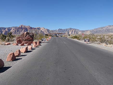
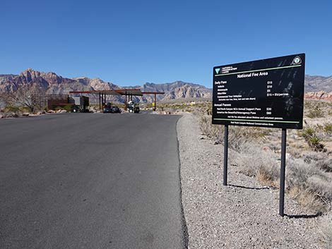
 Entrance road leads to fee booths (view NW) |
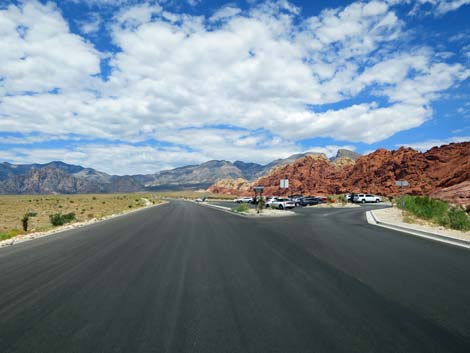
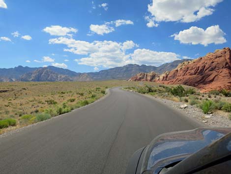
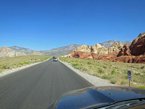
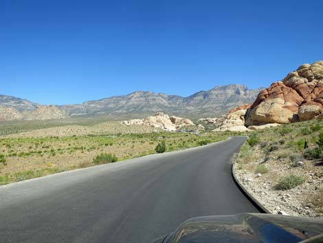
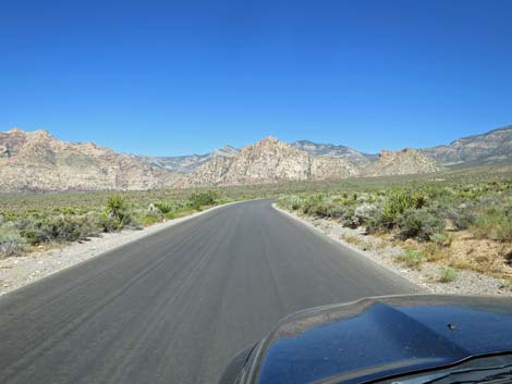
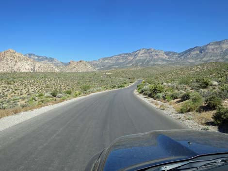
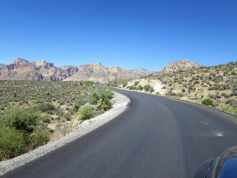
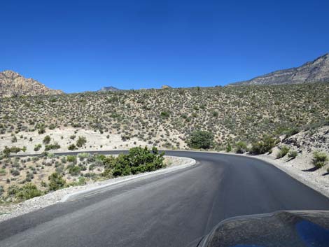
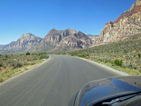
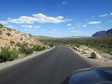
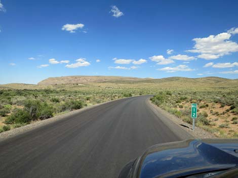
Beyond Calico Hills 1, the road runs along the spine of a ridge. To the right are the Calico Hills, but between here and there, a deep chasm blocks easy travel. Hiking trails run in the bottom of the gully and on the far hillside, so drivers might see hikers below. The red cliffs are quite popular among rock climbers, and often colorful specks can be seen creeping up the walls. To the left, the Red Rock Cliffs stand in the far distance, and most of the terrain between here and there burned in the 2005 and 2006 fires. Continuing to climb along the Calico Hills, the road reaches Calico Hills 2 Trailhead parking (Site 0524). Similar to Calico Hills 1, this pullout provides viewpoints and hiker access to the Calico Hills. The road continues to climb along the spine of the ridge, providing grand views in both directions and passing Mile Marker 2. Quite close to the Calico Hills, the road crosses a highpoint and begins to descend towards Sandstone Quarry, which can be seen ahead in the near distance. |
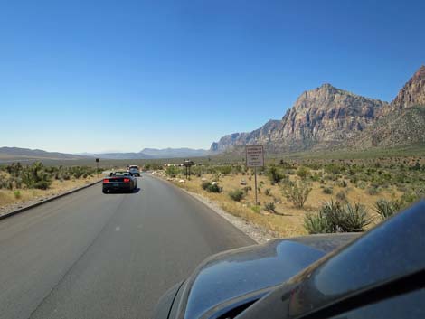
 Approaching a good selfie spot, but don't block traffic |
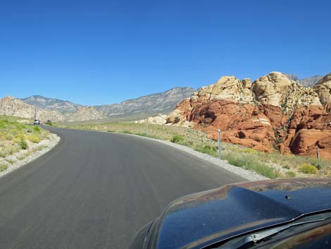
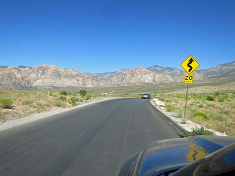
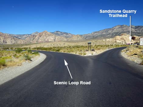
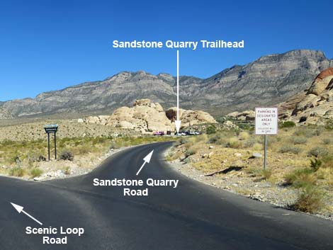
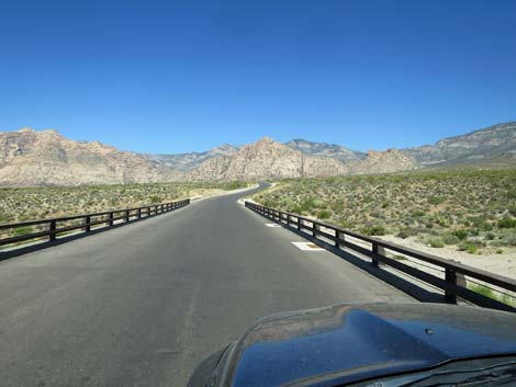
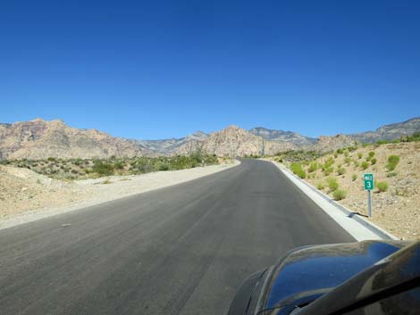
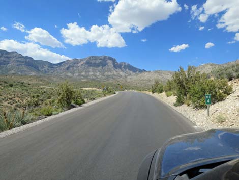
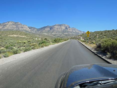
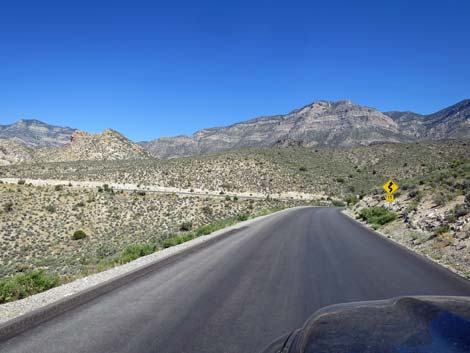
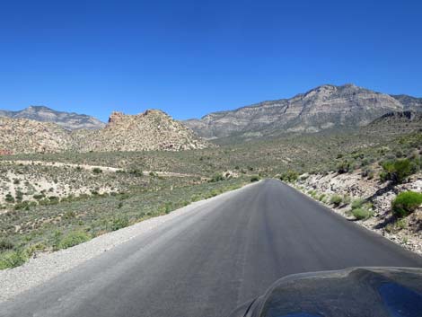
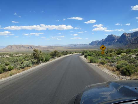
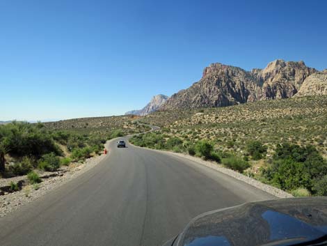
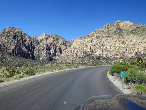
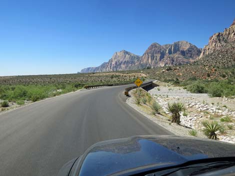
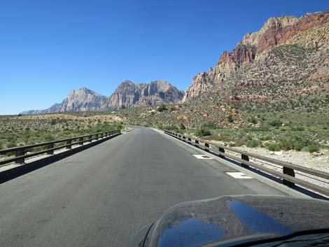
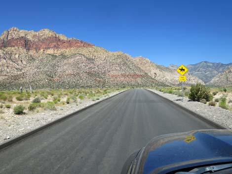
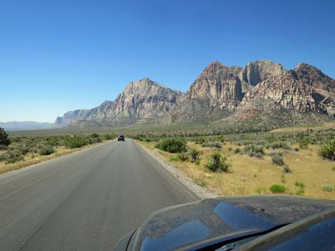
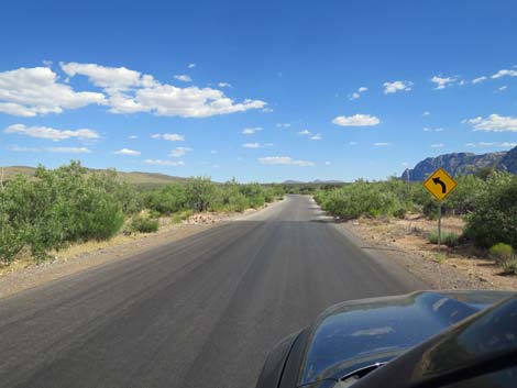
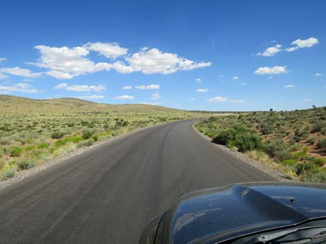
Curving to the left, at about 2.7 miles out, the Scenic Loop Road forks (Site 0874). The main road stays left, while the right leads into Sandstone Quarry. Sandstone Quarry Road provides access to Sandstone Quarry Trailhead, a large parking area, and a short trail to the historic quarry site. Longer trails run in all directions. Sandstone Quarry Road makes a horseshoe loop, so shortly the main road passes the exit from the trailhead, also on the right. Past Sandstone Quarry Road, the Scenic Loop Road turns south on high ground with grand views all around. Shortly, the road curves right to cross a bridge over Sandstone Wash, then quickly passes Mile Marker 3. Past Sandstone Wash Bridge, the road begins climbing more steeply, and the winding road provides views in different directions. To the north are the gray limestone cliffs of the La Madre Mountain Range. Off to the right is the prominent Turtlehead Peak, a bit of the La Madre Range and a popular hiking destination. Ahead to the left, the White Rock Hills can be seen from time to time, as can the Red Rock Cliffs off to the west. At about Mile Marker 4, Turtlehead Peak rears its head high above the roadway, but keep an eye out for hikers in the crosswalk (second Grand Circle Trail crossing). |
 A good selfie spot, but don't block traffic |
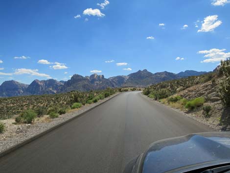
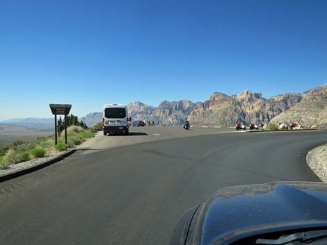
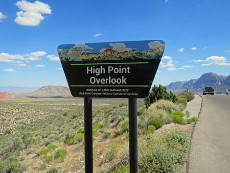
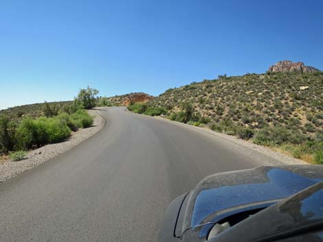
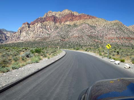
Eventually the road curves left and the grades lessen. The road, however, begins to wind more sharply back and forth as it traverses the hillside, running in and out of every wash. Be more careful on these curves than did other drivers (notice the skid marks running over the hillsides on the sharp curves). The road winds up to the High Point Overlook parking area (Site 0403). This is a nice place to stop and enjoy views that stretch across the entire area. From the overlook, to the left (east) Turtlehead Peak stands high above the Calico Hills. Beyond the Calico Hills, urban Las Vegas can be seen in the distance. More straight ahead (south), the Visitor Center can be seen, and behind that is Blue Diamond Hill. Down the valley, views stretch past Highway 160. To the right (west), the Red Rock Cliffs tower above everything. Be sure to turn around (north) and notice the La Madre Range standing high above the parking lot. |
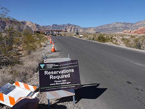 Lots of signs: Reservations Required from 8am to 5pm |
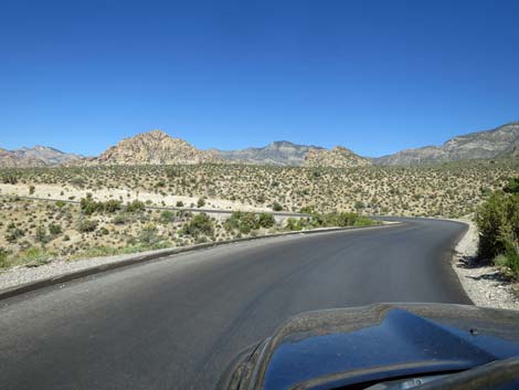
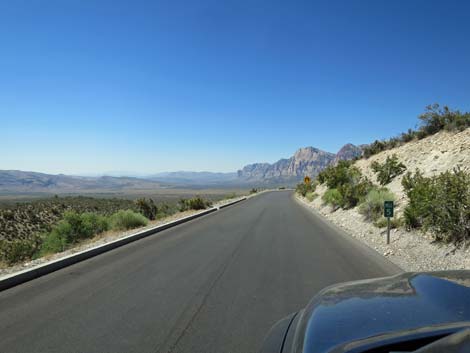
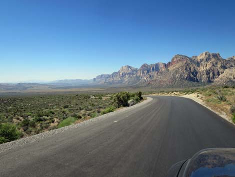
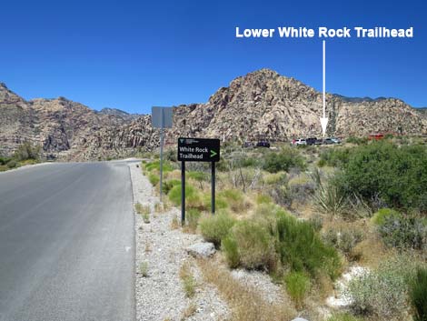
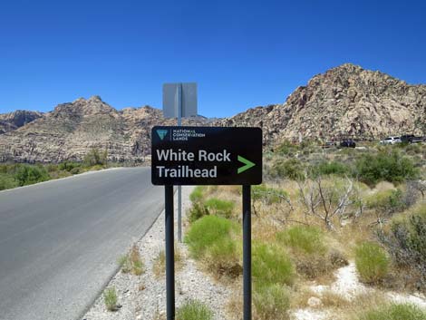
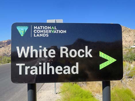
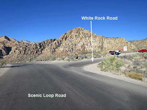
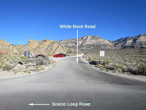
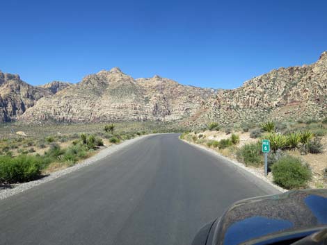
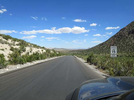
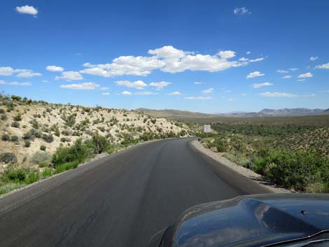
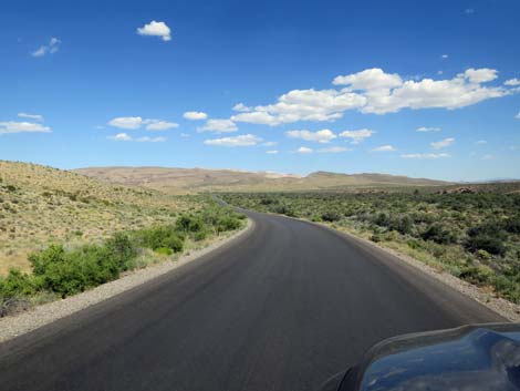
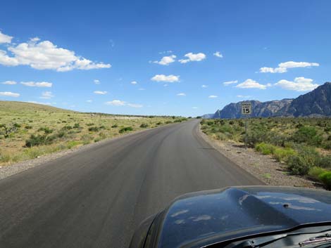
Beyond the High Point Overlook, the road winds sharply past Mile Marker 5, then winds even more sharply as it begins to descend the hillsides. Be careful not to hug the right shoulder through here because walkers and bikers always seem to stop in the road where you can't see them (drivers tend to stop on the right too). The road eventually makes a long, straight run to the south. Watch the downhill speed here as the approaching curve is quite sharp. The Scenic Loop Road eventually turns west, and at about 5.8 miles out, arrives at White Rock Road (Site 0525) on the right. White Rock Road is a bumpy dirt road that runs north for 0.6 miles to White Rock Trailhead, which serves several hiking trails. At the intersection, watch again for hikers using the unmarked Grand Circle Trail crosswalk. The Scenic Loop Road continues descending across the hillsides below the White Rock Hills, passes Mile Marker 6, and the sharpest curves are now in the rearview mirror. The relatively long, straight sections provide nice views south across the valley and west to the Red Rock Cliffs. At the bottom of the hill, watch during winter for Bighorn Sheep on the hills to the right. |
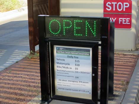
 Approaching the fee schedule sign (February 2022) |
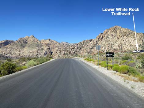
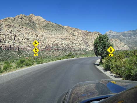
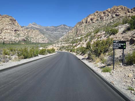
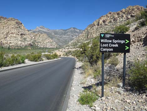
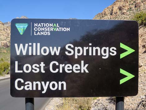
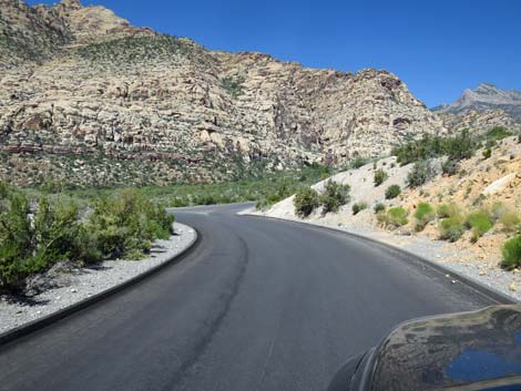
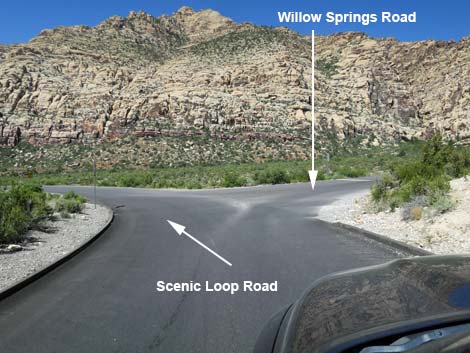
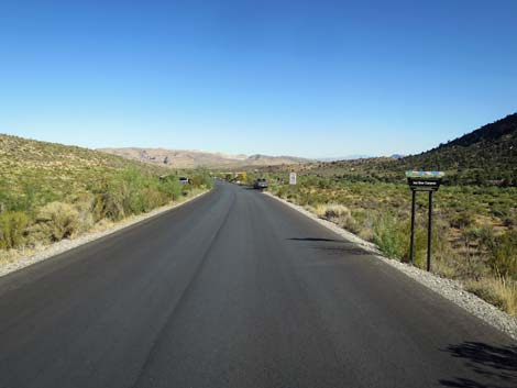
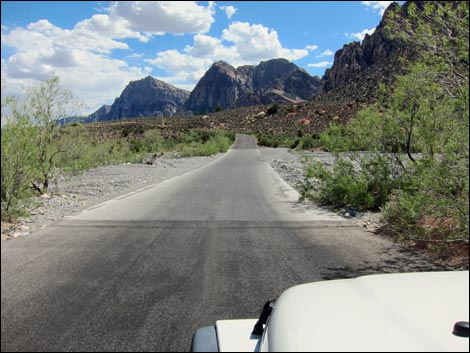
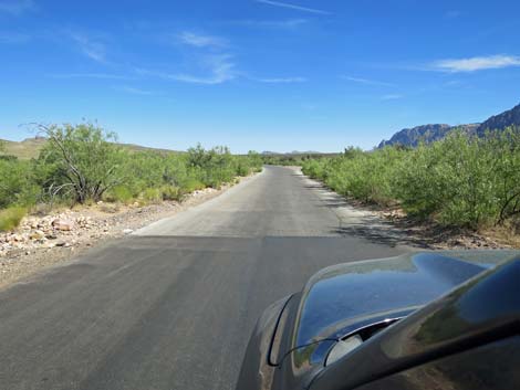
The road runs down to cross a wash, then climbs as it runs up onto the side of the South Ridge of White Rock Hills. The road passes Mile Marker 7, then arrives at a blind curve to the right; watch for pedestrian signs alerting drivers to a crosswalk where the Grand Circle Trail crosses the road for the last time. The road turns the corner and begins descending across a hillside heading northwest towards Red Rock Canyon. On a hairpin turn to the left, at about 7.3 miles out, the main road passes Willow Springs Road (Site 0526), on the right. Willow Springs Road runs north into the deep canyon between the Red Rock Cliffs on the left and the White Rock Hills on the right. This road provides access to Lost Creek Trailhead, Willow Springs Trailhead, Rocky Gap Road, interesting archeological sites, numerous hiking trails, and Willow Springs Picnic Area. |
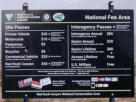 Fee schedule (August 2023) |
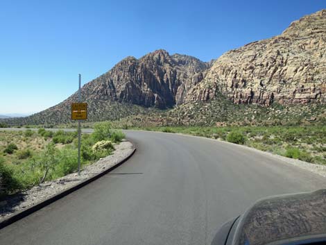
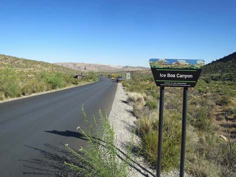
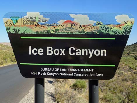
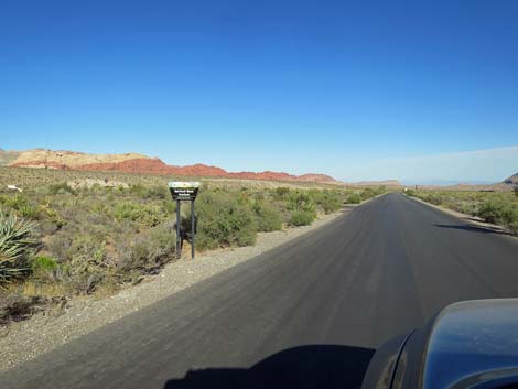
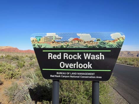
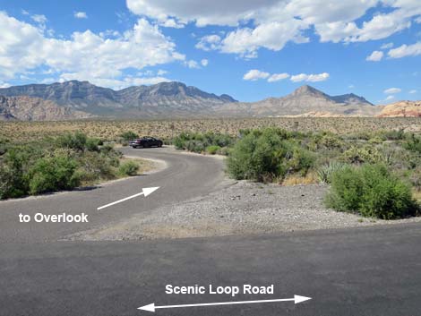
Descending beyond Willow Springs, the road parallels Red Rock Wash and shortly, 7.8 miles out, arrives at Ice Box Canyon Trailhead and Overlook (Site 0822). This is a nice place for a close-up view of the Red Rock Cliffs and a place to connect with trails into the canyons and along the base of the escarpment. Descending beyond Ice Box Canyon, the road passes Mile Marker 8 and runs down to cross Red Rock Wash on another bridge. In the old days, drivers had to use extra care here when water was flowing across the road, and stay out of flashflood waters. The road crosses the bridge, climbs out the other side of the wash, curves left, and shortly arrives at Red Rock Wash Road (Site 1524), on the left (8.8 miles out). Red Rock Wash Overlook provides a quiet place to stop and relax on benches overlooking the wash with views of the mountains beyond. |
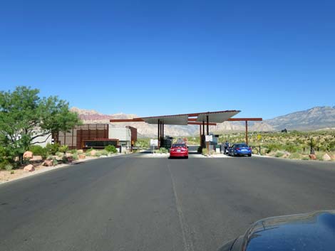 Approaching Red Rock Canyon Entrance Station (view NW) |
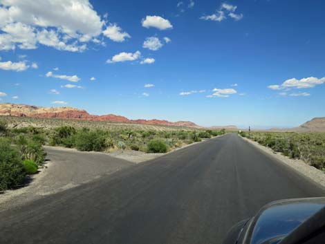
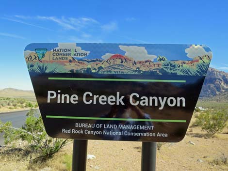
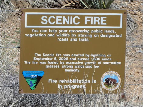
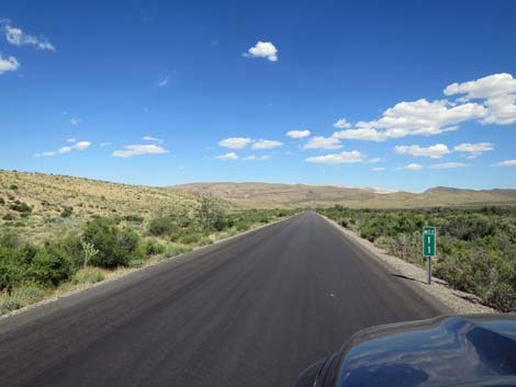
The area around Red Rock Wash Overlook is heavily vegetated with a diversity of shrubs and lots of Buckhorn Cholla cactus. A little farther along, the road enters the upper edge of the 2005 burn area. Driving along, notice the contrast between the left and right sides of the road. Eventually, around Mile Marker 9, both sides of the road are burned; this is a result of the 1,600-acre Scenic Fire of 2006. The road makes a sweeping curve to the right, then climbs the hillside back into the unburned area. Sweeping back to the left and running south, the road passes Mile Marker 10 and provides nice views of the valley and the Red Rock Cliffs. Running fairly straight, at about 10.4 miles out, the Scenic Loop Road arrives at Pine Creek Road (Site 0875), on the right. Pine Creek Road provides access to Pine Creek Trailhead with trails into the canyon and along the base of the escarpment. Descending through a bit of a canyon, the Scenic Loop Road curves to the left, parallel to Pine Creek Wash. Along this section, notice the Ponderosa Pine, Canyon Live Oak trees, and other heavy shrubbery that thrive on water and cool breezes flowing down Pine Creek. |
 Red Rock Canyon Entrance Station (view NW) |
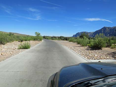
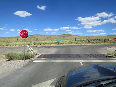
On the left, the burned hillside is more of the 2006 Scenic Fire. The road runs fairly straight, passes Mile Marker 11, out into the broad desert valley. After a gentle curve to the right, the road crosses Pine Creek Wash (don't enter if deeply flooded) and then passes Oak Creek Road (Site 0530; 11.8 miles out). This road leads about 3/4-miles to Oak Creek Road Trailhead, which provides access to trails in the Oak Creek Canyon area and along the base of the Red Rock Cliffs. Beyond Oak Creek Road, the Scenic Loop Road runs east across open desert flats, passes Mile Marker 12. then makes broad sweeping curves right and then left to arrive at the exit from the Scenic Loop Road at West Charleston Blvd (Site 0532; 12.4 miles out). Just to the left is the Scenic Road Exit Trailhead, which provides access to several trails on the desert flats. From here, drivers can turn left to return to the Red Rock Visitor Center and Las Vegas, or turn right towards Spring Mountain Ranch State Park and the south end of Las Vegas. |
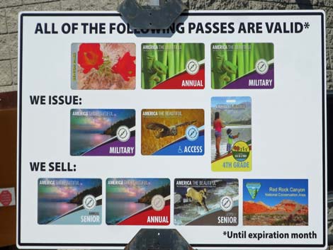 List of passes accepted |
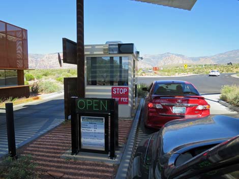 In line at the fee station |
 Fee schedule (February 2022) |
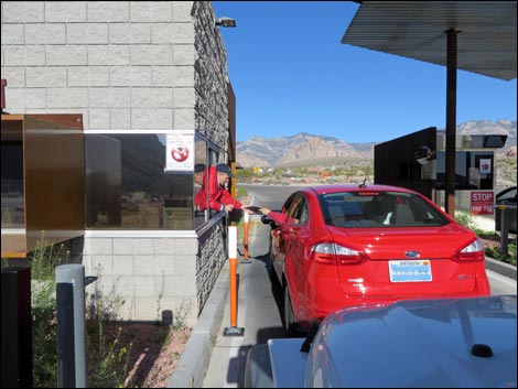 Visitor paying entrance fee |
 Departing the fee booths, stay right onto the Scenic Loop Road |
 Departing fee booths: left to exit; right to Scenic Loop Drive |
 Departing the fee booths, stay left to exit the area |
 Staying right onto the Scenic Loop Drive (view N) |
 Approaching sign for turnoff to Visitor Center (view N) |
 Sign at turnoff to Visitor Center (view N) |
 Turnoff to Visitor Center (view N) |
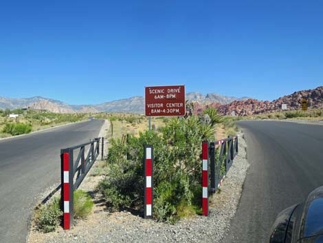 Seasonal hours of operation for the Visitor Center and Scenic Road |
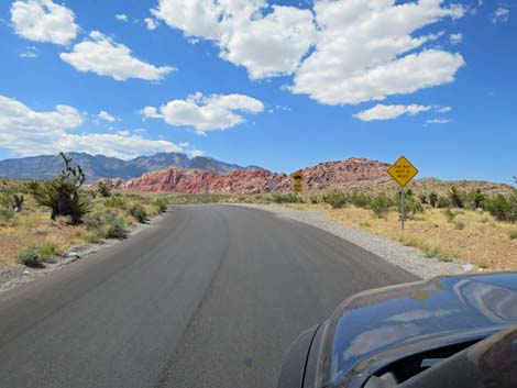 Approaching a series of information and caution signs |
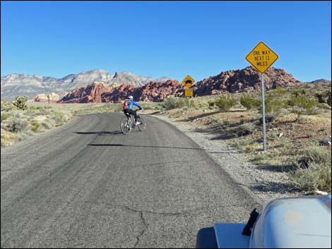 Sign: One way next 13 miles (watch for crazy bikers!) |
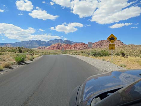 Sign: Tortoise Crossing - Caution! Tortoise on road |
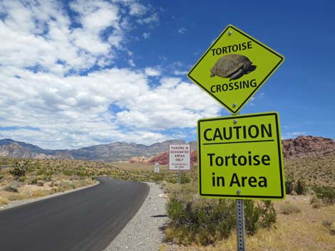 Keep an eye out for tortoises and other wildlife crossing the road |
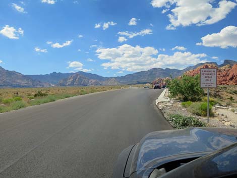
 Sign: Parking in Designated Areas Only; Violators will be Fined |
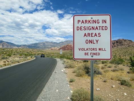 Sign: Parking in Designated Areas Only; Violators will be Fined |
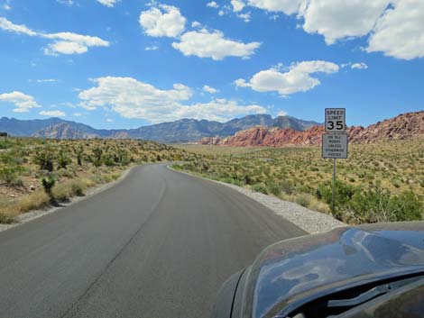 Sign: 35 mph on all roads unless otherwise posed |
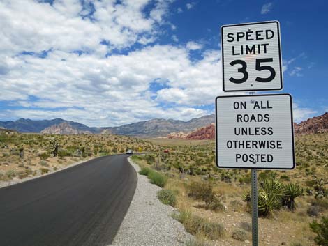 Sign: 35 mph on all roads unless otherwise posed |
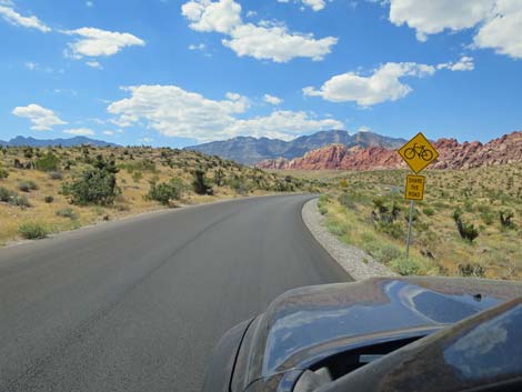 Sign: share the road with bicycles |
 Sign: share the road with bicycles |
 Crossing a wash; Calico Hills in the middle distance (view N) |
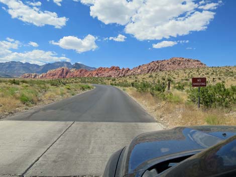 Sign: no shooting |
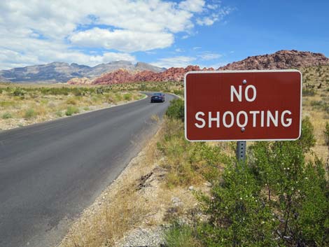 Sign: no shooting |
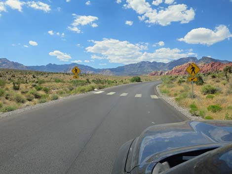 Watch for pedestrians at trail crossing (view NW) |
 Really getting started on the Scenic Loop Road (view N) |
 Mile Marker 1 (view N) |
 Sign: park only in designated area |
 Approaching Calico Hills 1 Trailhead parking (view NW) |
 Sign: Calico Hills 1 |
 Sign: Calico Hills 1 Trailhead (view NW) |
 Passing Calico Hills 1 parking area (view NW) |
 Final exit from Passing Calico Hills 1 parking and trail crossing |
 Heading into the hills (view NW) |
 The Loop Fire burned this area in 2005 (view NW) |
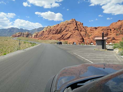
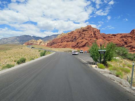 Approaching Calico Hills 2 Trailhead (view N) |
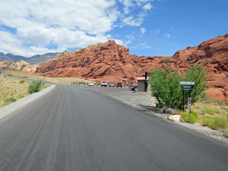 Approaching Calico Hills 2 Trailhead (view N) |
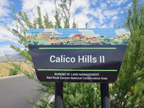 Calico Hills 2 Trailhead sign (view N) |
 Calico Hills 2 Trailhead parking (view N) |
 Watch for walkers on the road too (view N) |
 Mile Marker 2 (view NW) |
 Climbing along the Calico Hills (view NW) Climbing along the Calico Hills (view NW) |
 Steep hillside below the road (view NW) |
 Calico Hills on a flashflood day (view NE) |
 Calico Hills on a flashflood day (view NE) Calico Hills on a flashflood day (view NE) |
 Calico Hills on a flashflood day (view E) |
 Calico Hills on a flashflood day (view NE) |
 Climbing towards a high point (view NW) |
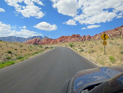
 Watch for upcoming curves (view NW) |
 Descending towards Sandstone Quarry (view N) |
 Scenic Loop Road at Sandstone Quarry Trailhead Road (view N) |
 Sandstone Quarry Trailhead Road (view NW from Scenic Loop Road) |
 Sandstone Quarry trailhead sign (view N) |
 Scenic Loop Road at Sandstone Quarry Exit Road (view W) |
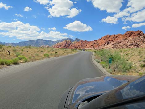
 Nice view of Red Rock Cliffs (view SW) |
 Caution sign when approaching bridge (view SW) |
 Approaching bridge over Sandstone Wash (view W) |
 Bridge over Sandstone Wash (view W) |
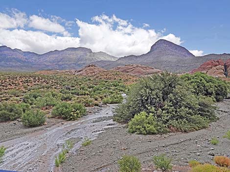 Sandstone Wash on a flashflood day (view N) |
 Mile Marker 3 (view NW) |
 Climbing towards White Rock Hills (view NW) |
 Climbing towards the La Madre Mountain Range (view NW) |
 Curving road climbs into the hills (view NW) |
 Nice view of Turtlehead Peak (view NE) |
 Mile Marker 4 (view N) |
 Grand Circle Trail crossing (view N) |
 Curves about to get sharper (view N) |
 Climbing towards the La Madre Mountain Range (view N) |
 Climbing towards the Red Rock Cliffs (view SW) |
 Climbing towards the Red Rock Cliffs (view SW) |
 Starting to curve west (view N) |
 Climbing towards High Point Overlook (note caution sign; view S) |
 High Point Overlook (note sign; view S) |
 High Point Overlook sign (view S) |
 Just past Highpoint Scenic Overlook (view NW) |
 Starting to get more good views of the Red Rock Cliffs (view SW) |
 White Rock Hills (view W) |
 Winding across the hillside (view NW) |
 Mile Marker 5 (view S) |
 Nice view of the Red Rock Cliffs, but watch the curve (view S) |
 Looking towards the White Rock Hills and LaMadre Range (view NW) |
 Long straight -- watch the downhill speed ... |
 ... watch the downhill speed ... |
 Long straight -- watch the downhill speed ... |
 ... because many people slide off the road here (view S) |
 Approaching White Rock Road (view SW) |
 Scenic Loop Road approaching White Rock trailhead sign (view SW) |
 White Rock trailhead sign (view SW) |
 White Rock trailhead sign (view SW) |
 White Rock trailhead sign (view SW) |
 Scenic Loop Road approaching White Rock Road (view SW) |
 Scenic Loop Road at White Rock Road (view SW) |
 White Rock Road (view NW from Scenic Loop Road) |
 Grand view along the Red Rock Cliffs (view S) |
 Mile Marker 6 (view W) |
 Descending towards the Red Rock Cliffs (view SW) |
 During winter, watch for Bighorn Sheep on the right (view SW) |
 Road dips to cross a wash (view S) |
 Climbing the last hill (view S) |
 Climbing the last hill (view SW) |
 Still climbing the last hill (view SW) |
 Mile Marker 7 (view W) |
 Grand Circle Trail crosses the road for a last time (view NW) |
 Descending into Red Rock Wash (view NW) |
 Sign: hairpin turn ahead with intersection (view NW) |
 Approaching Willow Springs Road sign (view NW) |
 Willow Springs Road sign (view NW) |
 Sign: right turn to Willow Springs Road (view NW) |
 Approaching Willow Springs Road (view W) |
 Scenic Loop Road at Willow Springs Road (view W) |
 Sweeping curve past the intersection (view S) |
 Descending along Red Rock Wash (view S) |
 Seems unreasonable, but they cut the speed limit to 15 mph here |
 Approaching Ice Box Canyon Trailhead sign (view SE) |
 Ice Box Canyon Trailhead sign (view SE) |
 Ice Box Canyon Trailhead sign (view SE) |
 Ice Box Canyon Trailhead Trailhead, both sides of the road (view SE) |
 Mile Marker 8 (view SE) |
 It is a long way before they put the speed limit back to 35 mph |
 Long view towards Blue Diamond Hill (view SE) |
 Approaching bridge over Red Rock Wash (view S) |
 Bridge over Red Rock Wash (view SW) |
 Historic Photo: Crossing Red Rock Wash before the bridge (view SW) |
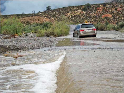 Historic Photo: Stranded van swept away when water rose higher |
 Climbing out of Red Rock Wash (view SE) |
 Long, straight road across open desert flats (view E) |
 Approaching turnoff to Red Rock Wash Overlook, on the left |
 Red Rock Wash Overlook sign (view NE) |
 Red Rock Wash Overlook sign (view NE) |
 Scenic Loop Road at Red Rock Wash Overlook Road (view NE) |
 Entrance to Red Rock Wash Overlook (view N from Scenic Loop Rd) |
 Exit from Red Rock Wash Overlook (view N from Scenic Loop Rd) |
 Long, straight road; Calico Hills on the left (view E) |
 Mile Marker 9 (view SE) |
 Scenic Fire burned this area in 2006 (view SE) |
 Curving back towards the Red Rock Cliffs (view SW) |
 Watch for horses crossing the road (view NW) |
 Curving to parallel the escarpment (view W) |
 Running along the base of the escarpment (view S) |
 Mile Marker 10 (view S) |
 Long and straight (view S) |
 Scenic Loop Road approaching Pine Creek Trailhead (view S) |
 Scenic Loop Road approaching Pine Creek Trailhead sign (view S) |
 Pine Creek Canyon Trailhead sign (view S) |
 Scenic Loop Road at Pine Creek Trailhead access road (view S) |
 Descending into Pine Creek Wash (view SE) |
 Sign: no parking in this area (view SE) |
 Boulders block improper parking area (view SE) |
 Between the Scenic Fire (left) and Pine Creek Wash (right; view SE) |
 Historical sign: info about the Scenic Fire (view NE) |
 Mile Marker 11 (view SE) |
 Wide open desert flats (view SE towards Blue Diamond Hill) |
 Watch for water across the road (view SE) |
 Approaching Pine Creek Wash crossing (view S) |
 Approaching Pine Creek Wash crossing (view S) |
 Crossing Pine Creek Wash (view S) |
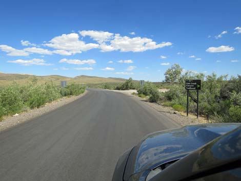 Approaching Oak Creek Canyon Road (view SE) |
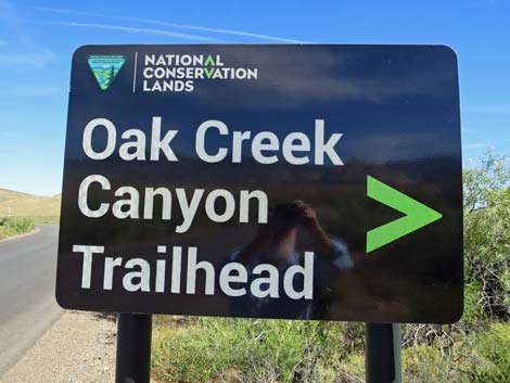 Sign: Oak Creek Canyon Road (view SE) |
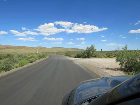 Scenic Loop Road at Oak Creek Canyon Road (view SE) |
 Long and straight across desert flats (view E) |
 Mile Marker 12 (view E) |
 Broad, sweeping curve right (view S) |
 Slow to 15 mph again (view S) |
 Slow to 5 mph! (view S) |
 Left- and right-turn lanes at the exit onto W. Charleston Blvd) |
 Approaching the end of the Scenic Loop Road (view E) |
 Tire spikes - don't back up (view E) |
 Tire spikes - don't back up (down) |
 Sign: various travel options (view SE) |
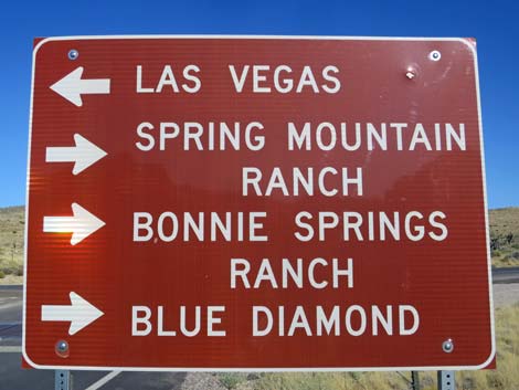 Sign: various travel options (view SE) |
 Scenic Loop Road at West Charleston Blvd (view E) |
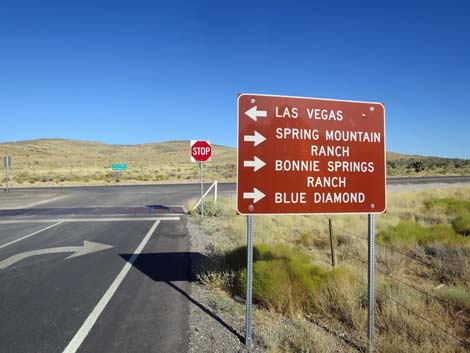
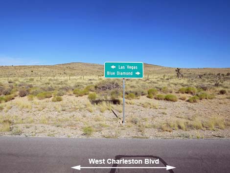 At stop sign: directional sign across West Charleston Blvd (view E) |
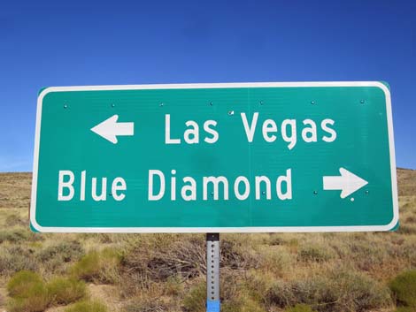 At stop sign: directional sign across West Charleston Blvd (view E) |
Table 1. Highway Coordinates based on GPS data (NAD27; UTM Zone 11S). Download Highway GPS Waypoints (*.gpx) file.
| Wpt. | Location | Latitude (N) | Longitude (W) | Elevation (ft) | Point-to-Point Distance (mi) | Cumulative Distance (mi) |
|---|---|---|---|---|---|---|
| 0519 | Hwy 159 at Scenic Loop Rd Entrance | 36.13169 | 115.42062 | 3,681 | 0.00 | 00.00 |
| 1526 | Scenic Loop Rd at Visitor Center Rd | 36.13421 | 115.42327 | 3,707 | 0.28 | 00.28 |
| 0523 | Calico I parking area | 36.14595 | 115.42991 | 3,995 | 0.88 | 01.16 |
| 0524 | Calico II parking area | 36.15180 | 115.43653 | 4,097 | 0.58 | 01.74 |
| 0874 | Scenic Loop Rd at Sandstone Quarry | 36.16042 | 115.44812 | 4,280 | 0.95 | 02.69 |
| 0403 | Scenic Loop Highpoint | 36.17063 | 115.46532 | 4,780 | 1.94 | 04.63 |
| 0525 | Scenic Loop Rd at White Rock Rd | 36.16600 | 115.47418 | 4,664 | 1.15 | 05.78 |
| 0526 | Scenic Loop Rd at Willow Springs Rd | 36.15603 | 115.48927 | 4,441 | 1.53 | 07.31 |
| 0522 | Scenic Loop Rd Ice Box Canyon Parking | 36.15028 | 115.48328 | 4,288 | 0.54 | 07.85 |
| 1524 | Scenic Loop Rd at RR Wash Overlook Rd | 36.14223 | 115.47232 | 4,144 | 0.97 | 08.82 |
| 0875 | Scenic Loop at Pine Creek Rd | 36.12959 | 115.47238 | 4,061 | 1.60 | 10.42 |
| 0530 | Scenic Loop Rd at Oak Creek Rd | 36.11692 | 115.45570 | 3,804 | 1.35 | 11.77 |
| 0532 | Hwy 159 at Scenic Loop Rd Exit | 36.11116 | 115.44850 | 3,846 | 0.65 | 12.42 |
Happy Hiking! All distances, elevations, and other facts are approximate.
![]() ; Last updated 240330
; Last updated 240330
| Backroads | Hiking Around Las Vegas | Glossary | Copyright, Conditions, Disclaimer | Home |