
Hiking Around Las Vegas, Spring Mountains (Mt. Charleston), Kyle Canyon

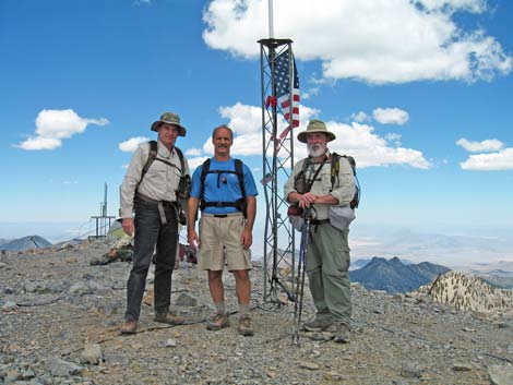 Mt Charleston summit (view N) |
Overview The North Loop Trail is a strenuous, 10.8-mile trail starts on the Deer Creek Road (8,440 ft) and runs out across hillsides and exposed ridges to the summit of Charleston Peak (11,918 ft). Much of the trail is forested, so there is plenty of shade until the last half-mile above timberline. The only water on the route is Cave Spring (4.5 miles out) where water can be filtered from a pool at the base of a cliff. Water is also available at Mummy Spring via a 0.6-mile, round trip, spur trail. The views from the ridges and the summit are spectacular, and there are lots of fossils in the rocks. The North Loop Trail can be done in part to the Viewpoint or the Raintree, or all the way to the summit. It can also be done in combination with the Mummy Spring, Trail Canyon, or the South Loop trails. This trail is described in several sections. Presented here is one photo per section. Click the links for more photos from each section. Link to map. |
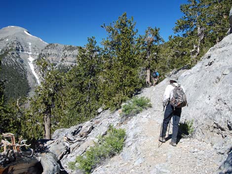 Hiker high on the way to Mt. Charleston (view NW) |
Watch Out Other than the standard warnings about hiking in the desert, ...this trail traverses narrow ledges with some serious exposure out near Devil's Thumb. While the hiking is safe, be careful along these sections because you will be tired by the time you get there (either coming or going), and a stumble could be your last. This is a long trail to a high-elevation place, so take it easy if you've just come up from the desert and aren't used to the elevation. While hiking, please respect the land and the other people out there, and try to Leave No Trace of your passage. Also, this is a long hike, so be sure to bring the 10 Essentials. This trail runs up into the Mt. Charleston Wilderness Area, so pay particular attention to respecting the land. |
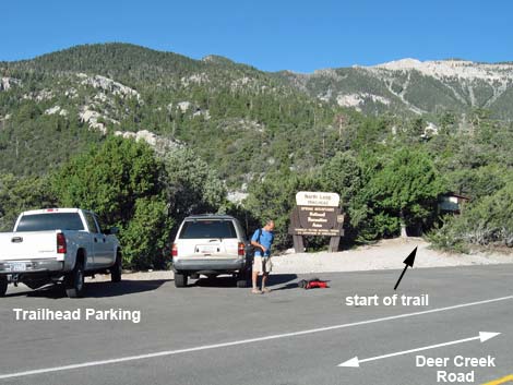 North Loop Trailhead (view W) [more photos] |
Getting to the Trailhead The trail is located up in the Spring Mountains National Recreation Area (generally referred to as Mt. Charleston) between Kyle and Lee Canyons, about 1 hour northwest of Las Vegas. From town, drive out to the Spring Mountains Visitor Center, then continue up Deer Creek Road to the North Loop Trailhead. |
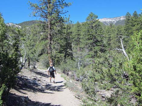 First part of trail (view W) [more photos] |
The Hike Section 1: Trailhead to The Viewpoint From the trailhead (Table 1, Waypoint 01), the trail runs into the forest on a clearly marked and well-maintained trail. Initially, the trail is fairly gentle and passes through a forest of tall ponderosa pines and white fir, with an open understory of mountain mahogany and wild currents. At about 0.3 miles out, the trail passes a Mt. Charleston Wilderness Area boundary sign, and then at about 0.6 miles out, actually enters the wilderness area. The trail runs at moderate grades across hillside and up shallow canyons. Eventually, the trail steepens and climbs switchbacks up across a steep hillside to a flat ridgetop that I refer to as “The Viewpoint” (Wpt. 02). More photos of this section. |
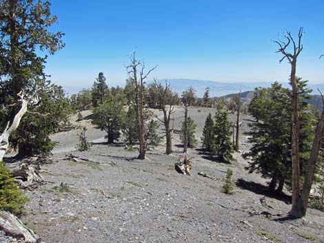 Looking back across Viewpoint Ridge (view SE) [more photos] |
Section 2: Viewpoint Ridge At about 1.5 miles out, the trail arrives at the Viewpoint (Wpt. 02), an open, flattish area with some good campsites and grand views of the Sheep Range, Urban Las Vegas, and other points to the east and south. Most of the trees here are bristlecone pine, but most are relatively young (only hundreds of years old) and don't display the gnarled appearance of thousand-year-old trees. For hikers looking for a moderate, 3-miles round-trip hike with grand views, this is a good destination. For other hikers, this is a good place to stop, sit in the shade, and relax for a few minutes before tackling the next section of trail. More photos from the Viewpoint. |
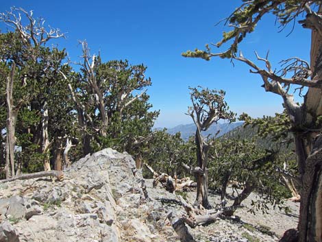 Highpoint [more photos] |
Section 3: Viewpoint Ridge to the Highpoint From the Viewpoint, the trail starts out easy, but quickly becomes steep and then starts switchbacking steeply up the forested hillside. The tall, straight trees here are more young bristlecone pine. After a dozen switchbacks and at 0.71 miles out, the trail climbs onto a saddle between a rocky knob on the left (Highpoint Knob; 10,023 feet elevation) and the side of the main ridge on the right. This is the Highpoint (Wpt. 03), the highest point between the North Loop Trailhead and the Raintree. From the saddle, hikers can look west along the high ridge to see Mummy's Toes. The Highpoint is another good place to take a break and enjoy the view (as much as can be seen through the trees) or at least enjoy the shade. More photos of this section. |
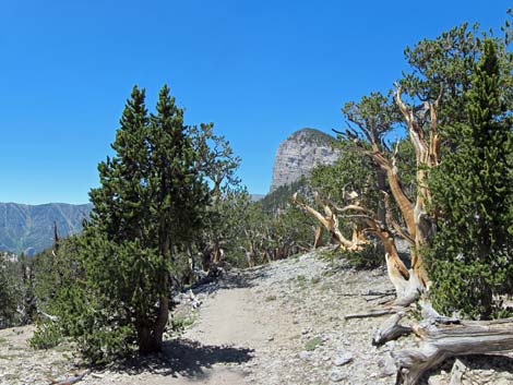 Highpoint Ridge (view W) [more photos] |
Section 4: Highpoint to Raintree (High Ridge) From the Highpoint, the trail runs east along the High Ridge with big views south down into Kyle Canyon and west to the limestone cliffs of Mummy's Toes. On this high, exposed ridge, the trail runs through an open forest of twisted bristlecone pine trees. Some of these trees are very old, more than 2,000 years. The trail descends gently along the south side of the ridge to a saddle on the ridgeline, and then moves onto the north side of the ridge and continues the gentle descent. At the next saddle on the ridgeline, 0.31 miles from the Highpoint, the faint Fletcher Peak Trail branches left and descends into Kyle Canyon. The trail continues from that saddle on the north side of the ridge to yet another saddle on the ridgeline, and at 2.65 miles from the trailhead, arrives at a junction with the Mummy Spring Trail (Wpt. 04). This trail junction is watched over by the fabled "Raintree," an enormous old bristlecone pine that is some 3,000 years old. More photos of this section. |
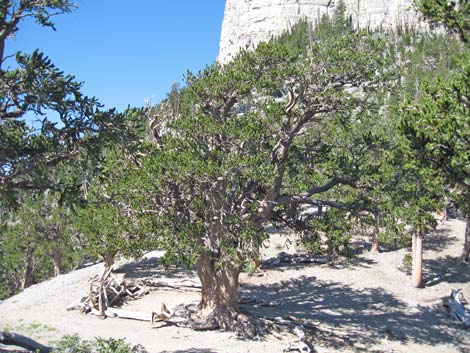 Raintree (view W) |
Section 5: Raintree The Raintree: the fabled bristlecone pine that is one of the largest and oldest (some 3,000 years) trees in the Spring Mountains. This tree is a marvel that puts human lifetimes in some kind of perspective. It is worth hiking up here just to be in its presence, so spend time communing with the tree and enjoying a picnic lunch. This old tree has stood proudly for some 3,000 years. However, with so many visitors, it is starting to show signs of human use. Please do not climb on the tree, don't camp beneath the tree, and don't even spend too much time standing under the tree. Each of us who stands close to the tree compacts the soil, reducing infiltration and water-holding capacity, and thereby denies the tree life-giving water. Each of us who sits or stands on the roots damages the bark covering the roots. Our footsteps also cause dirt around the roots to erode away, exposing more of the roots to damage. Each of us who climbs the tree damages the bark. While each little insult is imperceptible to us, they add up over time. If we hope the Raintree lives another 1,000 or 2,000 years, we need to stop loving it to death. More photos of the Raintree. |
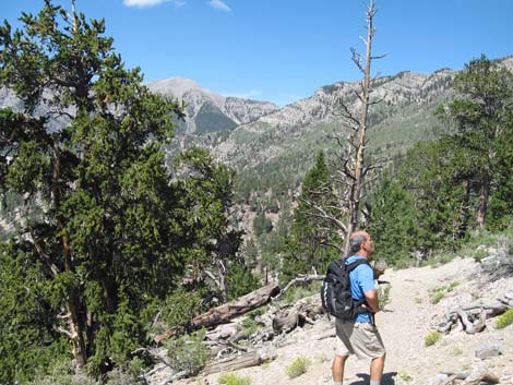 Trail beyond the Raintree (view W) [more photos] |
Section 6: Raintree to Trail Canyon From the Raintree, the trail turns south and drops rather steeply off the south side of the ridge crossing sunny slopes beneath Mummy's toes. About halfway around, the trail passes two long switchbacks on a steep section, and then two more short switchbacks on a more gentle section. From there, the trail continues a gentle traversing descent into a saddle between the rocky Coxcomb Ridge on the left and Mummy Mountain on the right. At the saddle, 4.1 miles out, the North Loop Trail reaches a junction with Trail Canyon Trail (Wpt. 05). A mix of tall ponderosa pines, white fir, and bristlecone pines at the junction provide nice shade, while fallen logs provide nice seats. More photos of this section. |
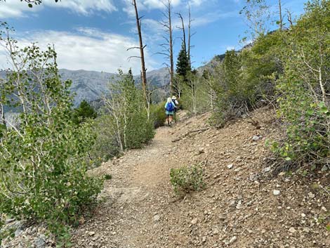 North Loop Trail departing Trail Canyon junction (view NW) |
Section 7: Trail Canyon to Cave Spring From the trail junction, the Trail Canyon Trail runs south down Trail Canyon to Echo Road in Kyle Canyon. Hiking up the North Loop Trail and down the Trail Canyon Trail (or vice versa) makes for a good day hike if you can position vehicles at both trailheads. Hiking up Trail Canyon en route to the summit of Mt. Charleston is 2.0 miles shorter and 750 feet lower than starting at the North Loop trailhead, so for those climbing the peak starting from the Trail Canyon Trailhead, subtract 2.0 miles from the remaining trail distances. From the Trail Canyon Trail junction, the North Loop Trail continues northwest and climbs at moderate grades through an old burn area. Many of the large old dead trees are still standing, but the area is growing back nicely with shrubs and trees. The trail runs up to some crags below the Mummy's shins and reaches Cave Spring (Wpt. 06) at about 4.6 miles out. More photos of this section. |
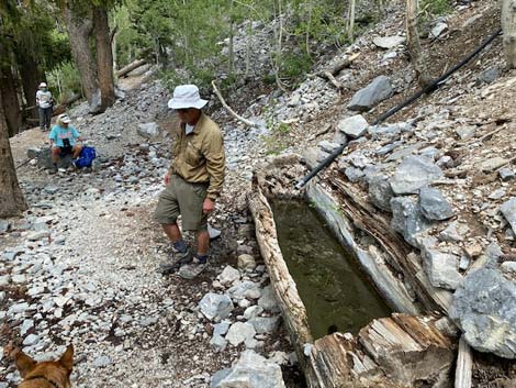 Hiker at Cave Spring watering trough (view NW) [more photos] |
Section 8: Cave Spring Not really visible from below, Cave Spring drips from the low cliffs and falls into a small catch basin with water that probably is safe to drink. At the trail, an old watering trough, carved from a single large log, provides water for wildlife. A cave-like ledge near the spring is a popular campsite, although it is too close to water to be legal. On these dry mountain hillsides, it is important to give wild creatures some space so they feel free to come in for a drink. More photos of this section. |
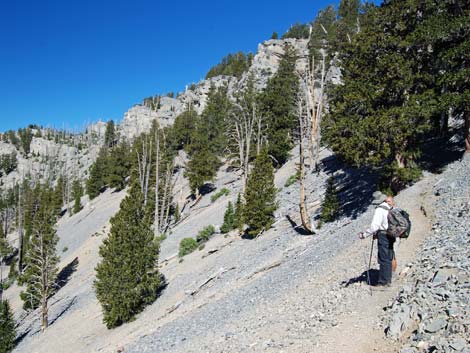 |
Section 9: Cave Spring to Devils Thumb (North Ridge) From Cave Spring, the North Loop Trail continues climbing through the old burn area as it ascends the big scree gully between Mummy Peak and the North Ridge. The burn area is growing back in aspen (which provide nice shade in the summer and color in the fall) and pines, including at least one limber pine along the trail. The trail makes three big switchbacks (two corners) until crossing out of the scree gully near the top of the North Ridge and climbing to some nice viewpoints (Wpt. 07) that look out to the south. Along the North Ridge, the trail stays on the south side of the ridge, occasionally breaking onto the top of the ridge at saddles that provide nice campsites and great views to the north. The hillsides are steep in this area, and they get steeper as the trail winds along rocky cliffs towards the Devil's Thumb. The trees are almost entirely bristlecone pines. In this area, the trail has been rerouted off the top of the ridge and does not match the USGS topographic map. |
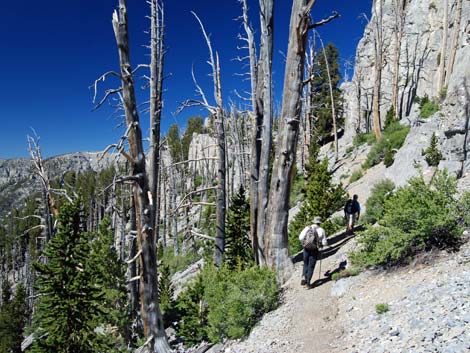 Hikers along North Ridge (view W) [more photos] |
After the third saddle with views north (Wpt. 08), the trail climbs a steep, but short, set of tight switchbacks through rocky cliffs (Wpt. 09). From this point until the start of switchbacks up the summit slope, the trail traverses precipitous ledges. There are also many interesting fossils (mostly corals and sponges) in the limestone along this section of trail, but don't get distracted and stumble off the trail. After the short switchbacks, the trail passes cliffs, another saddle with a campsite view north, runs up and down steep sections, and passes one outcrop promontory where hikers can walk out from the trail and get great views down Kyle Canyon (Wpt. 10). The surface of the outcrop has some nice bas-relief coral and sponge fossils. From the outcrop, the trail runs up and down, passes another small saddle with a campsite, and eventually climbs up onto a large saddle with the first view over the crest of the Spring Range to the east (Wpt. 11; 8.5 miles out). The south edge of this saddle is formed by rocky limestone crags. One stocky crag separated from the main cliffs, the Devils Thumb, looks like a warty thumb with red-orange splotches (the warts are fossiliferous). More photos of this section. |
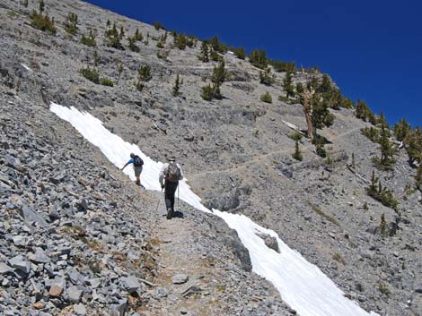 E Face, Mt. Charleston (view NW) [more photos] |
Section 10: Devils Thumb to the Summit (East Face) Past Devils Thumb, the trail turns south and more-or-less contours out across steep slopes and precipitous ledges that make up the East Face of Mt. Charleston. The trail runs up and down, and in and out, as it follows precipitous ledges. There is one short set of switchbacks most of the way across the face. Near the south side of the face (Wpt. 12), the trail switches back to the north and begins a series of six long, steep switchbacks that run up the mostly treeless summit slopes to the peak (Wpt. 13; 10.2 miles out). More photos of this section. |
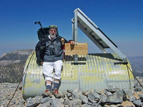 Summit (view NE) [more photos] |
Section 11: Summit The views from the summit are magnificent; they say that you can see 300 miles on a clear day. Look for Mt. Whitney and other 14,000-foot peaks along the Sierra crest to the west, the radioactive mesas on the Nevada Test Site to the north, the Grand Wash Cliffs and the Kaibab Plateau to the east, the Hualapai Mountains (south of Kingman Arizona) to the southeast, and the Los Angeles mountains to the southwest. To get back to the trailhead, retrace your steps or continue south and descend the South Loop Trail to the Cathedral Rock picnic area, making a grand circle and ending at the Cathedral Rock Trailhead. More photos of the summit. |
Table 1. Hiking Coordinates Based on GPS Data (NAD27; UTM Zone 11S). Download Hiking GPS Waypoints (*.gpx) file.
| Wpt. | Location | UTM Easting | UTM Northing | Elevation (ft) | Point-to-Point Distance (mi) | Cumulative Distance (mi) | Verified |
|---|---|---|---|---|---|---|---|
| 01 | Trailhead | 624679 | 4018903 | 8,435 | 0.00 | 0.00 | GPS |
| 02 | Viewpoint | 623635 | 4018053 | 9,331 | 1.47 | 1.47 | GPS |
| 03 | Highpoint | 623420 | 4017531 | 10,023 | 0.71 | 2.18 | GPS |
| 04 | Mummy Spring Trail (Raintree) | 622786 | 4017247 | 9,968 | 0.47 | 2.65 | GPS |
| 05 | Trail Canyon Trail | 621573 | 4016349 | 9,307 | 1.42 | 4.07 | GPS |
| 06 | Cave Spring | 621075 | 4016876 | 9,692 | 0.53 | 4.60 | GPS |
| 07 | Nice viewpoints | 620044 | 4016609 | 10,602 | 1.52 | 6.12 | GPS |
| 08 | Third saddle with view north | 618531 | 4016488 | 10,821 | 1.18 | 7.30 | GPS |
| 09 | Switchbacks through cliffs | 618064 | 4016390 | 11,064 | 0.43 | 7.73 | GPS |
| 10 | Promontory | 617821 | 4016246 | 10,996 | 0.22 | 7.95 | GPS |
| 11 | Devils Thumb | 617293 | 4015688 | 11,004 | 0.60 | 8.55 | GPS |
| 12 | Southeast face | 617605 | 4014580 | 11,046 | 0.91 | 9.46 | GPS |
| 13 | Summit | 617238 | 4014665 | 11,914 | 0.78 | 10.24 | GPS |
Happy Hiking! All distances, elevations, and other facts are approximate.
![]() ; Last updated 240329
; Last updated 240329
| Hiking Around Mt Charleston | Hiking Around Las Vegas | Glossary | Copyright, Conditions, Disclaimer | Home |