Hiking Around Las Vegas, Mount Charleston Area, Kyle Canyon
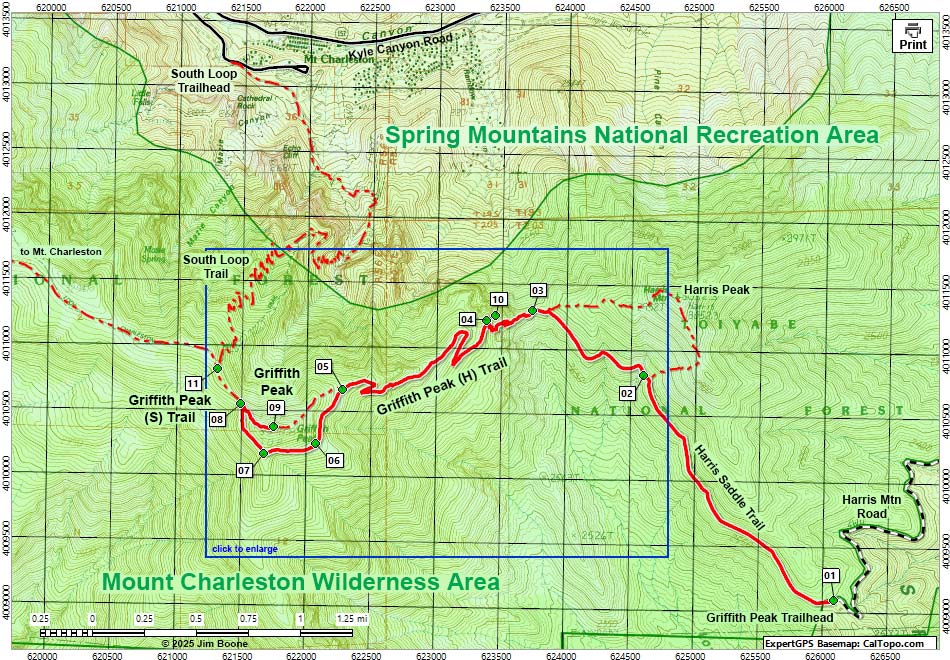
Note: Roads are black (solid = paved; dashed = unpaved). Trails and routes are red (solid = main; dashed = adjacent or alternate). Map based on USGS 7.5-minute topo map, which may have red grid lines and various numbers. North is at the top. Grid is UTM NAD27 CONUS. Wilderness Areas (boundaries solid green, fill light green) based on BLM data. National Forest areas (boundaries dashed brown, fill light green) based on USFS data. Download waypoint coordinates from route description page.
Happy Hiking! All distances, elevations, and other facts are approximate.
![]() ; Last updated 250329
; Last updated 250329
Return to Griffith Peak (H) Trail (via Harris Saddle)
Return to Griffith Peak (S) Trail (via South Loop Trail)
| Hiking Around Mt Charleston | Glossary | Copyright, Conditions, Disclaimer | Home |