Hiking Around Las Vegas, Spring Mountains (Mt. Charleston), Kyle Canyon
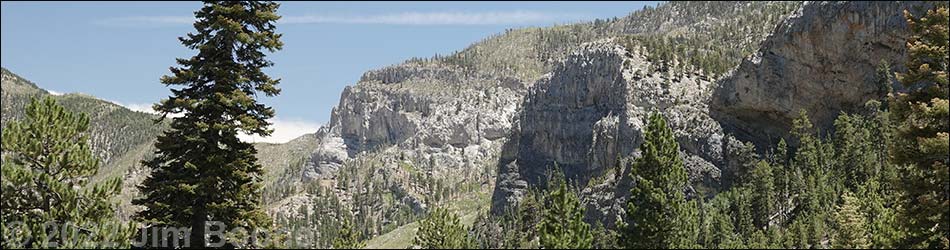
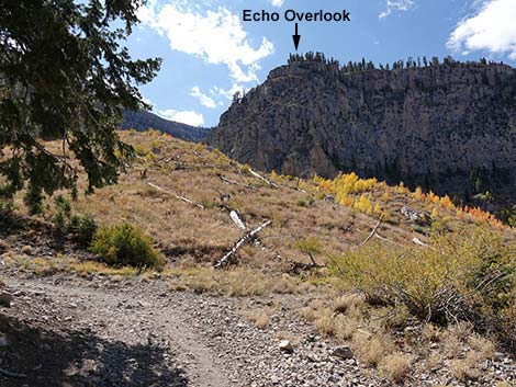
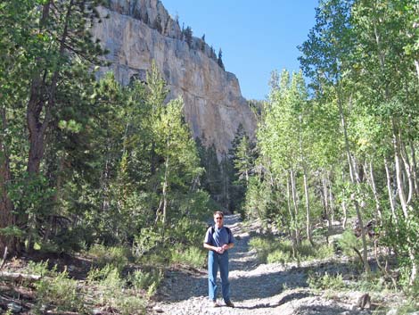
 Echo Cliffs and Echo Overlook (view south) |
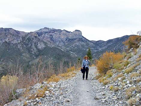
Overview This is a strenuous, 2-mile hike that uses the South Loop Trail, aka Mount Charleston National Recreation Trail (NRT), to climb to an overlook atop the Echo Cliffs. Echo Cliffs are the cliffs visible high above the trailhead. The trail starts at the Cathedral Rock Trailhead and climbs 1,500 feet as it passes through a mixed Pine-Fir Forest (Canadian Life Zone), climbs through an avalanche chute, and finally switchbacks up the steep canyon wall to the top of the Echo Cliffs. Views up and down the canyon are grand. This is a great hike in the fall when the Quaking Aspen are turning from green to yellow and finally red. Link to map. |
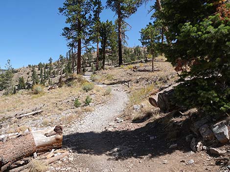
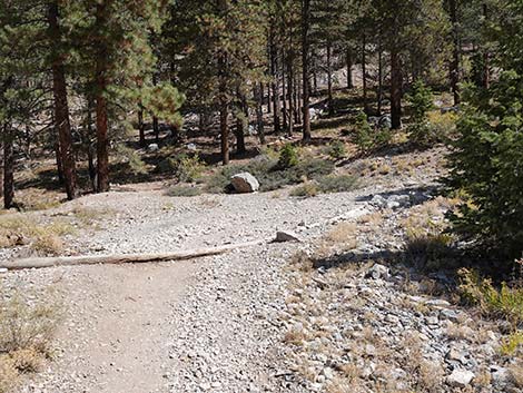
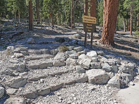 Cathedral Rock - South Loop Trailhead (view W) |
Watch Out Other than the standard warnings about hiking in the desert, ...this is a pretty safe hike, but watch your footing, and that of your kids, near the edge of the overlook. There are places along the trail where a slip would prove hazardous, but nothing out of the ordinary. This trail would be a good hard hike for young kids. During winter, be cautious of avalanche. While hiking, please respect the land and the other people out there, and try to Leave No Trace of your passage. Also, this hike is moderately long, so bring what you need of the 10 Essentials. Getting to the Trailhead This hike is located in Kyle Canyon up in the Spring Mountains National Recreation Area, about 1 hour northwest of Las Vegas. From town, drive out to the Spring Mountains Visitor Center, then continue up the road to the Cathedral Rock Trailhead. |
 |
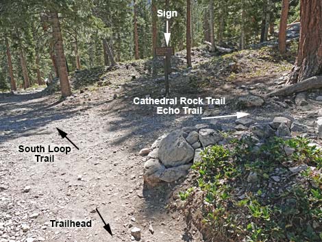
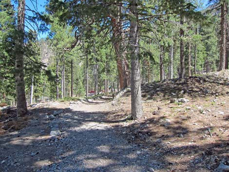
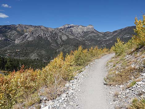
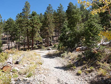
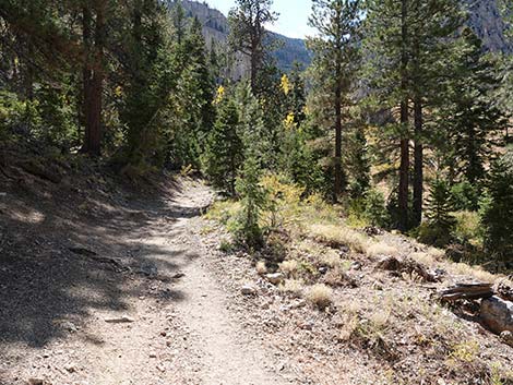
The Hike The Echo Overlook Trail starts from the Cathedral Rock Trailhead (Table 1; Waypoint 01) where the trailhead sign reads "Cathedral Rock Trail and Mt Charleston NRT"). The Echo Overlook Trail runs up and left around a fenced area where land managers are encouraging the vegetation to regrow without being trampled. About 200 yards out, the Echo Overlook Trail reaches a fork (Wpt. 02). At the fork, a sign shows that the Cathedral Rock Trail and the Echo Trail (westbound) turn right up the hillside, while trails towards Griffith Peak and Mt. Charleston (the South Loop Trail to include the Echo Overlook Trail) continues straight and level. Following the South Loop Trail past the fork, the trail continues at moderate grades through a fairly thick, mixed forest of Ponderosa Pine and White Fir, and it passes the Cathedral Rock Picnic Area (visible below the trail). |
 Note: the sign is still there, but it's been knocked down (view S) |
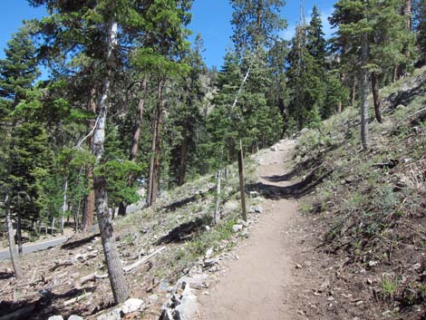
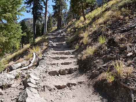
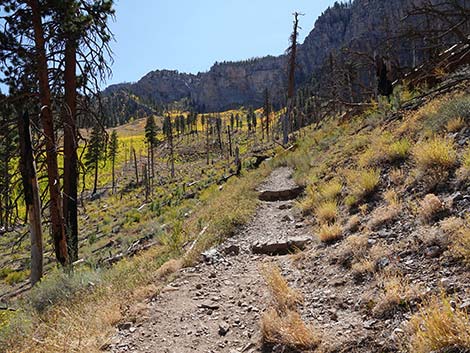
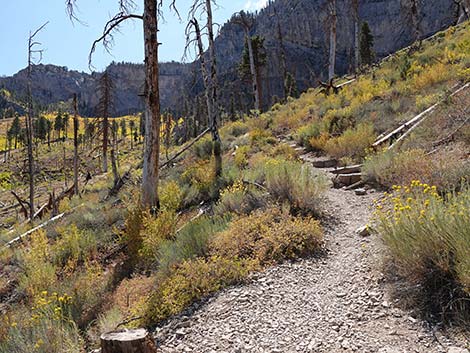
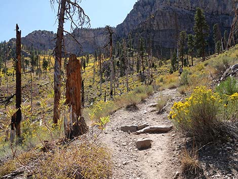
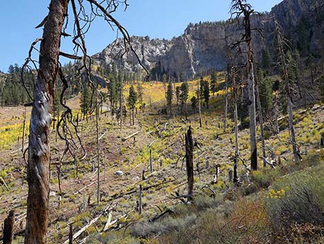
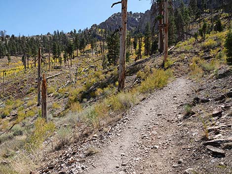
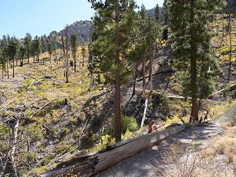
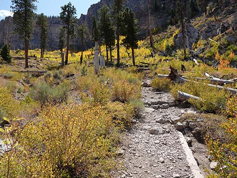
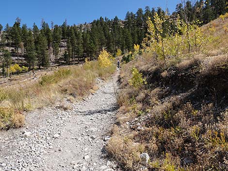
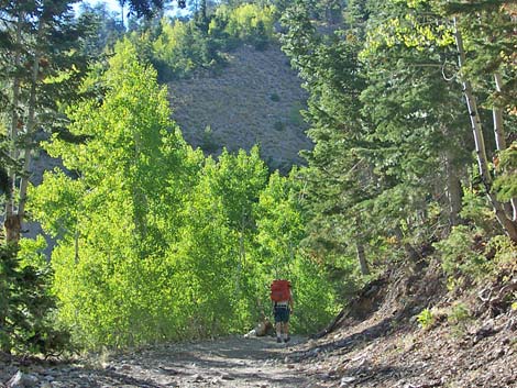
Before long, the Echo Overlook (South Loop) Trail starts up at a fairly steep grade with stone stairs as it runs southeastward towards the base of the gray limestone Echo Cliffs in the distance. In this area, the trail enters the 2013 Carpenter 1 burn zone that burned hot in this area and devastated the forest. Some standing-dead trees remain, but most have fallen. It is encouraging to see that young Ponderosa Pines are reclaiming their habitat. With the forest gone, views in this area become expansive, and Quaking Aspen can be seen regrowing in the gully and slopes below the trail. During summer, the Quaking Aspen offer a bit of shade, but in fall as the days shorten and cool, they erupt in yellows and reds. At about 0.66 miles out, the trail joins an old road (Wpt. 03), which is followed up and across a side canyon that comes down from the north face of Griffith Peak and runs through the Echo Cliffs at this point. This is an avalanche chute where the snow knocks down the taller trees and opens the forest for bushes and aspen thickets. This is a good place to look for Mule Deer and Neotropical Migrant bird species such a Yellow-rumped Warblers and Western Tanagers. |
 Note: this sign is still there, but it's been knocked down (view S) |
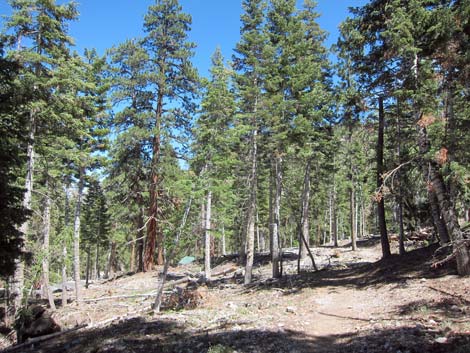
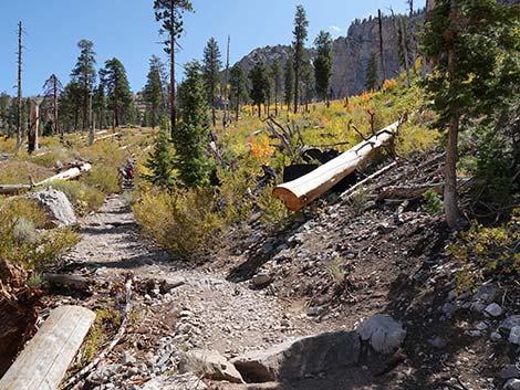
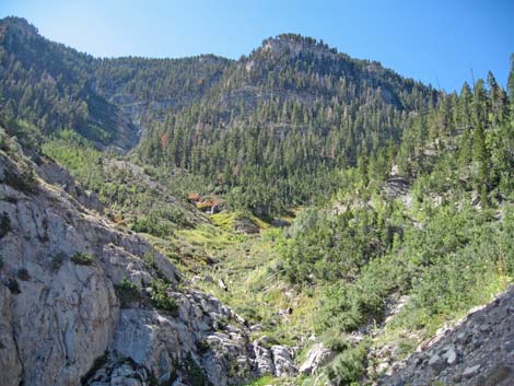
The trail continues up and across the avalanche chute, crosses the main gully in the bottom of the canyon, and continues east towards the forest on the other side. The old road climbs through 3-4 short switchbacks in the trees and arrives at a fork (Wpt. 04). The Echo Overlook (South Loop) Trail stays right and turns to run very steeply up along the east side of the avalanche chute. This part of the trail was an old road, evidence of which can be seen in places, and eventually runs up against towering limestone cliffs and is forced to cross back across the canyon (Wpt 05). During winter, hikers should be careful here because this is an avalanche chute with nowhere to hide. Across the avalanche chute, the trail switchbacks up the steep west side of the canyon to reach Echo Overlook (Wpt. 06) at the top of the Echo Cliffs. Much of this section is forested, so there is plenty of shade. |
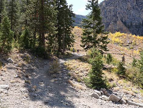
 Continuing past the trail junction (view SE) |
There are lots of Ponderosa Pine and White Fir at the overlook, so there is plenty of shade, but hikers will have to get right out on the very edge of the cliff to get a good view into Kyle Canyon and the desert to the east. There is a nice campsite at the overlook. To return to the trailhead, retrace your steps back down the South Loop Trail. On the way down, stay on the trail and don't cut the switchbacks. Cutting switchbacks damages the trail and the vegetation and it makes trail conditions worse for everyone. For hikers continuing up towards the high peaks, the South Loop Trail runs west along the top of the Echo Cliffs before resuming the climb towards the skyline. |
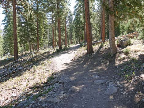
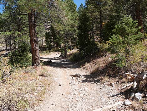
 Trail runs through open forest above the picnic area (view S) |
 Trail runs through open forest above the picnic area (view S) |
 Steeper parts of the trail now have stone stairs (view SE) |
 Before long, the trail enters the 2013 Carpenter 1 burn zone |
 |
 |
 Lots of standing dead trees remain (view SE) |
 South Loop Trail (view SE) |
 South Loop Trail (view SE) |
 South Loop Trail (view SE) |
 South Loop Trail (view SE) |
 South Loop Trail starts out across the avalanche chute (view SE) South Loop Trail starts out across the avalanche chute (view SE) |
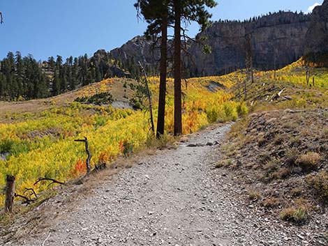 Quaking Aspen provide for colorful fall hikes (view SE) |
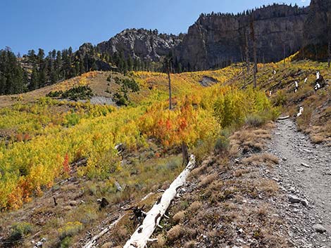 Quaking Aspen provide for colorful fall hikes (view SE) |
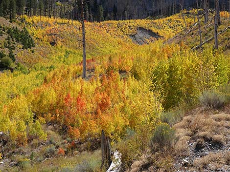 Quaking Aspen provide for colorful fall hikes (view SE) |
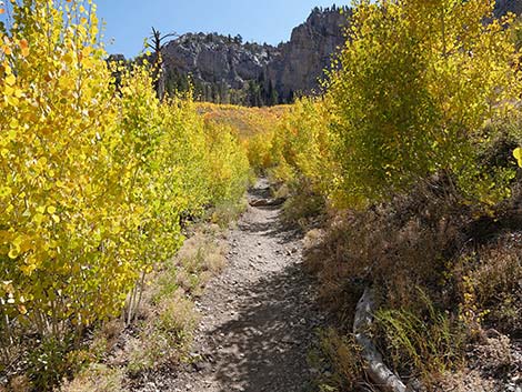 Quaking Aspen provide for colorful fall hikes (view SE) |
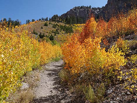 Quaking Aspen provide for colorful fall hikes (view SE) |
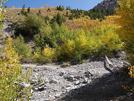 South Loop Trail at the main gully (view SE) |
 South Loop Trail crossing the main gully (view E) |
 Exiting the gully (grand view N towards Mummy Mountain) |
 Nice views where trees are knocked down by avalanche |
 South Loop Trail continues across the avalanche chute (view E) |
 South Loop Trail approaching the forest (view E) |
 Trail continues right (flat picnic site straight ahead) |
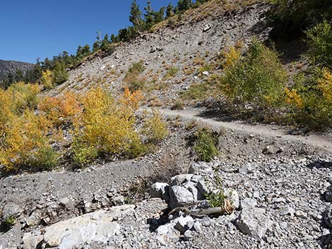
 The trail winds up along the edge of the avalanche zone (view SW) |
 Echo Overlook doesn't seen so far away now (view SW) |
 The old road switchbacks up through the trees (view NE) |
 The old road switchbacks up through the trees (view SW) |
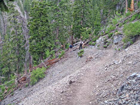
 Hiker coming down trail along the avalanche chute (view S) |
 Hiking getting up under the limestone cliffs (view S) |
 Avalanche chute (view S) |
 Switchbacking up across avalanche chute (view SE) |
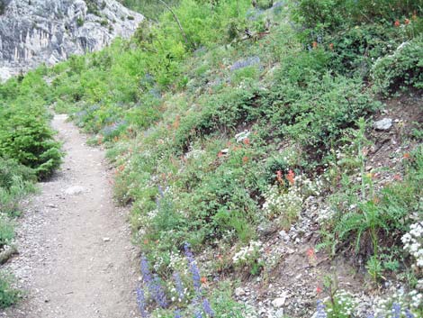 Summer wildflowers in the avalanche chute |
 Hikers descending trail below Echo Overlook (view S) |
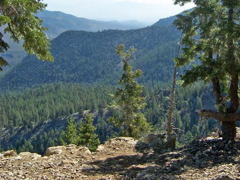 Lower Kyle Canyon (view E from Echo Overlook) |
 More to come ... |
Table 1. Hiking Coordinates Based on GPS Data (NAD27; UTM Zone 11S). Download hiking GPS Waypoints (*.gpx) file.
| Wpt. | Location | UTM Easting | UTM Northing | Elevation (ft) | Point-to-Point Distance (mi) | Cumulative Distance (mi) | Verified |
|---|---|---|---|---|---|---|---|
| 01 | Cathedral Rock Trailhead | 621731 | 4013026 | 7,713 | 0.00 | 0.00 | Yes |
| 02 | Cathedral-South Loop Trail Junction | 621802 | 4012928 | 7,716 | 0.10 | 0.10 | GPS |
| 03 | Join Old Road | 622189 | 4012283 | 7,914 | 0.56 | 0.66 | GPS |
| 04 | Old Road Forks | 622517 | 4012134 | 8,186 | 0.35 | 1.01 | GPS |
| 05 | Crossing Avalanche Chute | 622283 | 4011678 | 8,585 | 0.35 | 1.36 | GPS |
| 06 | Echo Overlook | 622152 | 4011879 | 9,077 | 0.74 | 2.10 | GPS |
| 01 | Cathedral Rock Trailhead | 621731 | 4013026 | 7,713 | 2.10 | 4.20 | GPS |
Happy Hiking! All distances, elevations, and other facts are approximate.
![]() ; Last updated 241016
; Last updated 241016
| Hiking Around Mt Charleston | Hiking Around Las Vegas | Glossary | Copyright, Conditions, Disclaimer | Home |