
Backroads Around Las Vegas, Lake Mead National Recreation Area

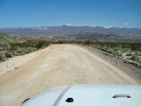 Nevada Telephone Cove Road (view northeast) |
Overview Nevada Telephone Cove Road is a graded backcountry road in southern Lake Mead National Recreation Area near Laughlin. The road runs from Highway 163 to Nevada Telephone Cove, a scenic cove on the shore of Lake Mohave that offers fishing, free camping, and vault toilets. The road down to the lake runs through a geologically interesting area mixed with coarse-grained granitic rocks and ancient lava flows, plus the left side of the road (northwest) is the Spirit Mountain Wilderness Area. Shade trees and a diversity of plants can be found, including some not found farther north around Las Vegas, down towards the lake. This road provides access to Lower Grapevine Canyon Road (Road 13), which is now a hiking trail because the road washed out. Link to Area Map. |
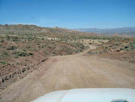 |
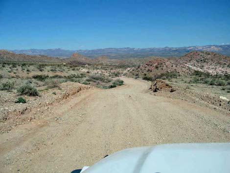
Watch Out Other than the standard warnings about hiking in the desert, ... this graded road is safe, but watch for people driving too fast around the corners with boat trailers sliding around behind. Nevada Telephone Cove Road is a bit bumpy, but should be fine for a passenger vehicle. In wet weather, road conditions can change rapidly, and all bets are off. |
 |
While out, please respect the land and the other people out there, and try to Leave No Trace of your passage. Also, even though this road is short, be sure to bring what you need of the 10 Essentials. Be aware of the weather and stay out of this area if rain is expected; you don’t want to get caught in a flash flood. Within Lake Mead NRA, watch for brown backcountry signs with numbered yellow arrows and sometimes road names. Approved roads are signed with yellow arrows. The number in the yellow arrow is the road number. Driving on roads or trails not marked with a yellow arrow is prohibited. Driving off roads, in washes, or cross country damages the fragile desert soil and is prohibited. Please check with local rangers on the road conditions before driving into the backcountry. Maps of approved backcountry roads are available online and at the Alan Bible Visitor Center. |
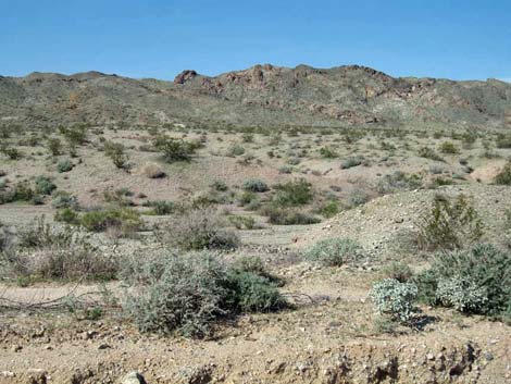 Spirit Mountain Wilderness Area(view from the road) |
Getting to the Roadhead This road is located in Lake Mead National Recreation Area near Laughlin, about 75 miles south of Las Vegas (5 miles west of Laughlin). From Las Vegas, drive south towards Laughlin. From the intersection of Highway 93 and 95 (Table 1, Site 0914), drive south on Highway 95, past Searchlight and Cal-Nev-Ari, for 54 miles to Highway 163 (Site 0826). Turn left onto Highway 163 towards Laughlin and drive east for 13.5 miles to an unmarked turnoff on the north side of the highway. This point is 1.7 miles past (east of) the turnoff to Christmas Tree Pass Road (Site 0823) and about 5 miles before the bridge in Laughlin. |
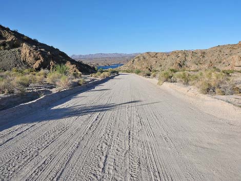 |
The Road From the pavement (Site 1253), turn northeast onto the unsigned and unpaved Nevada Telephone Cove Road and follow it as it bends to the east and parallels Highway 163. Soon there is a brown backcountry road sign showing a yellow arrow with road number 9. Follow Nevada Telephone Cove Road northeast for 2.25 miles to an intersection (Site 1254) where Roads 11, 12, and 14 fork off to the right. Bear left staying on the main road (Road 9), and follow it all the way to the shores of Lake Mohave (Site 1258). The beach at Nevada Telephone Cove is scenic, secluded, and pleasant. |
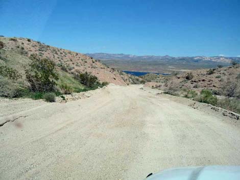 Approaching Lake Mohave |
Note that all along Nevada Telephone Cove Road, the lands to the left (northwest) are inside the Spirit Mountain Wilderness Area and protected from development forever. Stop anywhere and wander into the wilderness area -- you don't have to walk far as this wilderness area is accessible to most everyone. When finished at the cove, drive a short distance back up Nevada Telephone Cove Road to once was Lower Grapevine Canyon Road (Road 13). The road is now closed to vehicles because it washed out, but hikers can use the old road to hike into the Spirit Mountain Wilderness Area. Hike up the old road a short way, less then 0.5 miles, then stop and look back to the east where there is a great view of the lake. Camping at Telephone Cove is unregulated, except that there is a 7-day limit. Vault toilets are provided, but there is no trash pickup or facilities of any kind. |
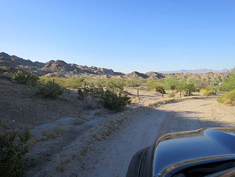 NV Telephone Cove Rd at what was Lower Grapevine Canyon Rd |
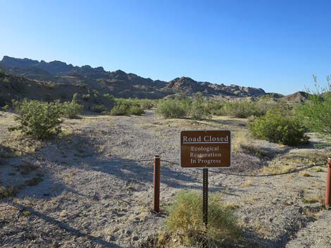 Sign at the old Lower Grapevine Canyon Rd (view NW) |
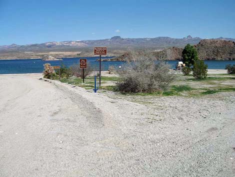 Nevada Telephone Cove entrance (view E) |
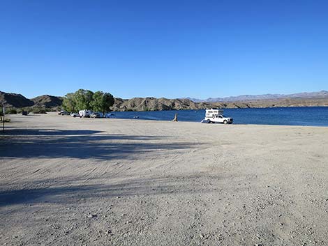 Nevada Telephone Cove (view N) |
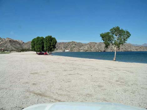 Nevada Telephone Cove (view N) |
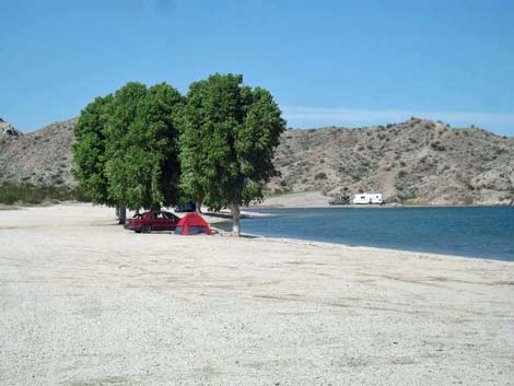 Happy campers at Telephone Cove |
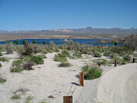 Telephone Cove (view E from old Lower Grapevine Canyon Road) |
 More to come ... |
Table 1. Highway Coordinates Based in GPS Data (NAD27; UTM Zone 11S). Download Highway GPS Waypoints (*.gpx) file.
| Site | Location | Latitude (N) | Longitude (W) | UTM Easting | UTM Northing | Elevation (ft) | Point-to-Point Distance (mi) | Cumulative Distance (mi) |
|---|---|---|---|---|---|---|---|---|
| 0823 | Highway 163 at Christmas Tree Pass Road | 35.20082 | 114.66796 | 712306 | 3897607 | 1,952 | . | . |
| 0826 | Highway 95 at Highway 163 | 35.19280 | 114.85245 | 695527 | 3896339 | 2,516 | . | . |
| 0914 | Highway 95 at Highway 93 (Railroad Pass) | 35.96744 | 114.89381 | 689922 | 3982187 | 2,340 | . | . |
| 1253 | Hwy 163 at Nevada Telephone Cove Rd (Rd 9) | 35.19254 | 114.64002 | 714872 | 3896749 | 1,536 | 0.00 | 0.00 |
| 1254 | Nevada Telephone Cove Rd (Rd 9) at Road 14 | 35.21094 | 114.61623 | 716990 | 3898842 | 1,111 | 2.30 | 2.30 |
| 1255 | Nevada Telephone Cove Rd (Rd 9) at Road 13 | 35.22927 | 114.59514 | 718860 | 3900921 | 698 | 1.90 | 4.20 |
| 1258 | Nevada Telephone Cove | 35.23258 | 114.59357 | 718994 | 3901292 | 1,016 | 0.30 | 4.50 |
Happy Hiking! All distances, elevations, and other facts are approximate.
![]() ; Last updated 240525
; Last updated 240525
| Backroads Around Las Vegas | Hiking Around Las Vegas | Glossary | Copyright, Conditions, Disclaimer | Home |