
Hiking Around Las Vegas, Lake Mead National Recreation Area

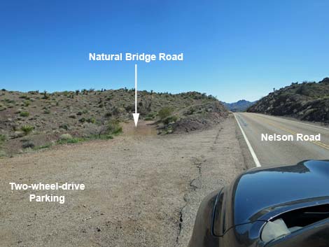 Nelson Road at Natural Bridge Road (view SE) |
Overview Natural Bridge Road is a narrow high-clearance road that runs 0.2 miles from Nelson Road to the Natural Bridge trailhead parking area. The road is narrow, has one steep, rocky part, a rocky part, and the turn-around at the end is small. The steep, rocky part is probably better with a 4WD vehicle, but is passable with some tire spinning for 2WD-HC vehicles. Link to map. |
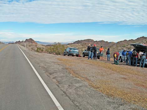 Nelson Road at Natural Bridge Road (view N) |
Watch Out Other than the standard warnings about being in the desert, ...this road is safe but a bit rough in spots, and 4WD vehicles are the better choice. While driving, please respect the land and the other people out there, and try to Leave No Trace of your passage. Also, this road is fairly short, so just bring what you need of the 10 Essentials. This road is just outside the El Dorado Wilderness Area, so pay extra attention to respecting the land. |
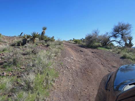 The steep part of Natural Bridge Road; rocks around corner (view SE) |
Getting to the Road Natural Bridge Road is located south of Las Vegas near the town of Nelson, just outside the Lake Mead National Recreation Area and adjacent to the El Dorado Wilderness Area. From Las Vegas, drive south on Highway I-11 towards Boulder City. Past Railroad Pass, exit right onto Highway 95 towards Searchlight and drive south for about 10 miles to Nelson Road (Highway 165). Turn left onto Nelson Road and drive east for about 9.5 miles to Natural Bridge Road (Table 1, Site 0910). Watch for a "steep downhill road ahead" symbol sign, and then a narrow dirt road angling to the left just before the paved road goes into a road cut and starts down the steep hill. For drivers who miss the turn, the road crests the hill in the roadcut and descends straight into Nelson Town. The road is narrow, and people drive fast, so the safest place to turn around is the first intersection in Nelson town. Turn around safely and drive back to the top of the hill. From the first intersection (and the first curve) in Nelson, it is 1.3 miles back to Natural Bridge Road. |
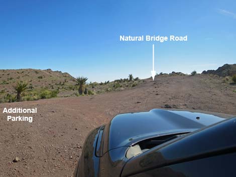 Natural Bridge Road widens and provides additional parking |
The Road From the pavement (Site 0910), Natural Bridge Road starts in a large, cleared area where people have been parking and pushing the bushes back for years. From the cleared area, Natural Bridge Road runs southeast as a narrow road that is fairly smooth. Shortly, Natural Bridge Road bends to the left and climbs a short, but steep hill with more rocks towards the top than at the bottom. Atop the steep hill, the road enters another large, cleared area that serves as an overflow parking area. Continuing southeast, the road starts fairly rocky, but then improves. Natural Bridge Road finally curves left and dips into a saddle with a turn-around loop (Site 0911). It appears that the road continues, but it does not, and people continuing up the hillside past the turn-around loop will need to back down the steep hill. Park to the edge of the turn-around circle to keep the loop open for others to turn around. Park here; this is the Natural Bridge trailhead. |
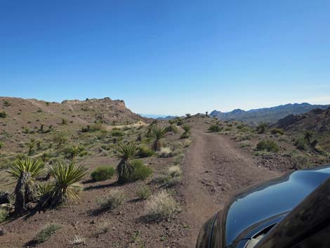 Natural Bridge Road continues (view SE) |
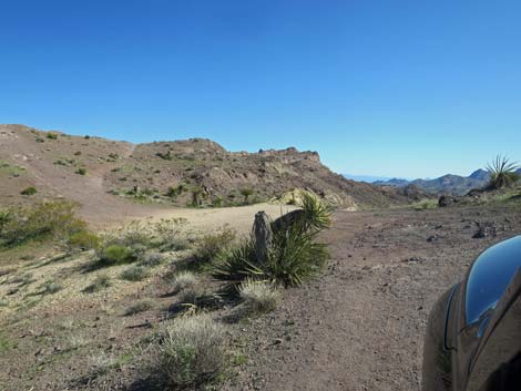 Approaching the end of Natural Bridge Road (view SE) |
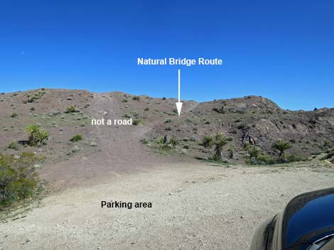 End of Natural Bridge Road (view SE) |
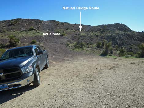 Trailhead parking at end of Natural Bridge Road (view E) |
Table 1. Highway Coordinates Based on GPS Data (NAD27; UTM Zone 11S). Download Highway GPS Waypoints (*.gpx) file.
| Wpt. | Location | Latitude (N) | Longitude (W) | Elevation (ft) | Point-to-Point Distance (mi) | Cumulative Distance (mi) |
|---|---|---|---|---|---|---|
| 0910 | Nelson Rd at Natural Bridge Rd | 35.72983 | 114.83075 | 3,482 | 0.00 | 0.00 |
| 0911 | Natural Bridge Trailhead | 35.72787 | 114.82962 | 3,508 | 0.17 | 0.17 |
Happy Hiking! All distances, elevations, and other facts are approximate.
![]() ; Last updated 240326
; Last updated 240326
| Hiking Around Lake Mead | Hiking Around Las Vegas | Glossary | Copyright, Conditions, Disclaimer | Home |