
Backroads Around Las Vegas, Lake Mead National Recreation Area

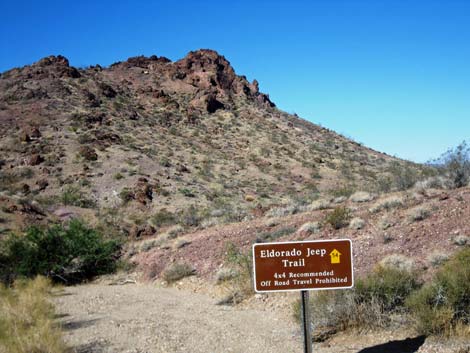 Sign at Lake Mead boundary (Photo 0824) |
Text and photos by Mark Petterson, Henderson Overview The El Dorado Jeep Trail Road is a 13-mile backcountry route in Arizona that follows washes west from U.S. 93 into Lake Mead National Recreation Area and the Colorado River. The road runs through the Black Mountains, a breathtaking landscape of volcanic origin adorned by Mojave Desert Scrub vegetation, to the shore of Lake Mohave. Except for the small mining area within the first 2 miles, there are no structures of any kind along this road. There are no services. Note that on road signs, the name El Dorado is incorrectly spelled as Eldorado. Link to map. |
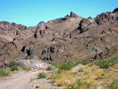 Wonderland of jagged mountains (Photo 0828) |
Watch Out Other than the standard warnings about being in the desert, ... this is a fairly easy drive. The name of the road gives the impression that it is very rough, a true "Jeep" road, but it is actually quite smooth and flat, with few rocky areas. Although 2WD vehicles may be able to handle most of this road in ideal conditions, a 4WD would be safer. Also, at about 25 miles south of Hoover Dam and up to 13 miles from the pavement, this is wild and remote country. Make sure you have plenty of fuel and water, a good spare tire, and notify someone of your travel plans. Your cell phone probably won’t work. Most of the road surface is soft, loose gravel where it is possible to get stuck. If you feel yourself driving in deep, loose sand or gravel, keep moving and don’t stop. Find a firmer area to stop to get out for a photo or to explore this wonderful area. |
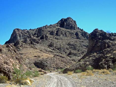 Wonderland of jagged mountains (Photo 0873) |
While out, please respect the land and the other people out there (but don’t expect to see anyone), and try to Leave No Trace of your passage. Also, even though this road is only 13 miles, be sure to bring the 10 Essentials. Be aware of the weather and stay out of this area if rain is expected; you don’t want to get caught in a flash flood. At the Lake Mead NRA boundary, watch for a brown backcountry road sign giving the name of the road and a numbered yellow arrow. Approved roads are signed with yellow arrows. The black number in the center of the arrow designates the road number. Driving on roads or trails not marked with the yellow arrow is prohibited. Driving off roads, in washes, or cross country damages the fragile desert soil and is prohibited by National Park Service regulations. Check with local rangers on the road conditions before driving into the backcountry. Maps of approved backcountry roads are available online and at the Alan Bible Visitor Center. |
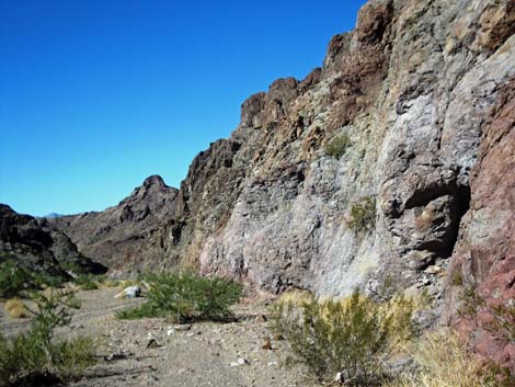 Menagerie of rocks (Photo 0837) |
Getting to the Roadhead This road is located This road is located in Lake Mead National Recreation Area along U.S. Highway 93 in Arizona, about 1-1/2 hours southeast of Las Vegas. From town, drive south on Hwy. 93 through Boulder City and over the bridge into Arizona. Continue south on Hwy. 93 past the roads to Willow Beach and Temple Bar. Drive past mile marker 24, then begin looking for a right turn lane and a right turn (west) onto an unmarked dirt road surfaced with red dirt. |
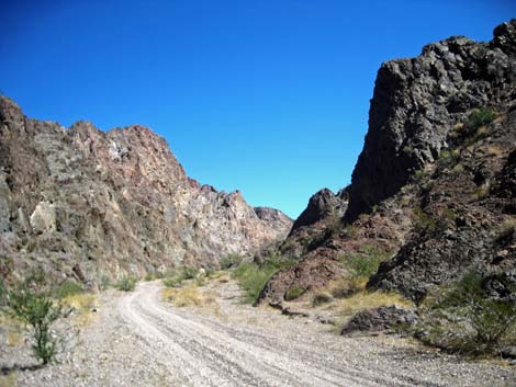 Menagerie of rocks (Photo 0875) |
The Road From the pavement (Table 1, Site 1248), the dirt road runs west and uphill. At about 2.5 miles out, the road passes the gated entrance to a mine area, then bends southwest and at about 3.1 miles out, it reaches a road intersection (Site 1249) on a curve where the side road on the right is barely noticed. Beyond the intersection, the road runs south. The Pope Mine area is off to the east (left), but barely noticeable. At about 3.5 miles out, the road forks (Site 1250), and signs announce the El Dorado Jeep Trail, which angles off to the right to runs southwest across fairly level terrain. At the turn, a brown National Park Service sign that reads, "Road 54, El Dorado Jeep Trail, Lake Mohave 9 miles." This is your gateway to an exciting and beautiful drive. |
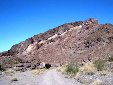 Layer cake mountain (Photo 0852) |
El Dorado Jeep Trail runs southwest to a saddle 4.5 miles out. A dirt side-road turns right here along the ridgeline, but the main road continues over and starts down towards the Colorado River. At about 4.9 miles out, the road passes off of BLM land and enters Lake Mead National Recreation Area (Site 1251). To this point, the first couple of miles have been somewhat uninspiring, but as you enter the National Recreation Area at another brown sign (Photo 0824), you can sense the great scenery to come. As you look westward, you can see the Black Mountains sloping towards the Lower Black Canyon of the Colorado River, with the El Dorado Mountains of Nevada towering in the distance (Banner Photo). |
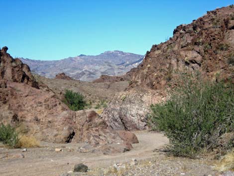 S-curves (Photo 0849) |
Your anticipation is soon rewarded when the road enters a wonderland of tortured, jagged mountains and beautiful side canyons (Photos 0828 and 0873). The Black Mountains are primarily volcanic in origin, as old as 70 million years, with various colors of rocks mixed in to create a remarkable geologic jumble. This is most evident at about the halfway point, where the road passes alongside a small range of colorful rock composed of a menagerie of rocks (Photos 0837 and 0875). A mile or so further west, a lava flow has transformed a sloping mountaintop into a layer cake with “frosting” dripping slightly over the side (Photo 0852). If you’re lucky, you may see desert bighorn sheep or wild burros. After the road passes a scenic S-curve (photo 0849) and two narrow gaps in rocky ridges (Photo 0868), drivers are rewarded with your first view of the azure waters of upper Lake Mohave (Photo 0855). |
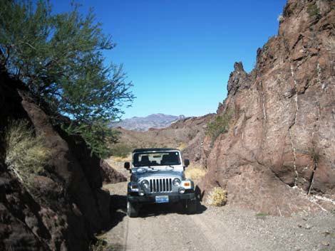 Narrow gap in a rocky ridge (Photo 0868) |
The road ends (Site 1252) unceremoniously in a thicket of saltcedar and cattails. Depending on the thickets, walk down through the brush to reach the shoreline or use-trails on the cliffs overlooking the river to get past the thickets. Either way, hikers get views of the lake with the Chalk Cliffs shimmering in the distance (Photos 0856, 0858). Be careful of the damp, spongy soil; there are even some areas that are virtually quicksand. Walk close to the rocky shore where the soil is firmer. If you go into the water, again be careful of the soft soil as you try to regain your footing on the beach. Return the way you came; after you pass the brown sign, turn left (north) onto the red dirt road. It bends to the right (east) and returns to U.S. 93, where you will turn left (north) again to head back to Las Vegas. |
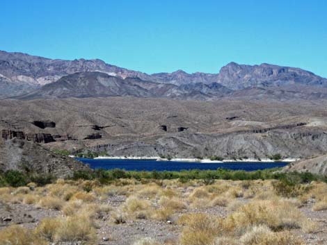 Lake Mohave (Photo 0855) |
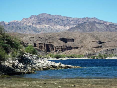 Lake Mohave (Photo 0856) |
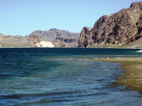 Chalk Cliffs in the distance (Photo 0858) |
 More to come ... |
Table 1. Highway Coordinates based on GPS Data (NAD27; UTM Zone 11S). Download highway GPS waypoints (*.gpx) file.
| Site | Location | UTM Easting | UTM Northing | Latitude (N) | Longitude (W) | Elevation (ft) | Verified |
|---|---|---|---|---|---|---|---|
| 1248 | Hwy 93 at El Dorado Jeep Trail | 725852 | 3959180 | 35.75254 | 114.50218 | 2,415 | Yes |
| 1249 | El Dorado Jeep Trail at Road Jct | 721191 | 3958162 | 35.74443 | 114.55397 | 2,927 | Yes |
| 1250 | El Dorado Jeep Trail at Road Jct | 721137 | 3957553 | 35.73895 | 114.55474 | 2,963 | Yes |
| 1251 | ED Jeep Trail at Lake Mead Bndry | 719361 | 3956523 | 35.73007 | 114.57464 | 2,989 | Yes |
| 1252 | ED Jeep Trail at Lake Mohave | 708584 | 3956325 | 35.73063 | 114.69375 | 656 | Yes |
Happy Hiking! All distances, elevations, and other facts are approximate.
![]() ; Last updated 240326
; Last updated 240326
| Backroads Around Lake Mead | Hiking Around Las Vegas | Glossary | Copyright, Conditions, Disclaimer | Home |