
Muddy Mountains Wilderness Area, Hiking Around Las Vegas, Lake Mead NRA

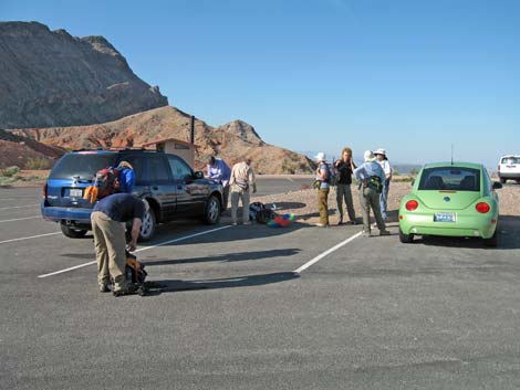 Northshore Summit Trailhead (view W) |
Overview The Bowl of Fire (BOF) is an area of brilliant-red Jurassic-Age sandstone outcrops surrounded by gray limestone mountains. The limestone forms the sides of the bowl, and the red sandstone forms the fire in the bottom. The BOF is a place to wander about in a wonderland of jumbled piles of red sandstone; a place to go and just hike about with no particular destination. If you have a map, you can try to keep track of where you are (at least in general), but if you get confused about exactly where you are, just hike downhill to get out. The BOF Loop Route runs 8 miles as it circles around the northern section of the BOF and swings south to skirt the southwestern section of the BOF. This can be done as a true loop, but as described here, the hike requires a car shuttle. Link to map or elevation profile. |
 Starting up Northshore Summit Trail (view N) |
Watch Out Other than the standard warnings about hiking in the desert, ...this is fairly safe hike, but there are a number of high pour-overs to climb up and down. Always be extra careful when you are high enough to fall and get hurt. This is wild country, so a rescue would be time consuming and fairly difficult. It would be easy to get turned around in the maze of side canyons and boulder piles, so if you get "lost," just hike down any wash (always go downhill) and you will eventually come out. This is a good route to load up your GPS and pay close attention to following the waypoints. While hiking, please respect the land and the other people out there, and try to Leave No Trace of your passage. Also, this is a long hike in a remote area, so be sure to bring the 10 Essentials. |
 From the high ridges of Northshore Summit, the goal seems a long way off (view NW) |
Getting to the Trailhead This hike is located along Northshore Road in Lake Mead National Recreation Area, about 50 minutes northeast of Las Vegas. From town, drive out to Lake Mead, then drive north on Northshore Road to the Mile 20.6 (Northshore Summit) Trailhead. Park here; this is the trailhead. Along the way, at the Mile 16.0 Trailhead, the unpaved Callville Wash North Road (Road 94) starts up Callville Wash. This deep-sand, 4WD road provides shorter access to the BOF, but lots of vehicles get stuck in the sand. Also along the way, notice the Mile 18.2 Trailhead on the left side of the road. This is where the "loop" route ends. Leave a vehicle here for a car shuttle at the end of the hike. |
 Hiker descending a canyon (view W) |
The Hike From the Northshore Summit trailhead (Table 1, Waypoint 1), the route starts on the Northshore Summit Trail. The route follows the trail, staying right at the fork, and climbs onto a saddle on the summit ridge (Wpt. 02). The route follows the ridge northwest for 0.34 miles to another saddle (Wpt. 03), and from the low point, drop off the west side of the ridge into the canyon below (Wpt. 04). The route follows canyons downhill until they empty out onto the Callville Wash North Road (Wpt. 06). |
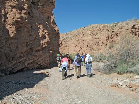 Hikers on Callville Wash North Road (view N) |
The route turns north and follows Callville Wash Road for 0.87 miles to a side canyon on the west side (Wpt. 07). The route turns into the side canyon, passes a Muddy Mountains Wilderness Area sign, and heads upstream. The canyon gets narrower and narrower, but eventually the canyon walls fall away, and the route follows the wash. The wash winds around, passes a couple of pour-overs and a nice little arch, and continues west to an overlook (Wpt. 11) with views down into the major canyon that splits the northern BOF. |
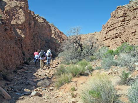 Leaving Callville Wash North Road (view W) |
From the overlook, the route runs northwest and circles around the head of the major canyon, then turns southwest climbs onto the low ridge across the canyon. Beyond the low ridge, the route starts down (Wpt. 12) into yet another major canyon, which is followed west and then south, and rather circuitously, all the way to the southwest corner of the northern BOF (Wpt 18). At this point (Wpt 18), the canyon joins another major canyon coming in from the west. If hikers intend to hike back to the trailhead (Wpt. 01), this would be a good place to start back. In this case, follow the wash southeast and around the south side of the BOF cliffs, then make your way cross-country towards the point where the route first hit the Callville Wash Road (Wpt. 06). |
 One of several water hazards (view W) |
Continuing south towards the southwestern BOF, climb out of the wash on the steep dirt bank, and pick up a use-trail (Wpt. 19) that runs south. The use-trail fades in and out, but it continues south past red sandstone crags (Wpt. 20) and onto a low saddle (Wpt. 21). The route drops into the wash beyond the saddle (Wpt. 22), and follows washes southwest and downstream passing more high pour-overs until reaching the southwest BOF (Wpt. 25). |
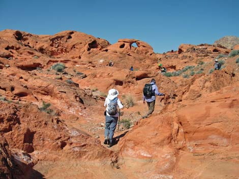 Sandstone wonderland (view W) |
Either wander up into this section of the BOF, or continue down the wash. The route exits the BOF area at some interesting conglomerate boulders that form a pour-over, then continues down the wash for 0.26 miles to a use-trail that cuts up the left bank of the wash (Wpt 27), then runs southeast towards Callville Wash before fading out. Crossing Callville Wash Road (Wpt 29), the route continues southeast and picks up a use-trail that passes around the north edge of Hill 651, turns due south, and runs out to Northshore Road at the Mile 18.2 parking area. If you end up here, hopefully you arranged a car shuttle; if not, turn east and start hiking up the highway (watch for drunk drivers!). |
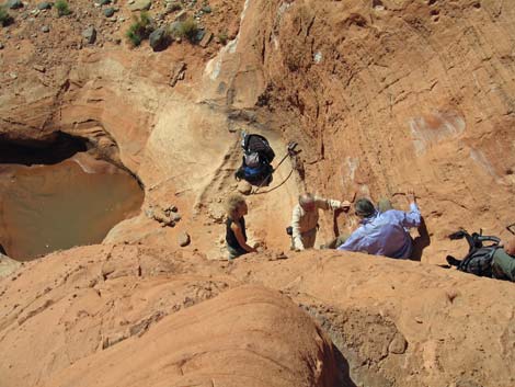 Most technical spot (Wpt. 13). Not so difficult, but the drop zone is uneven and help from below is useful. |
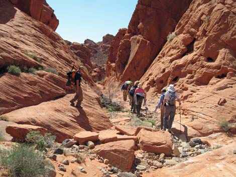 Group of hikers descending a red sandstone canyon (near Wpt. 16; view SW) |
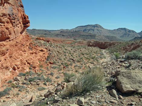 Southwest corner of the northern BOF (Wpt 19; view SE) |
 Approaching the southwest section of the BOF (view S) |
 Navigating one of the last pour-overs. There are many such spots on the loop route (view S) |
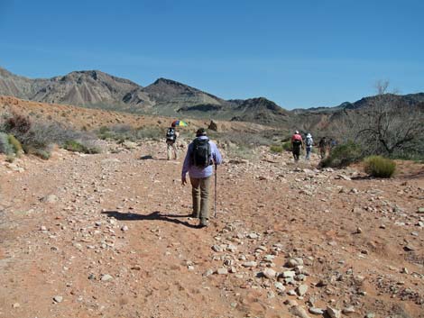 Hikers in the wash downstream from the southwest section of the BOF (between Wpts. 26 and 27; view SE) |
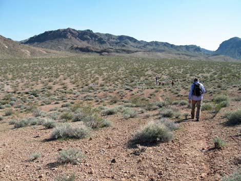 Hikers approaching Mile 18.2 Trailhead (view S) |
 More to come ... |
Table 1. Hiking Coordinates Based on GPS Data (NAD27, UTM Zone 11S). Download Hiking GPS Waypoints (*.gpx) file.
| Wpt. | Location | Time | Easting | Northing | Elevation (ft) | Point-to-Point Distance (mi) | Cumulative Distance (mi) | Verified |
|---|---|---|---|---|---|---|---|---|
| 01 | Trailhead | 0906 | 713895 | 4011573 | 2,418 | 0.00 | 0.00 | GPS |
| 02 | Northshore Summit Ridge | 0918 | 713646 | 4011977 | 2,568 | 0.38 | 0.38 | GPS |
| 03 | Low point on saddle | 0931 | 713365 | 4012401 | 2,523 | 0.34 | 0.72 | GPS |
| 04 | Bottom of large wash | 0945 | 713167 | 4012461 | 2,315 | 0.17 | 0.89 | GPS |
| 05 | Fork in canyon | 0956 | 712971 | 4012723 | 2,174 | 0.33 | 1.22 | GPS |
| 06 | Callville Wash Road | 1002 | 712753 | 4012806 | 2,110 | 0.19 | 1.41 | GPS |
| 07 | Leave the road | 1033 | 712666 | 4014024 | 2,201 | 0.87 | 2.28 | GPS |
| 08 | Small pour-over | 1048 | 712295 | 4014110 | 2,244 | 0.37 | 2.65 | GPS |
| 09 | Bypass pour-over | 1053 | 712129 | 4014125 | 2,268 | 0.15 | 2.80 | GPS |
| 10 | Arch | 1101 | 712035 | 4014097 | 2,286 | 0.08 | 2.88 | GPS |
| 11 | Overlook down into BOF | 1120 | 711404 | 4013998 | 2,365 | 0.47 | 3.35 | GPS |
| 12 | Starting down into canyon | 1147 | 710724 | 4014097 | 2,419 | 0.60 | 3.95 | GPS |
| 13 | High pour-over | 1158 | 710441 | 4014030 | 2,334 | 0.22 | 4.17 | GPS |
| 14 | Overlook | 1249* | 710183 | 4013982 | 2,299 | 0.21 | 4.38 | GPS |
| 15 | Wet slot | 1255 | 710123 | 4013936 | 2,256 | 0.05 | 4.43 | GPS |
| 16 | Pour-over | 1306 | 710067 | 4013808 | 2,233 | 0.12 | 4.55 | GPS |
| 17 | Confluence with side canyon | 1323 | 710194 | 4013447 | 2,182 | 0.32 | 4.87 | GPS |
| 18 | SW Corner of BOF | 1338 | 710048 | 4013083 | 2,117 | 0.29 | 5.16 | GPS |
| 19 | Use-trail atop dirt cliff | 1340 | 710043 | 4013056 | 2,147 | 0.01 | 5.17 | GPS |
| 20 | Sandstone crags | 1351 | 709955 | 4012580 | 2,146 | 0.32 | 5.49 | GPS |
| 21 | Crossing low saddle | 1359 | 709974 | 4012235 | 2,151 | 0.24 | 5.73 | GPS |
| 22 | Down in canyon | 1408 | 710044 | 4012074 | 2,081 | 0.13 | 5.86 | GPS |
| 23 | Confluence with side canyon | 1415 | 709907 | 4011834 | 2,019 | 0.18 | 6.04 | GPS |
| 24 | High pour-over | 1429 | 709825 | 4011657 | 2,006 | 0.17 | 6.21 | GPS |
| 25 | Bypassing pour-overs | 1445 | 709729 | 4011195 | 1,960 | 0.35 | 6.56 | GPS |
| 26 | Conglomerate pour-over | 1454 | 709723 | 4010835 | 1,902 | 0.26 | 6.82 | GPS |
| 27 | Top of wash bank | 1503 | 709995 | 4010583 | 1,887 | 0.26 | 7.08 | GPS |
| 28 | Into Callville Wash | 1509 | 710369 | 4010358 | 1,876 | 0.27 | 7.35 | GPS |
| 29 | Crossing Callville Wash Road | 1510 | 710426 | 4010301 | 1,872 | 0.05 | 7.40 | GPS |
| 30 | Trail End at Mile Marker 18.2 | 1524 | 710751 | 4009690 | 1,930 | 0.50 | 7.90 | GPS |
* Stop for lunch.
Happy Hiking! All distances, elevations, and other facts are approximate.
![]() ; Last updated 240326
; Last updated 240326
| Hiking Around Lake Mead | Hiking Around Las Vegas | Glossary | Copyright, Conditions, Disclaimer | Home |