
Hiking Around Las Vegas, Death Valley National Park

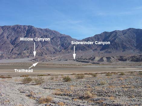 Sidewinder and Willow canyons (view NE from Hwy) |
Overview This moderately strenuous, 2.1-mile (one way) route runs up a deep, narrow canyon in the mountains with a wet pour-over in the Death Valley Wilderness Area. The route first traverses an alluvial fan to the mouth of a canyon that cuts into the bajada. The route then runs up a wide gravel wash to the base of the mountains that form the eastern edge of Death Valley (about 1.8 miles out). The route then enters a deep, narrow canyon and runs up to a 40- or 50-ft-high pour-over (with running water!) in a box canyon that blocks further uphill progress. Link to Route Map. |
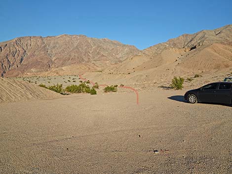 Trailhead parking (view NE) |
Judging from the amount of scat I found, many bighorn sheep use this area. If you get into the canyon and find sheep, back out and leave them alone. I found the remains of three dead sheep at the base of the pour-over (a lamb and a female that looked fresh, plus one old broken arm bone). The two fresh sheep appeared to have died while trying to climb the walls at the end of the canyon, perhaps trying to escape humans or predators. Please, don't push the sheep up the canyon where they might hurt themselves. |
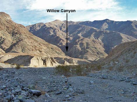 Willow Canyon (view SE from top of alluvial fan) |
Watch Out Other than the standard warnings about hiking in the desert, ...the hike up the alluvial fan and the gravel wash are pretty safe, but stay out of the narrow upper canyon if it is raining or threatens to rain because of flash flood dangers. In the upper canyon, there are a number of pour-overs that are easy to climb or scramble up (2nd- or 3rd-class scrambling), but the rock is slick and water-polished. Bighorn sheep use the area, and there is a lot of scat in the water, so don't drink the water. Also, don't push the sheep up the canyon where they might hurt themselves trying to climb out of the canyon. While hiking, please respect the land and the other people out there, and try to Leave No Trace of your passage. Also, this hike is fairly long, so be sure to bring the 10 Essentials. |
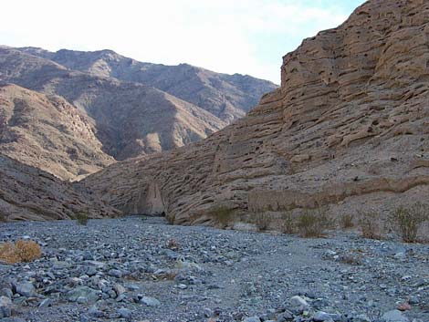 Interesting geology (view southeast) |
Getting to the Trailhead This hike is located in Death Valley National Park, about 3.5 hours northwest of Las Vegas. From town, drive out to Death Valley. From the Furnace Creek Visitor Center (Table 1, Site 712), drive south on Highway 190 for about 1.25 miles to the Badwater (Highway 178) turnoff (Site 741). Turn south (right) towards Badwater, and drive for about 31.2 miles to a well-graded dirt road on the east (left) side of the road (Site 773). There are no signs here, but this is 14.8 miles (and the first turnoff) south of Badwater (Site 714). There is a gravel pit at the end of the dirt road, which you can see from the pavement. Turn east (left) towards the mountains and drive for 0.3 miles to the gravel pit. Park on the north (left) end of the paved area (Site 775). Don't block the gravel piles in case the Park Service needs to get at them. Park here; this is the trailhead. |
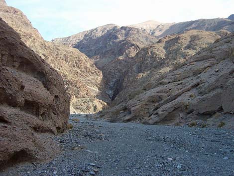 First view into the narrows (view east) |
This is also the trailhead for Sidewinder Canyon, and if you've come this far, you should visit Sidewinder Canyon too. The Hike From the trailhead (Table 2, Waypoint 10), hike northeast out of the gravel pit and up the edge of the alluvial fan to its top, which is about 0.46 miles out. Looking from the trailhead, this is the close alluvial fan, not the one against the far mountains that looks a long way off. The alluvial fan is composed of fairly small cobbles, so the tread is mostly firm, and the walking is fairly easy. The vegetation is sparse and dominated by creosote bush and desert holly, plus few other species (emphasis on the few). |
 |
From the trailhead, you can't see the top of the alluvial fan or the mouth of the canyon, and as you pass several large gullies, you will wonder if each is the one to go up; they are not. The mouth of the proper canyon is about 100-yards wide with a low vertical cliff on each side, and from the mouth, you can look all the way up the canyon and see the deep, dark cleft of Willow Canyon in the mountains (which is where you want to go). At the mouth of the canyon (Wpt. 11), turn southeast and hike up the moderately steep, loose gravel wash. Initially, the wash is about 100 yards wide with sidewalls that are about 30- to 40-ft wide. The canyon narrows, then widens again. |
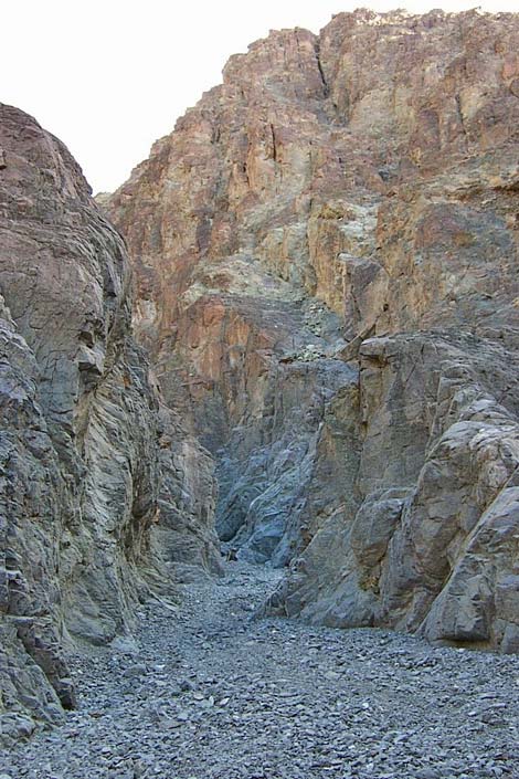 Beginning of the narrows (view east) |
Farther up the canyon, the low cliffs melt away and the wash widens to at least 200 yards across, revealing higher alluvial cliffs (about 100-ft high) farther back that now border the wash. Near the top of the alluvial canyon (about 1.10 miles out), a side canyon comes in from the east (Wpt. 12). This side canyon flash-flooded and carried enough boulders, rocks, and gravel into the main canyon to force the main wash off to a narrow spot on the west side of the canyon. Here, you can see fresh, gray alluvial material in contact with older, well-desert-varnished materials. In the evening light, the recent materials take on a green hue. A few minutes past the side wash, the cliffs change from gray alluvial materials to brick-red conglomerate rocks with many cobbles and big honeycomb holes, making for an interesting texture. Along this section, about 1.65 miles out, the canyon narrows and goes around a corner (Wpt. 13). After passing the corner, you see that you are at top of the bajada and that the deep cleft in the mountains lies just ahead. Just outside the cleft, a large wash comes in from south. This wash cuts across the top of the alluvial deposits between the metamorphic mountain and the bajada. There are many sheep footprints in this wash and several little pour-overs that would be pretty during a rainstorm, but I found nothing particularly spectacular up that canyon. From the mouth of the cleft (Wpt. 14), about 1.82 miles out, you can see the first of the flowing water, which is only a few minutes up the canyon. When I was there, the water was mostly down in the gravel, but there were several little pour-overs that forced it to surface. |
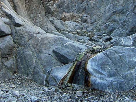 |
After only 10 minutes in the narrow canyon, you arrive at a 40- to 50-ft-high pour-over in the metamorphic rock (Wpt. 15), with water cascading down the smooth wall into a small pool at the bottom. This is the end of the trail and about 2.08 miles out. The rock here is well-polished with pretty bands of white, red, green, and gray. After resting in the cool canyon, washing your face in (but not drinking) the water, and enjoying the sounds of falling water in the desert, retrace your footprints to the trailhead. |
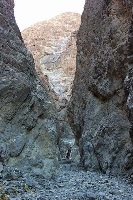 Narrows |
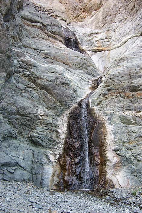 40-ft-high waterfall ends canyon (view east) |
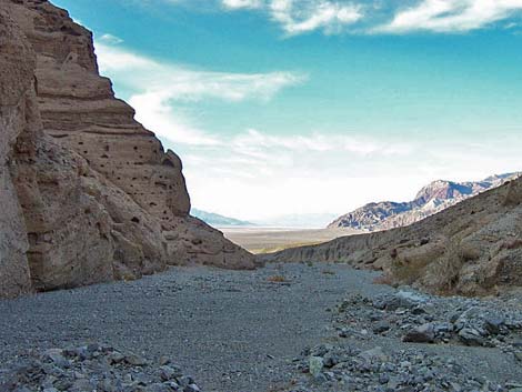 Returning: Death Valley salt pan in distance (view northwest) |
 More to come ... |
Table 1. Highway Coordinates Based on GPS Data (NAD27; UTM Zone 11S). Download Highway GPS Waypoints (*.gpx) file.
| Site # | Location | Latitude (N) | Longitude (W) | Easting | Northing | Elevation (ft) | Verified |
|---|---|---|---|---|---|---|---|
| 0712 | Furnace Creek Visitor Center | 36.46159 | 116.86574 | 512030 | 4034954 | -186 | Yes |
| 0714 | Badwater Parking | 36.22981 | 116.76638 | 520995 | 4009262 | -280 | Yes |
| 0741 | Hwy 190 at Badwater Rd | 36.44841 | 116.85192 | 513271 | 4033494 | 4 | Yes-2 |
| 0773 | Hwy 178 at Sidewinder Canyon Rd | 36.06763 | 116.74712 | 522773 | 3991279 | -253 | Yes |
| 0775 | Willow Canyon Parking | 36.06605 | 116.74396 | 523058 | 3991104 | -247 | Yes |
Table 2. Hiking Coordinates Based on GPS Data (NAD27, UTM Zone 11S). Download Hiking GPS Waypoints (*.gpx) file.
| Wpt. | Location | Easting | Northing | Elevation (ft) | Verified |
|---|---|---|---|---|---|
| 10 | Willow Canyon Trailhead | 523059 | 3991105 | -247 | GPS |
| 11 | Mouth of the canyon | 523661 | 3991530 | -111 | GPS |
| 12 | Side canyon on the east | 524321 | 3990731 | 134 | GPS |
| 13 | Canyon narrows on a corner | 524806 | 3990000 | 317 | GPS |
| 14 | Mouth of the cleft | 525030 | 3989869 | 399 | GPS |
| 15 | Pour-over | 525406 | 3989674 | 489 | GPS |
Happy Hiking! All distances, elevations, and other facts are approximate.
![]() ; Last updated 240324
; Last updated 240324
| Death Valley | Hiking Around Las Vegas | Glossary | Copyright, Conditions, Disclaimer | Home |