
Hiking Around Las Vegas, Death Valley National Park
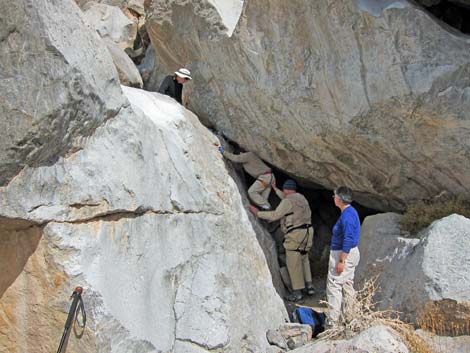
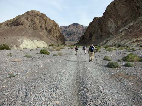 Walking into "the hole" (view NE) |
Overview This is a tough hike in a geologically unusual area where enormous boulders fell into the mouth of a narrow canyon, blocking easy progress and guarding against access to water-polished limestone narrows beyond. Passing the boulders requires route finding and minimal 5th-class climbing skills for which most hikers would find a rope comforting. Beyond the boulder obstacles, the narrows are blocked by a polished 9-ft pour-off. Past the narrows, the route follows a broad wash to the base of the 580-ft-high Widowmaker Dry Falls. Doing this route is a character-building experience as it is all about overcoming difficult obstacles. This route runs up into the Funeral Mountains (hence the macabre names) and the Death Valley Wilderness Area. |
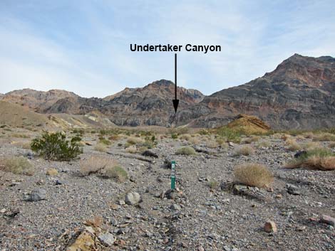 Trailhead (view NE) |
Watch Out Other than the standard warnings about hiking in the desert, ...this route is pretty dicey and requires 5th-class climbing skills to get through the boulders. Be extra careful when high enough to fall and get hurt. Be sure to stay out of the canyon if it is raining or threatens to rain because of flash flood dangers. While hiking, please respect the land and the other people out there, and please try to Leave No Trace of your passage. Also, even though this hike is short, it is difficult and remote, so bring the 10 Essentials. The route runs up into the Death Valley Wilderness Area, so pay particular attention to respecting the land. |
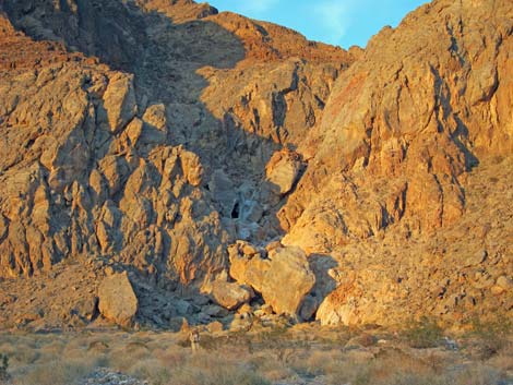 Mouth of Undertaker Canyon (view NE |
Getting to the Trailhead This hike is located in Death Valley National Park, about 2-1/2 hours northwest of Las Vegas. From town, drive out to Death Valley. From the Furnace Creek Visitor Center (Table 1, Site 0712), drive south on Highway 190 for about 1.25 miles to the Badwater (Highway 178) turnoff (Site 0741). Continue on Highway 190 for another 5.4 miles to Hole-in-the-Wall Road (Site 0936), a two-track road on the left. Turn left onto Hole-in-the-Wall Road and drive northeast. The road is a gravel two-track, but it can be suitable for a carefully driven sedan. Drive out 3.7 miles, through the "hole in the wall," and park where the canyon opens on the other side (Site 0595). Park here; this is the trailhead. For details of the road, see the Hole-in-the-Wall Road webpage. |
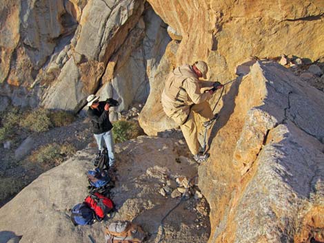 First Obstacle |
The Hike From the trailhead (Table 2, Waypoint 01), the route leaves the road running slightly east of north following the wash along the base of the cliffs. Within moments of leaving the road, the route enters the Death Valley Wilderness Area. The vegetation is Mojave Desert Scrub, dominated by creosote bush, white bursage, indigo bush, cottontop cactus, and beavertail pricklypear cactus. The walking in the wash is fairly easy, but the elevated islands of desert pavement are a bit easier to walk on. The ancients apparently liked these elevated platforms too: keep an eye out for evidence of their campsites. |
 Second Obstacle |
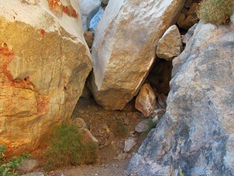
The route runs up the bajada for about 1 mile to the mouth of Undertaker Canyon (Wpt. 02), which is marked by a deep gash in the limestone mountains that is filled with enormous boulders. A canyon mouth filled with boulders is an unusual geologic situation, but slabs of limestone are calving off the slope above the canyon on the south side and falling into the wash. Over the years, water flowing over the boulders has produced many sculpted sections. Entering the canyon by normal means is impossible. Instead, immediately start looking around for ways to climb past the enormous boulders that are piled one upon another. There apparently are at least two ways to pass the first section, but one way is to scale an undercut boulder with a very high first step. |
 Third Obstacle |
The second obstacle is a water-polished smooth rock face. We choose to climb it back under the overhanging boulder, but others apparently climb the open face. The third obstacle is a water-polished slot between two boulders above an overhang. The lack of footing makes this somewhat difficult. The fourth obstacle is a high cleft between two boulders. The climb is somewhat awkward, and the fall is high enough to kill you. |
 Fourth Obstacle |
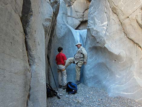
The fifth obstacle is a 9-ft-high, water-polished, smooth as silk pour-over in the narrows. The rounded edges make using chimneying techniques less than straight forward. The reward for passing the fifth and final obstacle is a hike through the narrows and a view of Widowmaker Dry Fall from the bottom. Well, not really... the reward is the feeling of accomplishment for making it to the fifth level of heaven. |
 Fifth Obstacle |
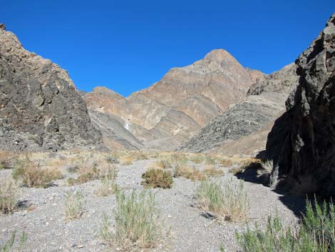 Getting late, this is a far as we got (view NW) |
Table 1. Highway Coordinates Based on GPS Data (NAD27; UTM Zone 11S). Download Highway GPS Waypoints (*.gpx) file.
| Site # | Location | Latitude (N) | Longitude (W) | Easting | Northing | Elevation (ft) | Verified |
|---|---|---|---|---|---|---|---|
| 0595 | Hole in the Wall Parking | 36.41500 | 116.72269 | 524862 | 4029813 | 1,852 | GPS |
| 0712 | Furnace Creek Visitor Center | 36.46159 | 116.86574 | 512030 | 4034954 | -186 | Yes |
| 0741 | Hwy 190 at Badwater Rd | 36.44841 | 116.85192 | 513271 | 4033494 | 4 | Yes-2 |
| 0936 | Hwy 190 at Hole in the Wall | 36.40488 | 116.78194 | 519553 | 4028678 | 999 | Yes |
Table 2. Hiking Coordinates Based on GPS Data (NAD27, UTM Zone 11S). Download Hiking GPS Waypoints (*.gpx) file.
| Wpt. | Location | Easting | Northing | Elevation (ft) | Point-to-Point Distance (mi) | Cumulative Distance (mi) | Verified |
|---|---|---|---|---|---|---|---|
| 01 | Trailhead | 524862 | 4029814 | 1,852 | 0.00 | 0.00 | GPS |
| 02 | Base of Canyon | 525449 | 4031198 | 2,271 | 1.02 | 1.02 | GPS |
| 03 | Undertaker Canyon | 525706 | 4031333 | 2,646 | 0.22 | 1.24 | GPS |
| 04 | Undertaker Falls, Base of | 526671 | 4032357 | 3,182 | 0.95 | 2.19 | GPS |
Happy Hiking! All distances, elevations, and other facts are approximate.
![]() ; Last updated 240324
; Last updated 240324
| Death Valley | Hiking Around Las Vegas | Glossary | Copyright, Conditions, Disclaimer | Home |