
Hiking Around Las Vegas, Death Valley National Park

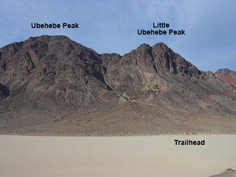 Ubehebe Peaks (view W from the Grandstand) |
Overview This is the quintessential desert summit in the Death Valley Wilderness Area. The route follows a narrow, rocky trail up the steep side of an airy ridge to a saddle on the crest. From the saddle, the trail becomes steep and hard to follow as it runs through bands of cliffs, swings out and around the west side of the peak, and finally climbs the south ridge to the summit. Although the views from the crest are good enough to stop there, they get even better higher up. From the summit, the views are grand in all directions, including the Racetrack Playa to the east and the Saline valley to the west. For a peak with a trail, this is a way-out-and-wild steep-narrow-rocky route up a tough peak that rewards the hiker with solitude and grand desert vistas. Link to map. |
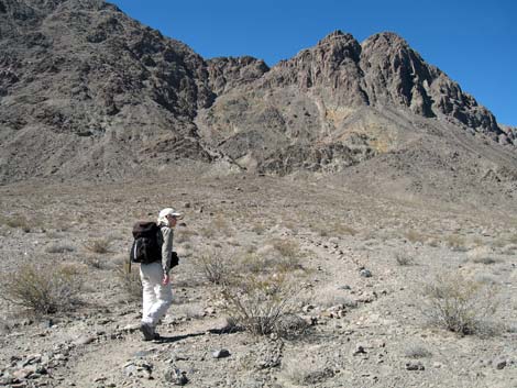 Starting on gentle bajada (view NW) |
Watch Out Other than the standard warnings about hiking in the desert, ...the trail is steep, narrow, and rocky, and a stumble from many places along the trail would prove seriously hazardous to your health. Above the saddle, the route is steeper, and a stumble up there might be your last. This is remote and wild country; don't take chances; don't get hurt here. Make sure your vehicle is in good working condition before driving out, carry plenty of water (for the radiator and for drinking), pack extra food, and drive slowly and carefully. While hiking, please respect the land and the other people out there, and please try to Leave No Trace of your passage. Also, this is a long hike, so be sure to bring the 10 Essentials. |
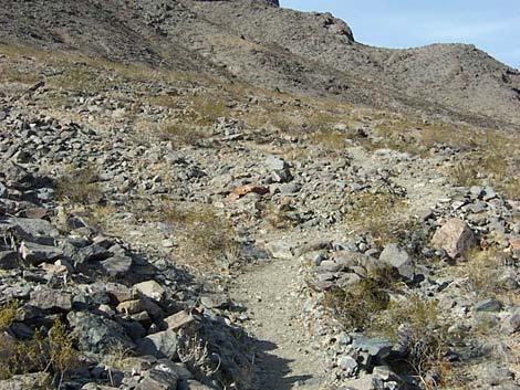 Trail begins to climb the hillside |
Getting to the Trailhead Racetrack Playa is located in Death Valley National Park, about 5-6 hours northwest of Las Vegas. From town, drive out to Death Valley. From the Furnace Creek Visitor Center (Table 1, Site 712), drive north and west to the north end of Racetrack Playa (Site 758), where there is a wide parking area on the right (west) side of the road and a sign on the left (east) side of the road. For details on getting to Racetrack Playa, see the description of the Racetrack Road. Park here; this is the trailhead. |
 Trail becomes steep |
The Hike From the trailhead (Table 2, Waypoint 01), the trail starts at the parking area and runs straight up the bajada towards the mountain. After a few minutes on a nice trail, the trail angles off to the north and cuts over to the side of the bajada. At the edge of the bajada (Wpt. 02), the trail starts angling up across the steep side of the mountain at a fairly gentle angle. After a couple of minutes of being lulled into tranquility thinking that this will be an easy hike, the trail turns and runs steeply up a rocky gully (Wpt. 03). It is easy to lose the trail in here, but the rocks are soon passed. Above the gully, the trail ascends a few steep switchbacks to a little ridge (Wpt. 04), which is a nice place to stop, rest, and enjoy the view. |
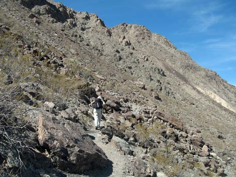 |
From there, the trail climbs steeply across steep slopes. When the trail gets near some even steeper hillsides fairly far out to the north (Wpt. 05), it starts switchbacking up the side of the ridge. The upper switchbacks are visible from the parking area. Vegetation on the hillside is dominated by creosote bush, and white bursage, plus some brittlebush, a few barrel cactus, cottontop cactus, and beavertail cactus, bunchgrasses, desert trumpet, various buckwheats and a few other things. The trail climbs high on the side of the ridge (Wpt. 06) and cuts back to the south, hitting the crest at a saddle (Wpt. 07). A few feet below the saddle, there are the remains of a little quarry where someone was trying to mine a green and blue mineral (copper?). There appears is a mine on the other side of the saddle, but this trail does not go over there. |
 Built trail on side of cliff (view NW) |
The saddle is a great place to stop. The views to the east and west are spectacular. Racetrack Playa and mountains beyond lie to the east, and Saline Valley with its salt playa and the mountains beyond lie to the west. If you continue towards the summit, the trail runs south and climbs steeply up the ridge. This part of the trail is well defined and easy to follow. After a few minutes of running straight up the hill, the trail does a "Walter's Wiggle" (see the Angle's Landing Trail in Zion National Park) up the crest for a few minutes. From the top of the wiggle, the trail angles up and west as it cuts steeply through a band of cliffs. The trail through here is steep and rocky with some 2nd-class sections and a spot or two of minimal 3rd-class climbing. This part of the trail is hard to follow. |
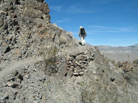 Hiker past built trail (view N) |
Above these rocky outcrops, another series of steep switchbacks lead to another band of cliffs (Wpt. 08). In an area with some big smooth slabs of rock, the trail seems to end, and the route seems to head directly up the slabs. However, the trail drops a few feet and runs out to the west, eventually angling up and over to a rocky outcrop that can be seen on the horizon. There is an old 5-gallon metal bucket at about the farthest point west on the trail (just above a rusty metal wheelbarrow on the side of the hill). From the bucket, the trail runs steeply up towards the summit. The trail eventually climbs back to the crest of the ridge at a saddle on the south side of the summit (Wpt. 10). From this point, it is an easy scramble north to the summit of Little Ubehebe Peak (Wpt. 11) or south to a lesser summit (Wpt. 12) with a good view of the route to "Big" Ubehebe Peak. |
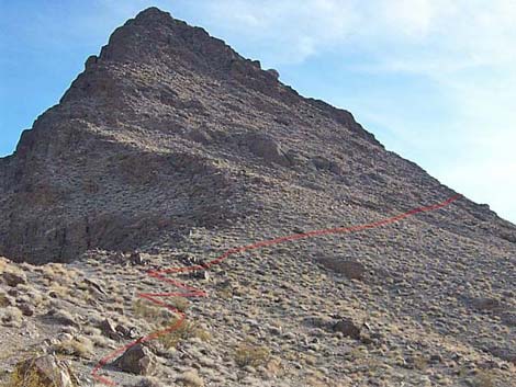 Looking up the route (view south from the saddle) |
Set a spell on the summit and enjoy the view. This was a serious hike to a wild place. "Big" Ubehebe Peak is higher, but I doubt the views are any grander. To climb "Big" Ubehebe Peak, continue south from the saddle (Wpt. 10) on the use-trail. A short way out, the trail drops steeply off the west side of the ridge to a saddle, then begins to climb again towards the summit. Time ran out on me here (Wpt. 14), so I turned around, but watching another hiking party ahead of me, it looks as though the use-trail continues up the ridge, staying somewhat to the west side of the crest. |
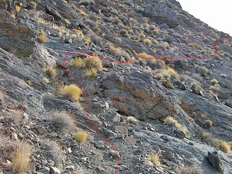 Looking up the route (view south from above the saddle) |
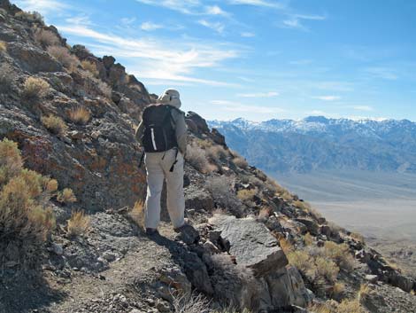 Hiker with a view |
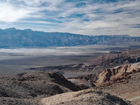 View into Saline Valley |
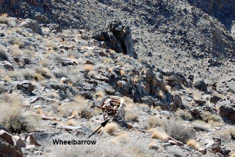 Historic artifact blending in on hillside |
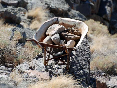 Historic wheelbarrow |
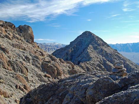 View south towards Big Ubehebe Peak |
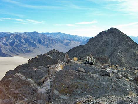 Summit (view S to Big Ubehebe Peak) |
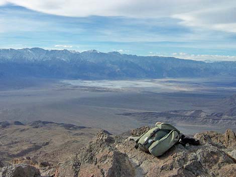 Summit (view NW into Saline Valley) |
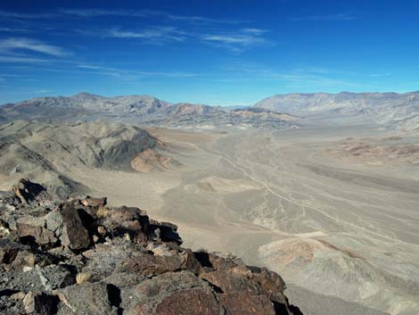 Summit (view NE along Racetrack Road) |
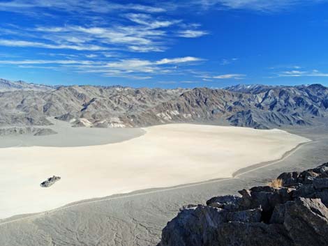 Summit (view SE into Racetrack Playa) |
 Traverse towards Big Ubehebe Peak |
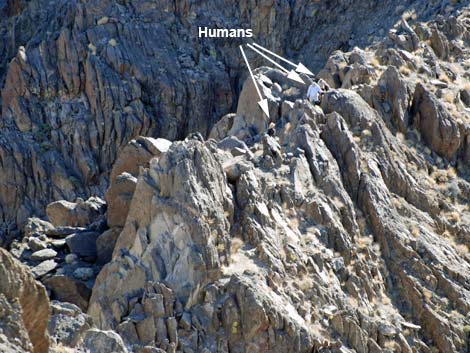 Hikers crossing saddle between Big and Little peaks |
Descending from the summit back to the trailhead
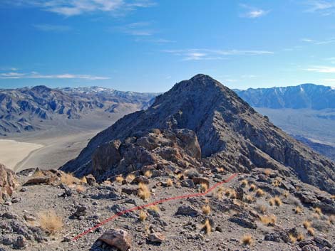 Departing the summit (view S to Big Ubehebe Peak) |
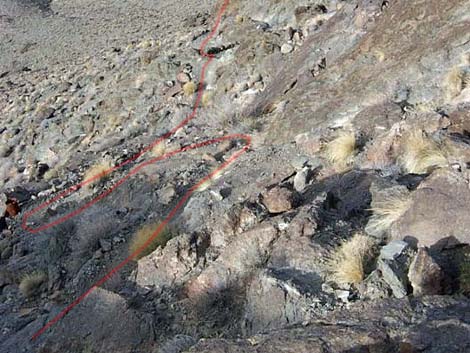 Trail descending from the summit (view N) |
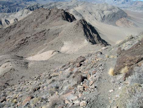 Looking back at the saddle |
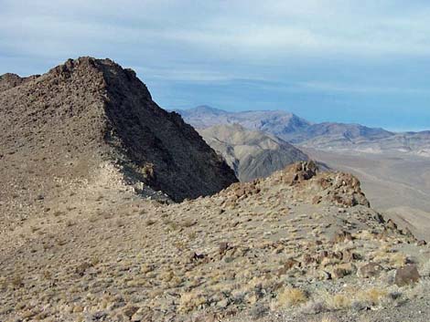 Descending gentle terrain towards the saddle (view N) |
 Looking down the route (view N from above the saddle) |
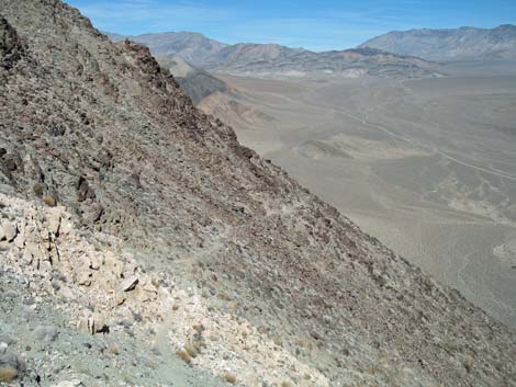 Trail switchbacking across steep hillside (view N) |
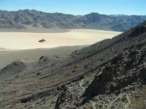 Trail on hillside (view SE towards Racetrack Playa) |
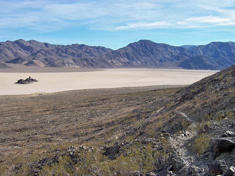 Returning: Racetrack Playa and the Grandstand (view SE) |
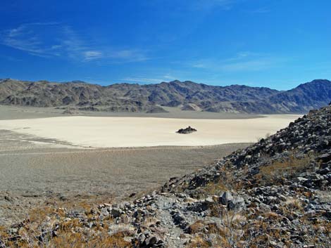 Returning: Racetrack Playa and the Grandstand (view SE) |
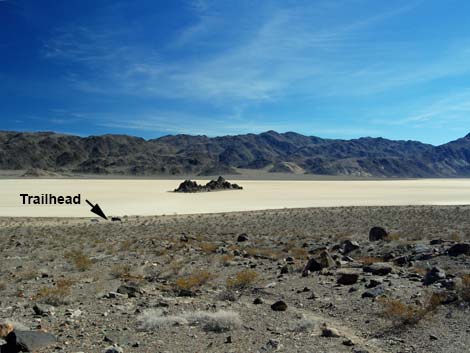 Returning: Racetrack Playa and the Grandstand (view SE) |
Table 1. Highway Coordinates Based on GPS Data (NAD27; UTM Zone 11S). Download Highway GPS Waypoints (*.gpx) file.
| Site # | Location | Latitude (N) | Longitude (W) | Easting | Northing | Elevation (ft) | Verified |
|---|---|---|---|---|---|---|---|
| 0712 | Furnace Creek Visitor Center | 36.46159 | 116.86574 | 512030 | 4034954 | -186 | Yes |
| 0758 | Racetrack Rd at Grandstand Parking | 36.69430 | 117.57073 | 449015 | 4060911 | 3,719 | Yes-2 |
Table 2. Hiking Coordinates Based on GPS Data (NAD27, UTM Zone 11S). Download Hiking GPS Waypoints (*.gpx) file.
| Wpt | Location | Easting | Northing | Elevation | Point-to-Point Distance (mi) | Cumulative Distance (mi) | Verified |
|---|---|---|---|---|---|---|---|
| 01 | Trailhead | 449007 | 4060922 | 3,701 | 0.00 | 0.00 | Yes |
| 02 | Base of hillside | 448487 | 4061076 | 3,910 | 0.39 | 0.39 | GPS |
| 03 | Start into Gully | 448264 | 4061301 | 4,103 | 0.21 | 0.60 | GPS |
| 04 | Ridge top | 448216 | 4061338 | 4,170 | 0.06 | 0.66 | GPS |
| 05 | Lower north switchback | 447757 | 4061705 | 4,609 | 0.43 | 1.09 | GPS |
| 06 | Upper north switchback | 447716 | 4061765 | 4,725 | 0.12 | 1.21 | GPS |
| 07 | Saddle | 447640 | 4061620 | 4,901 | 0.17 | 1.38 | GPS |
| 08 | Slabs | 447694 | 4061335 | 5,220 | 0.22 | 1.60 | GPS |
| 09 | Ridge | 447663 | 4061253 | 5,255 | 0.06 | 1.66 | GPS |
| 10 | Saddle | 447743 | 4061153 | 5,409 | 0.12 | 1.78 | GPS |
| 11 | Little Ubehebe Summit | 447765 | 4061219 | 5,510 | 0.05 | 1.83 | GPS |
| 12 | South (middle) Summit | 447771 | 4061077 | 5,464 | . | . | GPS |
| 13 | Saddle | 447726 | 4060946 | 5,210 | . | . | GPS |
| 14 | End of my trail | 447725 | 4060848 | 5,280 | . | 0.24 | GPS |
Happy Hiking! All distances, elevations, and other facts are approximate.
![]() ; Last updated 240324
; Last updated 240324
| Death Valley | Hiking Around Las Vegas | Glossary | Copyright, Conditions, Disclaimer | Home |