
Hiking Around Las Vegas, Death Valley National Park

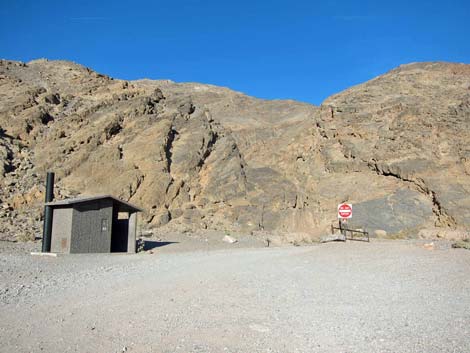 Trailhead parking and restroom (view NE) |
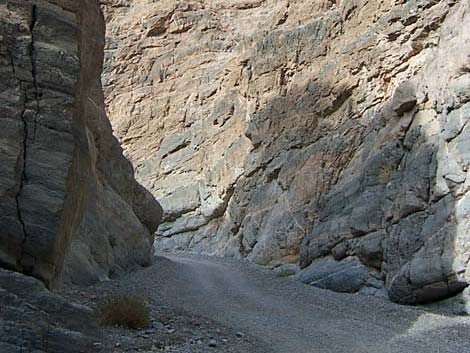
Overview This is one of the best easy hikes in Death Valley. The trail follows a gravel road up an amazing canyon through the layered-carbonate Grapevine Mountains. The canyon is quite narrow (about one SUV wide in places), especially for the first mile or so, and the walls are many hundreds of feet high. The walls of the canyon record a huge amount of earthquake activity (faulting, shifting, and tilting), and in places, the walls are formed from fractured rock (rubble) that was cemented back in place with a white, marble-like rock, and then water polished smooth. The grade is moderate and constant, and it is all uphill, but you can walk as far or as little as you like. While the road in the bottom of the canyon is not in wilderness, the surrounding canyon walls and mountains are included in the Death Valley Wilderness Area. Link to map. |
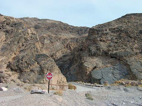 Mouth of Titus Canyon (view east from parking area) |
Watch Out Other than the standard warnings about hiking in the desert, ...this hike is pretty safe, but stay out of the canyon if it is raining or threatens to rain because of flash flood dangers. Also, watch for vehicles coming down the one-way road. While hiking, please respect the land and the other people out there, and please try to Leave No Trace of your passage. Depending on how far you intend to hike, consider what you might want of the 10 Essentials. |
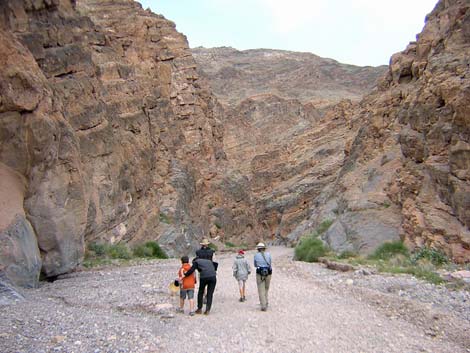 Hikers low in the canyon (view E) |
Getting to the Trailhead This hike is located in Death Valley National Park, about 3.5 hours northwest of Las Vegas. From town, drive out to Death Valley. From the Furnace Creek Visitor Center (Table 1, Site 712), drive north on Highway 190 for 17.4 miles to Scotty's Castle Road (Site 763). Turn right onto Scotty's Castle Road and drive north for 15.0 miles to the Titus Canyon turnoff (Site 761). There is a large sign at the intersection. Turn right onto Titus Canyon Road and drive east for 2.7 miles. The rocky road runs up the bajada to the parking area at the edge of the mountains. The road is a bit rough, but it is fine for all vehicles (except not trailers as there is nowhere to turn a trailer around). Stop in the parking lot just before the "one way, do not enter" sign (Site 760). The parking lot is at the end of the two-way road; the road is one-way, downhill, above this point. Park here; this is the trailhead. |
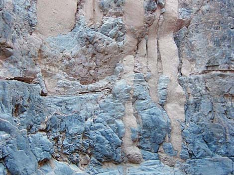 Curious mud patterns on the canyon wall (view NE) |
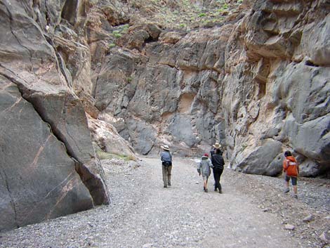
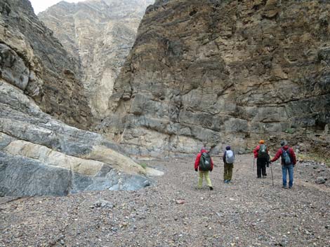
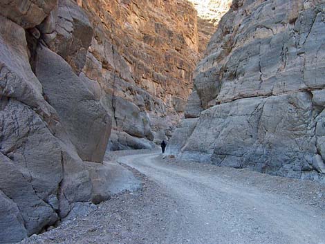
The Hike From the trailhead (Table 2, Waypoint 01), walk up the gravel road into the canyon. The mountains rise directly out of the parking lot, so the road immediately enters the deep, narrow canyon. Walking up the canyon, you pass through narrow areas, then the canyon will open up revealing the true height of the cliffs, all of which are amazingly twisted, folded, faulted, and water-polished. The canyon repeatedly narrows down, opens up a little, and narrows down again. |
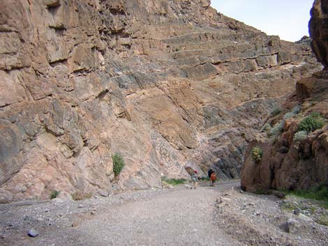 Hikers heading up the canyon (view E) |
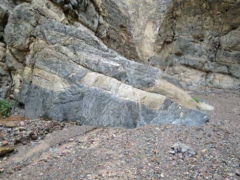
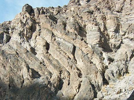
About 20 minutes up the canyon, there is a washout cave on the south side of the canyon, and just past is some interesting geology (breccia; Wpt. 02). Here, the parent material (dark gray carbonate rock) fractured into rubble with pieces of varying sizes, and then the open spaces between the fragments filled in with a white, marble-like material (calcite) that cemented all of the rubble in place. Then, low on the cliff, this rock is water polished and smooth, making for interesting patterns in the walls. Walk up the canyon for a far as you like; the best of the lower narrows ends at about Wpt 04. When ready to head back, retrace your footprints to the trailhead. It will, however, be hard to turn back because you will forever wonder what lies around the next curve. |
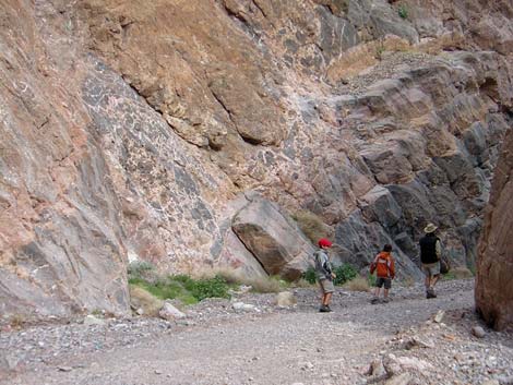 |
 |
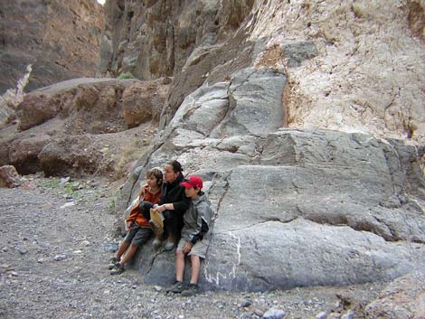 Taking a break (view E) |
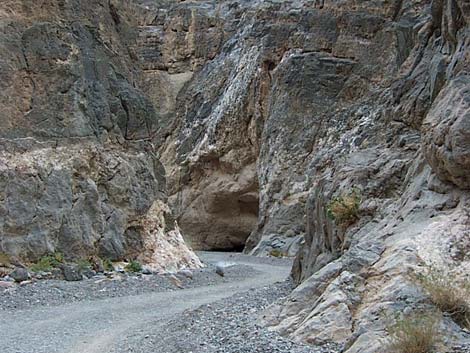 Approaching the washout cave on the right (view E) |
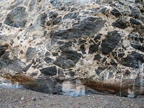 Brecciated wall (view S) |
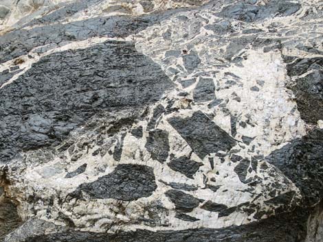 Brecciated wall (view S) |
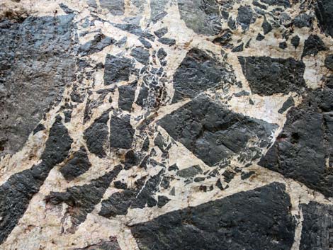 Brecciated wall (view S) |
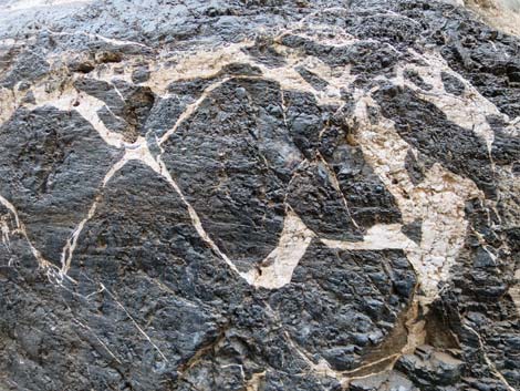 Brecciated wall (view S) |
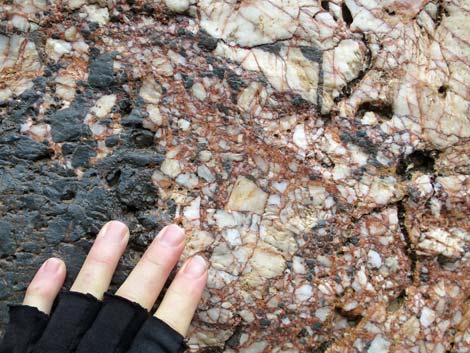 Brecciated wall (view N) |
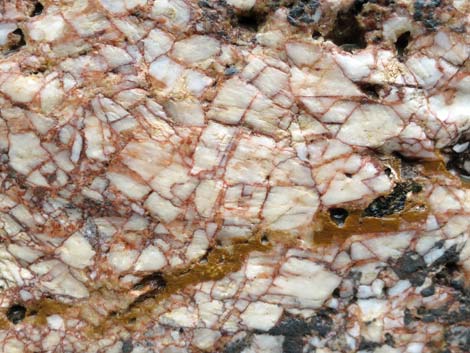 Brecciated wall (view N) |
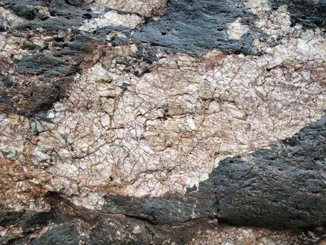 Brecciated wall (view N) |
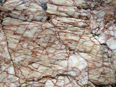 Brecciated wall (view N) |
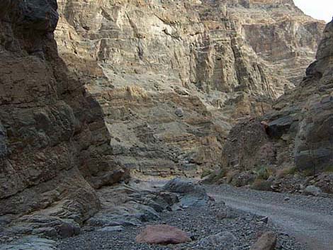 Farther up the canyon, parts are narrower (view E) |
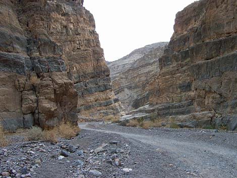 Farther up the canyon, parts are wider (view E) |
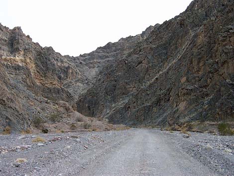 Layered wall in a wide part of the canyon (view E) |
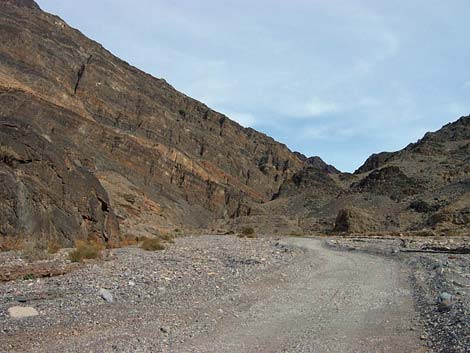 Wide canyon at about the end of the best hiking (view E) |
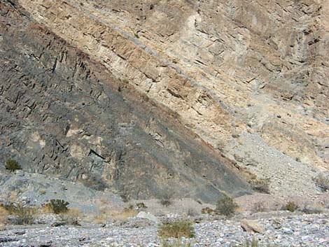 Layered geology marks a good place to turn around (view N) |
 More to come ... |
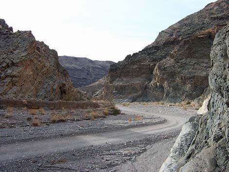
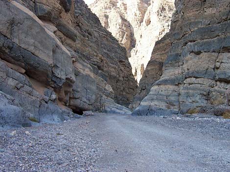
Returning Down Titus Canyon
 |
 |
 |
 |
 |
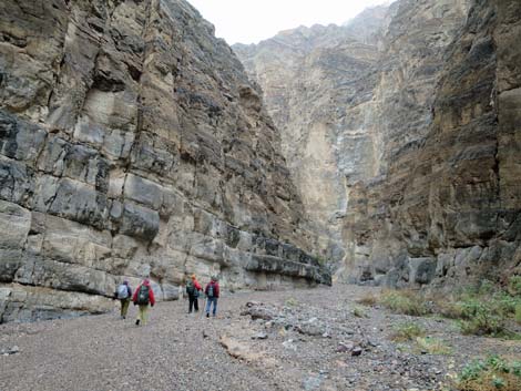 |
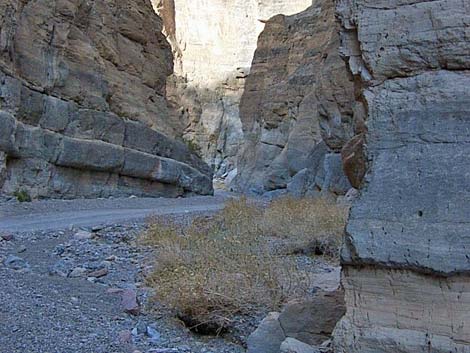 Returning down the canyon (view W) |
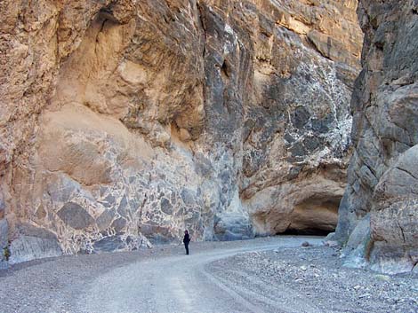 Returning to the brecciated wall (view W) |
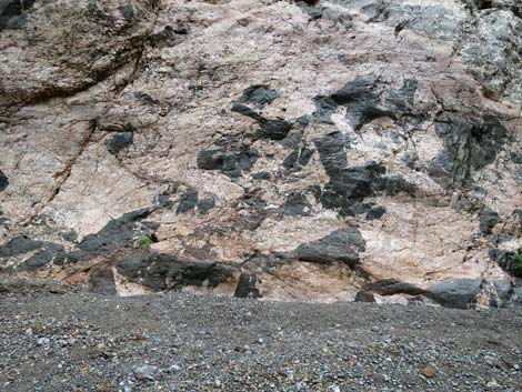 |
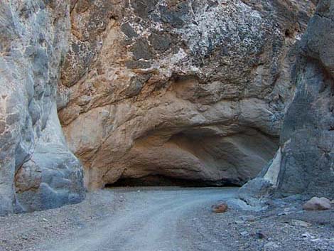 |
 |
 |
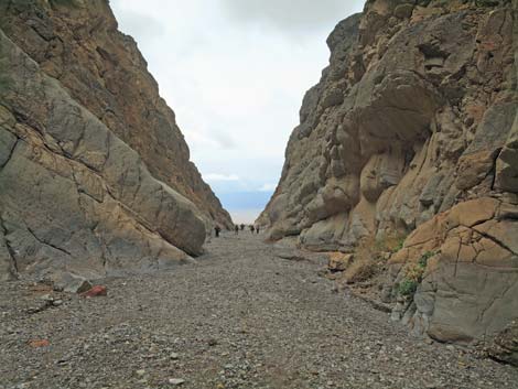 Hikers approaching the mouth of Titus Canyon (view W) |
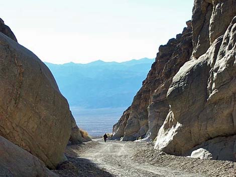 Human exiting Titus Canyon (view west) |
Table 1. Highway Coordinates Based on GPS Data (NAD27; UTM Zone 11S). Download Highway GPS Waypoints (*.gpx) file.
| Site # | Location | Latitude (N) | Longitude (W) | Easting | Northing | Elevation (ft) | Verified |
|---|---|---|---|---|---|---|---|
| 0712 | Furnace Creek Visitor Center | 36.46159 | 116.86574 | 512030 | 4034954 | -186 | Yes |
| 0760 | Titus Canyon Lower Parking | 36.82199 | 117.17321 | 484552 | 4074937 | 917 | Yes |
| 0761 | Scotty's Castle Rd at Titus Canyon Rd | 36.78771 | 117.19063 | 482991 | 4071137 | 169 | Yes-2 |
| 0763 | Hwy 190 at Scotty's Castle Rd | 36.63910 | 117.03531 | 496843 | 4054636 | 104 | Yes-2 |
Table 2. Hiking Coordinates Based on GPS Data (NAD27; UTM Zone 11S). Download Hiking GPS Waypoints (*.gpx) file.
| Wpt. | Location | Easting | Northing | Elevation | Verified |
|---|---|---|---|---|---|
| 01 | Trailhead | 484552 | 4074938 | 917 | GPS |
| 02 | Interesting Geology | 485380 | 4074880 | 1,000 | GPS |
| 03 | Canyon opens briefly | 485892 | 4074988 | 1,283 | GPS |
| 04 | End of first narrows | 486983 | 4074741 | 1,586 | GPS |
| 05 | End of my trail | 487743 | 4075009 | 1,808 | GPS |
Happy Hiking! All distances, elevations, and other facts are approximate.
![]() ; Last updated 240729
; Last updated 240729
| Death Valley | Hiking Around Las Vegas | Glossary | Copyright, Conditions, Disclaimer | Home |