
Hiking Around Las Vegas, Death Valley National Park

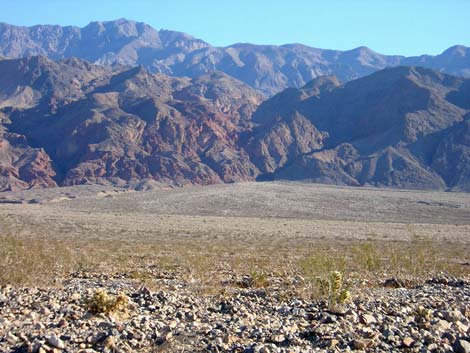 Mouth of Redwall Canyon (view E) |
Overview This is a nice, fairly easy 3-mile hike to a narrow, deep, and strikingly colored canyon with lots of astounding twisting, folding, faulting, and unconformities in the Death Valley Wilderness Area. The hike starts on the Scotty's Castle Road just north of Titus Canyon, ascends the bajada (2.2 miles, +1,000 ft), and then winds up a narrow canyon (0.7 miles, +600 ft) to a 25-foot pour-over. The pour-over can be passed (5th class), but it is only about 15 minutes from there to the top of the narrows, so if you don't want to risk climbing the pour-over, you won't miss much. Although it is a long walk to a short canyon, it is worth the effort to get there. Link to map. |
 |
Watch Out Other than the standard warnings about hiking in the desert, ...there are no particular dangers on this route. There is no shade on the bajada. If you want to climb the pour-over, there is one off-balance, poorly protected 5th-class move as you climb out from under a chockstone onto a slick face. I would take a short (half-length) climbing rope, a small selection of medium to large stoppers, a medium-sized camming device (such as a Friend), and a sling to leave for the rappel. While hiking, please respect the land and the other people out there, and try to Leave No Trace of your passage. This is a hike into an isolated canyon where rescue would be difficult, so be sure to bring the 10 Essentials. |
 |
Getting to the Trailhead This hike is located in Death Valley National Park, about 3.5 hours northwest of Las Vegas. From town, drive out to Death Valley. From the Furnace Creek Visitor Center (Table 1, Site 712), drive north on Highway 190 for 17.4 miles to Scotty's Castle Road (Site 763). Turn right onto Scotty's Castle Road and drive north for 15.0 miles to the Titus Canyon turnoff (Site 761). Stay on the paved road and continue driving north for another 3.5 miles to where the road crosses a shallow wash and curves to the west. The wash comes down from Redwall Canyon. There is no marked trailhead, just a 1.25-mile-long section of road to park along. |
 |
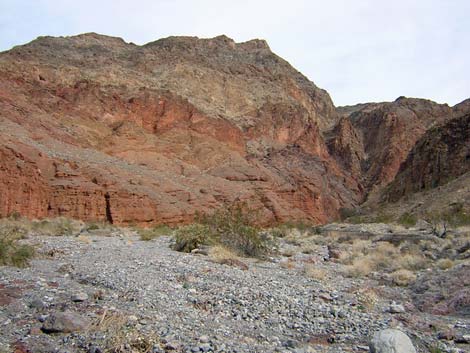
Cross the wash and continue driving for 0.25 to 1.5 miles. Stopping near the wash (0.25 miles) makes for a shorter hike, but driving farther up the road (1.5 miles) puts you higher on the bajada and might make for an easier hike. Park somewhere between the lower (Site 0762) and upper ends of the trailhead zone; this is the trailhead. The next time I do this hike, I'll park at the upper end and hike along the north side of the alluvial fan. From the lower trailhead (Site 0762), it is hard to see the mouth of the canyon, so regardless of where you start hiking, you might consider driving up the road to where you can clearly see the mouth of the canyon. The mouth is marked by a deep cleft in the mountain that separates dark gray rocks (south side) from bright red rocks (north side). |
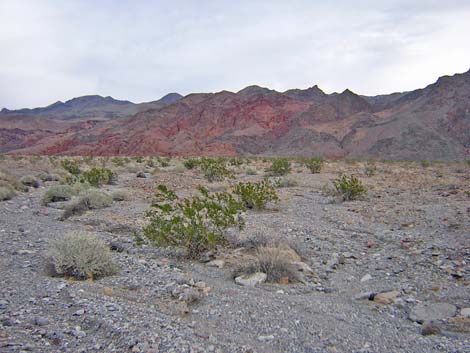
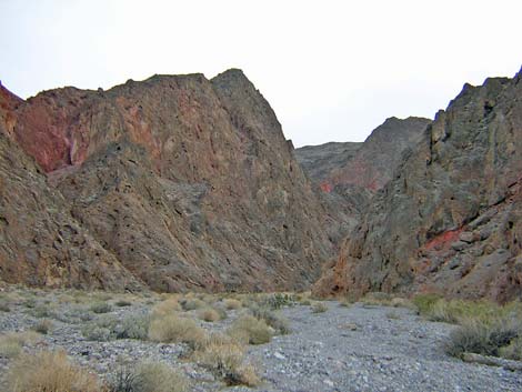 Entering Red Wall Canyon (view E) |
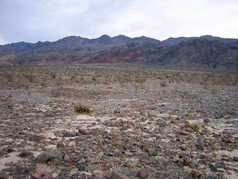
The Hike From the upper trailhead (Table 2, Waypoint 1), the lower trailhead (Wpt. 2), or somewhere between, hike up the bajada to the mouth of Redwall Canyon (Wpt. 3). The mouth is about 2.2 miles from the lower trailhead. The bajada is rocky and cut by many little washes, and the hiking is somewhat difficult because you are walking on loose, cobble-sized stones. If you start at the lower trailhead, there are ridges of older alluvial material with desert pavement that are easier to walk on, and these can be followed for about halfway up the bajada. From the upper trailhead, the route looks as if there is more dirt and fewer cobbles. The vegetation on the bajada is almost entirely widely scattered, stunted creosote bush with a little bit of bursage, cholla, and desert holly. |
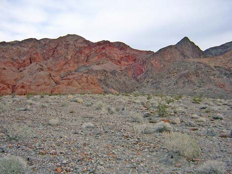
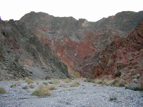 The lower red wall (view E) |
The mouth of the canyon is bordered by dark blue-gray carbonate rocks on the south side and bright red conglomerate rocks on north side. The back of the canyon is blue-gray limestone rock. Just inside the canyon on north side, there is a shear wall of dark limestone that forms a triangular peak; this is a good landmark to aim for when hiking up the bajada. There is much more vegetation in the canyon than on the bajada. There still is a little bit of creosote bush and bursage, but now there is lots of rabbitbrush, Encelia, and other shrubby composites (shrubs in the sunflower family), Mormon tea, desert fir, rock nettle, and even some coyote melon. There are a couple of big logs in the wash, probably pinyon pines that washed down from high in the mountains. About 5 minutes up the canyon, you arrive at the base of a bright red wall on the south side of the canyon. Although mostly red, there are many colors, including purple and yellow. The wall is formed by contorted layers of rock, some of which are gray conglomerate limestone, and there are many erosion holes in the wall. |
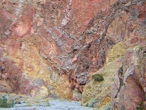 |
A couple of minutes beyond the first red wall, the canyon jogs northwest, narrows, and you pass through a brief narrow section between eroded limestone buttresses. A couple of minutes beyond there, the canyon abruptly jogs northeast and opens up a bit to reveal another beautiful, smooth red wall, this time on the north side of the canyon. Just beyond that wall, there is another crook in the canyon, and hikers enter the narrows. A few minutes into the narrows, a short scramble-up leads to the pour-over that blocks easy passage up the canyon (Wpt. 4). It took me 40 minutes to hike (slowly on painful knees) from the mouth of the canyon to the pour-over. The 25-foot pour-over, which is in the narrows, is capped by a very large chockstone. The bottom 10 feet of the pour-over is water-polished, smooth, and nearly vertical, then there is another 10 feet or so of steeply sloping water-polished rock to a ledge. Above that is another 8-foot slot to climb. |
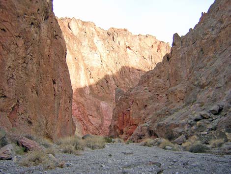 |
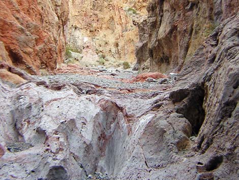
If you spend a few minutes, you can work out some easy moves to get up under the chockstone. From there, however, it is an airy and off-balance move to get out from under the chockstone and onto the steep, water-polished, dusty rock face. If you take a rope, you can protect this move from under the chockstone; but of course, the best place for pro is the only good place for a hand jam. Above the pour-over, there are a couple of little water-polished scramble-ups in the narrows. Then the canyon jogs north and opens up a bit. A couple of minutes above there, the canyon jogs northeast and completely opens up. At this point, you are above the rock layers that form the cliffs and canyons, and the area is more like a wash in the mountains than a narrow canyon. I didn't go any farther up the canyon, but from where I stopped, you can see striking colors (mostly reds) up the canyon. It looks as if it would make for a nice hike in the mountains. From as high in the canyon as you get, return to the trailhead by following your footprints down the canyon and across the bajada. |
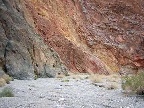 Colors in the lower red wall (view S) |
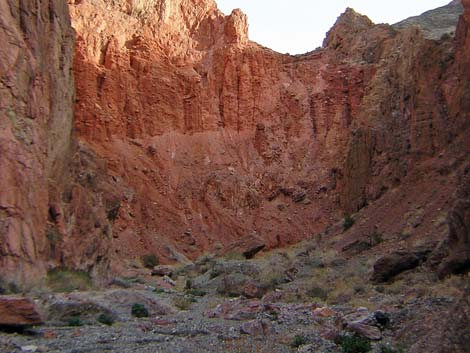 Red alluvial materials |
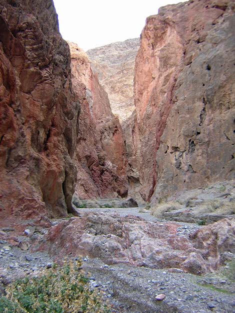 Narrow canyon above upper red wall (view E) |
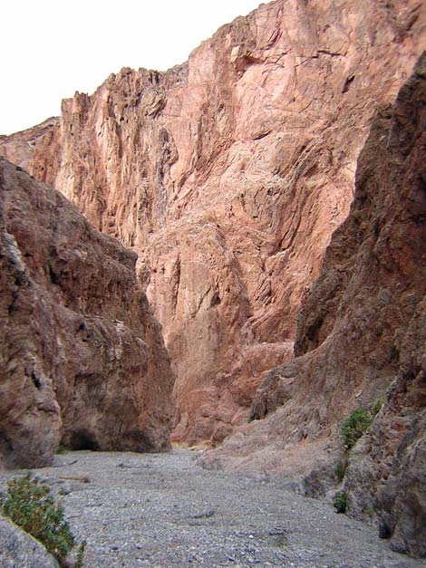 Upper red wall (view W) |
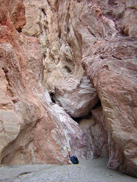 Pour-over and chockstone: looks easy to pass (view E) |
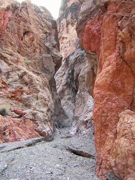 Narrow canyon above the pour-over (view E) |
 |
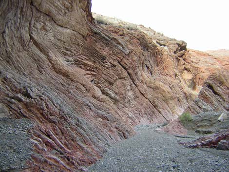 |
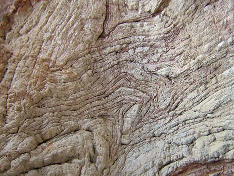 Folded rocks in the wall of the canyon (view W) |
 Above the narrow canyon (view E) |
Table 1. Highway Coordinates Based on GPS Data (NAD27; UTM Zone 11S). Download Highway GPS Waypoints (*.gpx) file.
| Site # | Location | Latitude (N) | Longitude (W) | Easting | Northing | Elevation (ft) | Verified |
|---|---|---|---|---|---|---|---|
| 0712 | Furnace Creek Visitor Center | 36.46159 | 116.86574 | 512030 | 4034954 | -186 | Yes |
| 0763 | Hwy 190 at Scotty's Castle Rd | 36.63910 | 117.03531 | 496843 | 4054636 | 104 | Yes-2 |
| 0761 | Scotty's Castle Rd at Titus Canyon Rd | 36.78771 | 117.19063 | 482991 | 4071137 | 169 | Yes-2 |
| 0762 | Scotty's Castle Rd at Redwall Canyon Parking | 36.83628 | 117.22497 | 479940 | 4076531 | 388 | Yes |
Table 2. Hiking Coordinates Based on GPS Data (NAD27; UTM Zone 11S). Download Hiking GPS Waypoints (*.gpx) file.
| Wpt. | Location | Easting | Northing | Elevation (ft) | Verified |
|---|---|---|---|---|---|
| 01 | Upper end of trailhead zone | 478296 | 4077627 | 516 | GPS |
| 02 | Lower end of trailhead zone | 479941 | 4076531 | 388 | GPS |
| 03 | Mouth of the Canyon | 481564 | 4079411 | 1,480 | GPS |
| 04 | Pour-over | 482300 | 4079730 | 2,100 | Map |
Happy Hiking! All distances, elevations, and other facts are approximate.
![]() ; Last updated 240324
; Last updated 240324
| Death Valley | Hiking Around Las Vegas | Glossary | Copyright, Conditions, Disclaimer | Home |