Hiking Around Las Vegas, Death Valley National Park

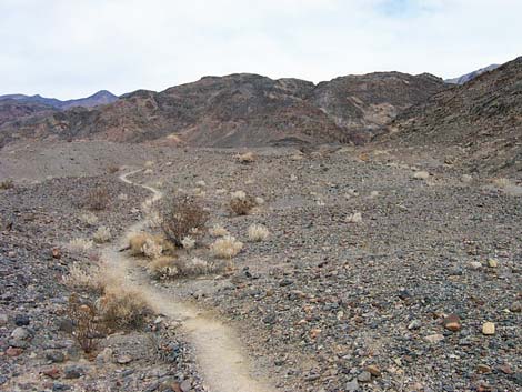
 Trail across top of bajada (view N from trailhead) |
Overview Lower Fall Canyon is an interesting hike in the Death Valley Wilderness Area that follows a deep, narrow, water-polished canyon for about 3 miles to a pour-over that, for day-hikers, marks a good place to turn around. The trail starts at the Titus Canyon parking area and runs north across the bajada to Fall Canyon, then turns east and follows the canyon as it progressively narrows to just a few feet wide at the pour-over. The route runs in the wash, which is mostly loose gravel, and although it isn't too steep, it is somewhat strenuous. |
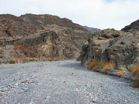
 Mouth of Fall Canyon (view E) |
Watch Out Other than the standard warnings about hiking in the desert, ...this is a fairly safe hike, but stay out of the canyon if rain threatens, even if it falls high in the mountains, because of possible flash floods. The canyon is narrow, and in many places, there would be nowhere to escape the floodwaters. Historically, there has been a mapping anomaly in this area for online maps that I think is the result of a misalignment among map projections along the east side of California. The result is that map-tiles didn't align properly and didn't display GPS coordinates correctly. Printed USGS topo maps are okay, but hikers should rely on instinct, route finding, and map reading skills if there seems to be a problem with online maps. Don't rely only on technology here. While hiking, please respect the land and the other people out there, and please try to Leave No Trace of your passage. This is a hike into an isolated canyon where rescue would be difficult, so be sure to bring the 10 Essentials. |
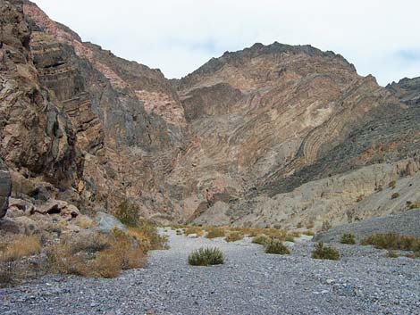
 Lower part of Lower Fall Canyon (view E) |
Getting to the Trailhead
This hike is located in Death Valley National Park, about 3.5 hours northwest of Las Vegas. From town, drive out to Death Valley. From the Furnace Creek Visitor Center (Table 1, Site 0712), drive north on Highway 190 for 17.4 miles to Scotty's Castle Road (Site 0763). Turn right onto Scotty's Castle Road and drive north for 15.0 miles to Titus Canyon Road (Site 0761). There is a large sign at the intersection. Turn right onto Titus Canyon Road and drive east for 2.7 miles. The rocky road runs up the bajada to the parking area at the edge of the mountains. The road is a bit rough, but it is fine for all vehicles (except not trailers as there is nowhere to turn a trailer around). Stop in the parking lot just before the "one way, do not enter" sign (Site 0760). The parking lot is the end of the two-way road. Above this point, the road is one-way -- downhill. Park here; this is the trailhead. |
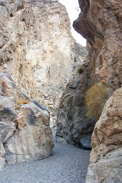
 Upper part of Lower Fall Canyon (view E) |
The Hike From the outhouse at the Titus Canyon Trailhead (Table 2, Waypoint 01), a use-trail runs northwest, then northeast along the base of the mountains. The use-trail runs over little hills and along washes to near the mouth of Fall Canyon. Near the mouth of Fall Canyon, the use-trail becomes braided, but the trails are easy to follow and (except for trails that obviously just cut up the hillside) they all go in the same general direction. The use-trail eventually arrives atop a ridge that overlooks the main Fall Canyon Wash (Wpt. 02). Drop into the gravel wash and head upstream for a few yards to the actual mouth of Fall Canyon (Wpt. 03), which is marked by abrupt cliffs. Farther up, stay to the right at a fork (Wpt. 04) in the canyon. From the mouth, the route runs up the canyon. The canyon generally is narrow with high, steep sides, but some spots are narrower than others. The canyon is spectacular with lots of polished rock, and the geology is interesting. The mountains are layered limestone, most of which is various shades of gray, but there are lighter colors and some red layers. It seems that there should be fossils here, but I saw none. The vegetation is sparse with a few creosote bushes and other shrubs here and there. |
 This 20-ft pour-over blocks easy access to upper canyon (view E) |
Fall Canyon eventually narrows to a true, water-polished "narrows," but then further upstream progress is blocked by a shear, 20-ft pour-over (Wpt 05). The pour-over is a good place to rest, eat lunch, and then hike back out. There is, however, a spectacular, narrow, water-polished section of canyon just above the pour-over. For hikers inclined to see the upper canyon, which requires a bit of 4th-class climbing that is a lot easier to climb up than to climb down, see Upper Fall Canyon. |
Table 1. Highway Coordinates (NAD27; UTM Zone 11S). Download Highway GPS Waypoints (*.gpx) file.
| Site | Location | Latitude (N) | Longitude (W) | Easting | Northing | Elevation (ft) | Verified |
|---|---|---|---|---|---|---|---|
| 0712 | Furnace Creek Visitor Center | 36.46159 | 116.86574 | 512030 | 4034954 | -186 | Yes |
| 0760 | Titus Canyon Lower Parking | 36.82199 | 117.17321 | 484552 | 4074937 | 917 | Yes |
| 0761 | Scotty's Castle Rd at Titus Canyon Rd | 36.78771 | 117.19063 | 482991 | 4071137 | 169 | Yes-2 |
| 0763 | Hwy 190 at Scotty's Castle Rd | 36.63910 | 117.03531 | 496843 | 4054636 | 104 | Yes-2 |
Table 2. Hiking Coordinates Based on GPS Data (NAD27, UTM Zone 11S). Download Hiking GPS Waypoints (*.gpx) file.
| Wpt. | Location | UTM Easting | UTM Northing | Elevation (ft) | Point-to-Point Distance (mi) | Cumulative Distance (mi) |
|---|---|---|---|---|---|---|
| 01 | Fall Canyon Trailhead | 484539 | 4074925 | 901 | 0.00 | 0.00 |
| 02 | Edge of Fall Wash | 484531 | 4075884 | 1,185 | 0.70 | 0.70 |
| 03 | Fall Canyon Mouth | 484622 | 4076022 | 1,212 | 0.11 | 0.81 |
| 04 | Fork; Go Right | 485847 | 4076902 | 1,736 | 1.27 | 2.08 |
| 05 | Lower Pour-Over | 487374 | 4077611 | 1,767 | 1.64 | 3.72 |
| 01 | Fall Canyon Trailhead | 484539 | 4074925 | 901 | 3.72 | 7.44 |
Happy Hiking! All distances, elevations, and other facts are approximate.
![]() ; Last updated 240324
; Last updated 240324
| Death Valley | Hiking Around Las Vegas | Glossary | Copyright, Conditions, Disclaimer | Home |