
Hiking Around Las Vegas, Death Valley National Park

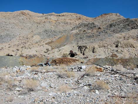 Ubehebe Lead Mine (view north) |
Overview Corridor Canyon, located in the Last Chance Range far to the north of Furnace Creek near the Racetrack Playa, is a great hike that runs out into the Death Valley Wilderness Area. The destination is a narrow canyon cut into upturned limestone strata that runs almost perfectly straight for nearly a mile. The hike starts at the Ubehebe Lead Mine and winds down scenic canyons with narrows, tight slots, fossils, a seeming impossible 3rd-class pour-over, impressive petroglyphs, and twisted, turned and eroded limestone strata. Link to Route Map. |
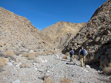 Hikers in the canyon (view north) |
Watch Out Other than the standard warnings about hiking in the desert, ...this route is fairly safe, but one pour-over is a bit high. Be extra careful when high enough to fall and get hurt. For hikers not wanting to tackle a class-3 scramble, it looks far worse than it really is, but take a 40-ft piece of rope. There are no nearby rappel anchors, but there is a good place for a companion to provide a body belay. They mined lead at the Ubehebe Lead Mine, so the area is contaminated with this heavy metal; it is best to not disturb the soils. Mines and other holes in the ground are never safe to enter. While hiking, please respect the land and the other people out there, and please try to Leave No Trace of your passage. Also, even though this hike is short, the area is remote, so be sure to bring the 10 Essentials. The route runs up into the Death Valley Wilderness Area, so pay particular attention to respecting the land. |
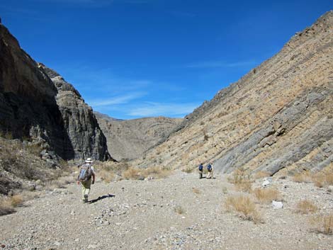 Hikers in the canyon (view west) |
Getting to the Trailhead This hike is located in Death Valley National Park, about 4-1/2 hours northwest of Las Vegas. From town, drive out to Death Valley. From the Furnace Creek Visitor Center (Table 1, Site 0712), drive north on Highway 190 for 17.4 miles to Scotty's Castle Road (Site 0763). Turn right onto Scotty's Castle Road and drive north for about 33 miles to Ubehebe Crater Road (Site 754), which is just past the Grapevine Entrance Station. Turn left (west) onto Ubehebe Crater Road and drive northwest for 5.7 miles to Racetrack Road (Site 0756), which cuts off to the right (west) just before the Ubehebe Crater parking area. This is the start of the Racetrack Road. |
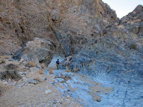 Hikers entering first narrows(view west) |
Turn right (west) onto Racetrack Road and drive about 19.5 miles to Teakettle Junction (Site 0757), which has a well-adorned road sign. From Teakettle Junction, continue southwest on the main road for 2.1 miles to Ubehebe Mine Road, which continues straight when Racetrack Road bends to the left. Drive onto a low saddle about 0.2 miles out. In a 2WD vehicle, consider stopping here and walking to the trailhead. Otherwise drive another 0.5 miles to the Ubehebe Lead Mine area (Site 1058). Park here; this is the trailhead. |
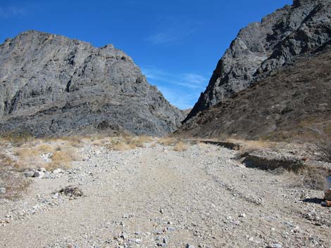 Below first narrows, the canyon empties into a broad wash (view east, upstream towards narrows) |
The Hike From the trailhead (Table 2, Waypoint 01), the route is simple: walk downhill until you get there. The details, of course, are what make the hike interesting. Also, it is always easy to walk down a wash, but paying attention on the way down in order to find the correct turns in the wash on the way back out is important. People have gotten lost coming back up these canyons. The route starts by passing the Ubehebe Lead Mine (Wpt. 02), but open mines, a wooden ore hopper, ore cart tracks, tramway cables, equipment, blue glass, a model-T truck on the hillside, and a collapsed wooden building all conspire to delay the start. |
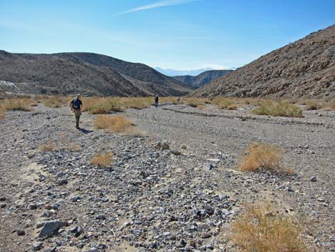 Hikers in broad wash (view west) |
Eventually hikers will continue down the canyon below the lead mine, and before the first bend in the canyon, the route enters the Death Valley Wilderness Area. The canyon narrows up a bit and winds around, but generally progress is quick and easy in the firm gravel. Early on, the hillsides show additional evidence of the mining activity that occurred in the area. At 0.9 miles down the canyon, the route passes the first major side-wash that could be a problem for finding the way back out. Cairns mark the confluence (Wpt. 03), but cairns are unreliable, so look back up the wash so you will recognize it on the way back. |
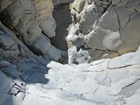 Scary pour-over (view down and west) ... |
Shortly after passing the confluence, watch for Desert Bearpoppies growing in the wash. These plants are rare and are considered a sensitive species. The area is located in the Upper Sonoran Life Zone and the habitat type is Mojave Desert Scrub. Typical for washes in this habitat type, watch for creosote bush, cheesebush, and black-banded rabbitbrush. The walls of the canyon are formed of limestone, and the layers of banding seen in the hillsides are a record of environmental conditions in the ocean at the time the layers were laid down. Some layers are hard and form cliffs, some are soft and erode easily, and others are full of fossils. |
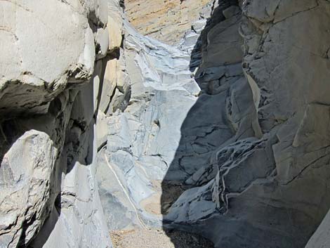 ...well, not-so-scary pour-over (view up and east) |
At about 1.47 miles out, the route passes through the first set of narrows (Wpt. 04). Here, flowing water cut through a very hard layer of limestone, so hard that most of it did not erode away, leaving only a narrow channel through the rock. Check the walls of the narrows for fossils and other items of historic and prehistoric interest. Below the narrows, the canyon opens onto a broad wash (Wpt. 05). This is the second important spot along the route to look back and build a mental image of the route for the way out. |
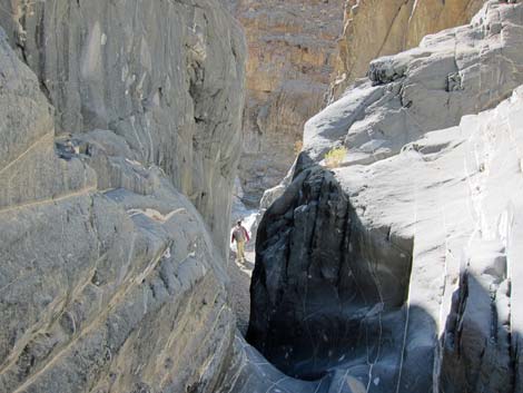 Narrows at entrance to Corridor (view west) |
Hiking down the broad wash, watch for fossils in black boulders that washed down from above. There are some amazing examples of crinoids along the route. The broad wash eventually begins to narrow and wind back-and-forth as soft layers erode away and hard layers hold fast, and at every turn in the canyon, one expects to see Corridor Canyon, but alas, hikers first encounter the pour-over (near to Wpt 06). At first glance, the look down the pour-over is a "holy cow!" kind of moment because the top looks like a slip-and-slide, and the bottom is a vertical cliff. My first thought was that perhaps gravel had washed out and the cliff was higher than I expected. |
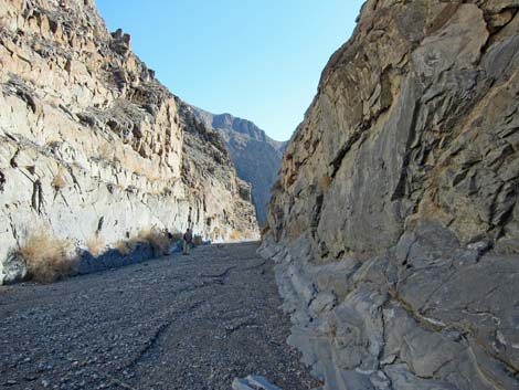 Corridor Canyon south section (view south) |
However, the pour-over is not as slick as it might be, and the vertical cliff is not as high as it appears. Climbing carefully, hikers can pass the obstacle, but a short bit of rope was nice for a belay. Below the pour-over the canyon stays narrow and eventually a slot opens into Corridor Canyon (Wpt. 07). This is the only slot in the canyon, so it is hard to get lost here on the way back. From the entrance, the canyon runs upstream to the north for about 0.3 miles and "The Corridor" ends where a high pour-over empties into the canyon (Wpt. 08). Passing this pour-over looks straight forward on the south side, but we were short of time and turned around here. |
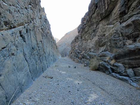 Corridor Canyon north section (view south) |
From the entrance, the canyon runs downstream to the south for about 0.7 miles and "The Corridor" ends (Wpt. 09) where the canyon makes a nearly 180-degree turn. The turn is impressive and begs for further exploration, but it was late in our day, so we turned around here. When ready, follow your footprints in the wash back to the trailhead. Be careful climbing the pour-over because the top is quite smooth, and watch carefully for the two forks (Wpt. 05 and Wpt. 03) in the canyon to stay on the proper route. |
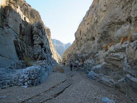 Corridor Canyon (view south from entrance) |
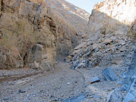 Corridor Canyon (view north from entrance) |
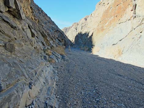 Lower Corridor Canyon |
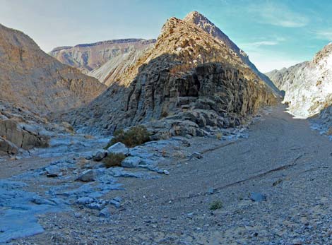 South end of the corridor (view northwest) |
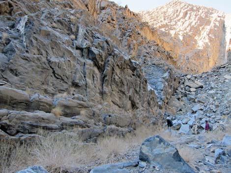 North end of the corridor (view northwest) |
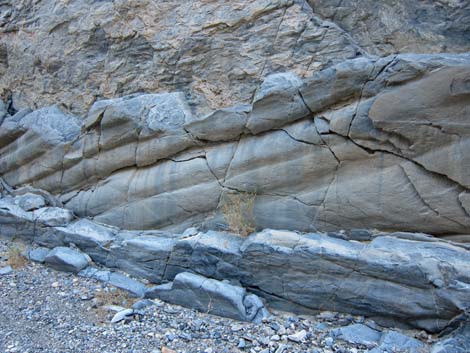 Odd patterns in wall of north Corridor Canyon. |
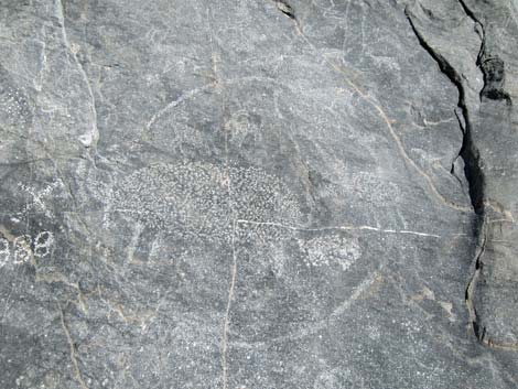 Tortoise and bighorn sheep, plus an 1888 date |
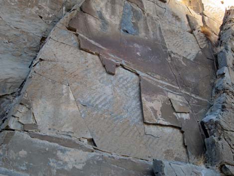 Fossilized ripple marks in the layered limestone |
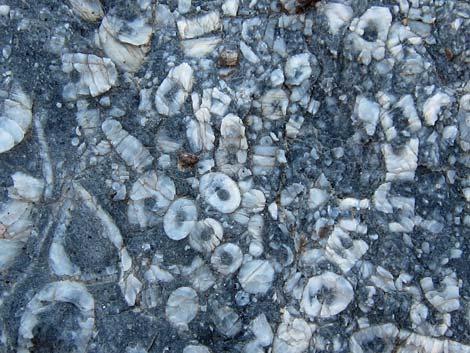 Fossilized rubble of crinoid stems, aboral cups, and arms |
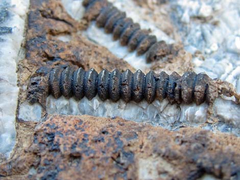 Fossilized guts of a crinoid - this is the stuff inside the stem! |
Table 1. Highway Coordinates (NAD27; UTM Zone 11S). Download Highway GPS Waypoints (*.gpx) file.
| Site | Location | Latitude (N) | Longitude (W) | Easting | Northing | Elevation (ft) | Verified |
|---|---|---|---|---|---|---|---|
| 0612 | Racetrack at Ube Mine Rd North | 36.74551 | 117.57431 | 448729 | 4066593 | 3,992 | Yes |
| 0613 | Racetrack at Ube Mine Rd South | 36.74408 | 117.57416 | 448741 | 4066435 | 3,973 | Yes |
| 0712 | Furnace Creek Visitor Center | 36.46159 | 116.86574 | 512030 | 4034954 | -186 | Yes |
| 0754 | Scotty's Castle Rd at Ubehebe Rd | 36.99863 | 117.36605 | 467429 | 4094580 | 2,292 | Yes |
| 0756 | Ubehebe Crater Rd at Racetrack Rd | 37.01291 | 117.45699 | 459345 | 4096199 | 2,515 | Yes |
| 0757 | Racetrack Rd at Teakettle Junction | 36.76008 | 117.54142 | 451674 | 4068192 | 4,143 | Yes |
| 0763 | Hwy 190 at Scotty's Castle Rd | 36.63910 | 117.03531 | 496843 | 4054636 | 104 | Yes |
| 1058 | Ubehebe Lead Mine Parking | 36.74868 | 117.58370 | 447893 | 4066950 | 3,925 | GPS |
Table 2. Hiking Coordinates Based on GPS Data (NAD27, UTM Zone 11S). Download Hiking GPS Waypoints (*.gpx) file.
| Wpt. | Location | Easting | Northing | Elevation (ft) | Point-to-Point Distance (mi) | Cumulative Distance (mi) | Verified |
|---|---|---|---|---|---|---|---|
| 01 | Ubehebe Lead Mine Trailhead | 447894 | 4066953 | 3,917 | 0.00 | 0.00 | GPS |
| 02 | Ubehebe Mine Area | 447864 | 4067010 | 3,915 | 0.05 | 0.05 | GPS |
| 03 | Fork in Canyon | 447184 | 4067473 | 3,623 | 0.85 | 0.90 | GPS |
| 04 | First Narrows | 446448 | 4067688 | 3,483 | 0.57 | 1.47 | GPS |
| 05 | Fork in Canyon | 446309 | 4067632 | 3,410 | 0.10 | 1.57 | GPS |
| 06 | Pour-Over | 445129 | 4067020 | 3,071 | 1.26 | 2.83 | GPS* |
| 07 | Enter The Corridor | 444997 | 4066993 | 2,997 | 0.10 | 2.93 | GPS |
| 08 | Corridor Canyon, N end | 444901 | 4067433 | 3,127 | 0.29 | . | GPS |
| 09 | Corridor Canyon, S end | 445111 | 4065994 | 2,869 | 0.70 | . | GPS |
Happy Hiking! All distances, elevations, and other facts are approximate.
![]() ; Last updated 240324
; Last updated 240324
| Death Valley | Hiking Around Las Vegas | Glossary | Copyright, Conditions, Disclaimer | Home |